
Email-a-Tree Service Doesn't Go As Planned, But in the Best Possible Way. "My dearest Ulmus," the message began.
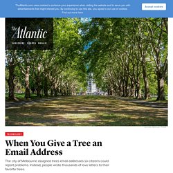
“As I was leaving St. Mary’s College today I was struck, not by a branch, but by your radiant beauty. You must get these messages all the time. You’re such an attractive tree.” This is an excerpt of a letter someone wrote to a green-leaf elm, one of thousands of messages in an ongoing correspondence between the people of Melbourne, Australia, and the city’s trees. Officials assigned the trees ID numbers and email addresses in 2013 as part of a program designed to make it easier for citizens to report problems like dangerous branches. “The email interactions reveal the love Melburnians have for our trees,” Wood said. To: Golden Elm, Tree ID 1037148 21 May 2015 I'm so sorry you're going to die soon. To: Algerian Oak, Tree ID 1032705 2 February 2015 Dear Algerian oak, Thank you for giving us oxygen. Some of the messages have come from outside of Melbourne—including this message, written from the perspective of a tree in the United States:
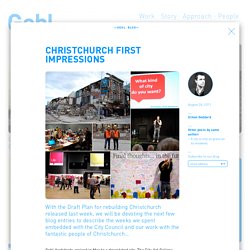
Japg_review.pdf. Minecraft generation - Gehl Architects. Christchurch reimagine their city – Gehl Architects. We had been in Christchurch in 2009 to do a Public Life/Public Space survey.
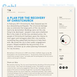
We knew people in the city and they knew us – the personal contacts & professional network were already in place. Just weeks after the earthquake hit, the city council called us and we got on the plane. Share an Idea We started by listening. The city council knew that the rebuilding of Christchurch had to be inclusive – that it had to be everybody’s project. The ‘Share an Idea’ campaign generated an incredible 106,000 ideas from the people of Christchurch. Finding Your Bearings We returned to Christchurch in May 2011. Over the next 100 days we were facilitators in getting the professionals, politicians and people to talk about the situation and find solutions to it. Tragic news from Nepal - Gehl Architects. Free Zone by Rosanbosch, photo courtesy of Anders Sune Berg IN CONVERSATION — A conversation with Gehl Partner Ewa Westermark and Project Manager Ola Gustafsson on working in a Scandinavian context and the challenges of exporting those valuable learnings around world.
Reconstruction New Zealand Post 2010-11 Christchurch Earthquakes_0. The Human Scale. Adaptive Streets - Gehl Architects. Free Zone by Rosanbosch, photo courtesy of Anders Sune Berg IN CONVERSATION — A conversation with Gehl Partner Ewa Westermark and Project Manager Ola Gustafsson on working in a Scandinavian context and the challenges of exporting those valuable learnings around world.
We find ourselves traveling all over the world, presenting ideas and examples founded on Scandinavian traditions and culture. A platform, which has provided a great starting point for cities to evolve towards considering the people who live in them. The standards are high in Scandinavia, and in many ways, we have succeeded in making our cities livable. But what does this mean in terms of the future of Scandinavian cities? Christchurch First Impressions - Gehl Architects. Free Zone by Rosanbosch, photo courtesy of Anders Sune Berg IN CONVERSATION — A conversation with Gehl Partner Ewa Westermark and Project Manager Ola Gustafsson on working in a Scandinavian context and the challenges of exporting those valuable learnings around world.
We find ourselves traveling all over the world, presenting ideas and examples founded on Scandinavian traditions and culture. A platform, which has provided a great starting point for cities to evolve towards considering the people who live in them. The standards are high in Scandinavia, and in many ways, we have succeeded in making our cities livable. Draft-central-city-plan. AssetMappingToolkit. PMT.pdf. Participatory Mapping: presenting spatial knowledge of local communities. What is Participatory Mapping?

Participatory mapping - also called community-based mapping - is a general term used to define a set of approaches and techniques that combines the tools of modern cartography with participatory methods to represent the spatial knowledge of local communities. It is based on the premise that local inhabitants possess expert knowledge of their local environments which can be expressed in a geographical framework which is easily understandable and universally recognised. Participatory maps often represent a socially or culturally distinct understanding of landscape and include information that is excluded from mainstream or official maps.
Using Participatory Mapmaking to Connect Citizens, Decision Makers. "Ground Truthing" PolicyUsing Participatory Map-Making to Connect Citizens and Decision Makers by Shalini Vajjhala Citizen participation has become an increasingly important component of development planning and environmental decision-making worldwide.
AssetMappingToolkit. 2008-07-toolkit-participatory-map.pdf. Community_Engagement_Strategies.pdf. Put your idea on the map. Wondering what tool to use for a public engagement project? Here’s a list. Back in September, Community Matters featured a blog post listing 50 tools for Online Public Engagement.

They gathered tools for digital outreach, ‘in no particular order (and with no implied endorsement)’. I figured the list could be even more helpful if the tools were grouped by purpose and who uses them. Community engagement that works. With recent improvements to OpenPlans, we’ve made it easy to get a Shareabouts map up and running in minutes.
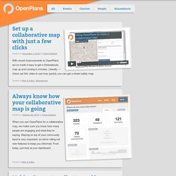
Literally — check out this video to see how quickly you can get a street safety map. When you use OpenPlans for a collaborative map, we make sure you know how many people are engaging and what they’re saying. Staying on top of your community input is very important, so we’re rolling out new features to keep you informed. From today, just look at your dashboard. On Monday, Philly’s bike share program collected the 10,000th response to proposed bike share locations. As it did with the Vision Zero initiative, OpenPlans has collaborated with cities to develop software tools that allow them to gather public input in a way that meets their needs.
Engaging-queenslanders-methods-and-techniques.pdf.