
The Obsessively Detailed Map of American Literature's Most Epic Road Trips. The above map is the result of a painstaking and admittedly quixotic effort to catalog the country as it has been described in the American road-tripping literature.
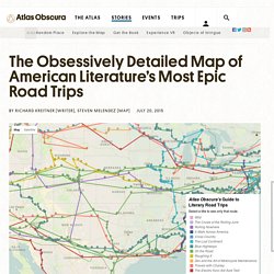
It includes every place-name reference in 12 books about cross-country travel, from Mark Twain’s Roughing It (1872) to Cheryl Strayed’s Wild (2012), and maps the authors’ routes on top of one another. You can track an individual writer’s descriptions of the landscape as they traveled across it, or you can zoom in to see how different authors have written about the same place at different times. Most interestingly of all, for me at least, you can ruminate about what those differences say about American travel, American writing, American history. A word to close readers: I hand-typed most of these 1,500-plus entries and located their coordinates as best I could. Amazon. A History of the World in Twelve Maps by Jerry Brotton – review. On the Map: Why the World Looks the Way It Does by Simon Garfield – review. My favourite living room – of those in my neighbourhood I can stare into – has old maps on the walls, which I find soothing and benign.
But Simon Garfield, whose home is apparently similarly decorated, tells us that map-making has been a way of appropriating the world, a function of power, whether carried on in ancient Alexandria or the Google HQ. He cites a British map of Calcutta, produced in 1842 by the "ominously named" Society for the Diffusion of Useful Knowledge. Public buildings like banks and police stations are shown, but no temples or mosques.
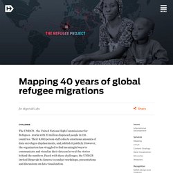
On the Map is peppered with such compelling and bizarre anecdotes, some to do with recurring cartographic howlers (because map makers, like cookery writers, copy one another). In 1622, a Spanish map depicted California as a big island off America. Cartographers' Guild - a community for maps of fantasy, sci-fi and real world locations. Mapping 40 years of global refugee migrations. The UNHCR - the United Nations High Commissioner for Refugees - works with 35 million displaced people in 126 countries.
Darkhorse Analytics Blog. 36 maps that will make you see the world in completely new ways. The internet has led to a renaissance in mapmaking, with thousands of interactive, illustrated, informational, or just plain silly maps being published on a daily basis.
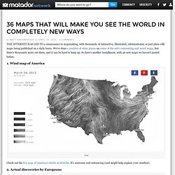
We’ve done a number of other pieces on some of the web’s interesting and weird maps, but there’s thousands more out there, and it can be hard to keep up. So here’s another installment, with 36 new maps we haven’t posted before. 1. Wind map of America Check out the live map of America’s winds at Hint.fm. 2. These are the lands Europeans actually first discovered — as in there weren’t already millions of people there. 3. This map was fairly surprising to me — I certainly wouldn’t have guessed that Russia was more tolerant than France, and I’m happy to see the US is in the most tolerant group. 4.
Because Every Country Is The Best At Something. Geography, Topography, and Everythingography. By Maria Popova Google vs.
Hitler, underwear peninsulas, Hansel and Gretel, global black holes, 18th century German lovescapes, how Holland’s streets are finally becoming rivers, why Philly is reinventing the wheel, and what Joan Miró has to do with NASA. We’re exorcising our maps obsession. Alright, folks. It’s happening: Google has officially begun its world conquest. We’ll leave it to the pros to elaborate on the details, but we’ll just say that if the Nazis were able to re-imagine New York in their own world domination schemes… …why shouldn’t Google? Fashion: it’s a global thing. Where You Are: Cartography as Wayfinding for the Soul. By Maria Popova Mapping the human experience based on disposition rather than position.
Mapping the Human Condition. By Maria Popova What the empire of love has to do with the intellect forest and the bay of agoraphobia.
We love maps. Watch as 1000 years of European borders change. The biggest Internet Database about Cost of Living, Housing Indicators and many other informations about cities and countries! Numbeo is the world’s largest database of user contributed data about cities and countries worldwide.
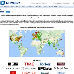
Numbeo provides current and timely information on world living conditions including cost of living, housing indicators, health care, traffic, crime and pollution. Numbeo is a collection of Web pages containing numerical and other itemizable data about cities and countries, designed to enable anyone to contribute or modify content. Legendary Lands: Umberto Eco on the Greatest Maps of Imaginary Places and Why They Appeal to Us. By Maria Popova “Often the object of a desire, when desire is transformed into hope, becomes more real than reality itself.”
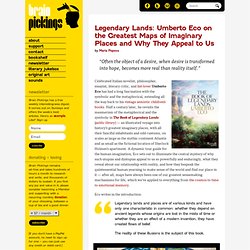
Celebrated Italian novelist, philosopher, essayist, literary critic, and list-lover Umberto Eco has had a long fascination with the symbolic and the metaphorical, extending all the way back to his vintage semiotic children’s books. Art - Lapham’s Quarterly. Mapping Stereotypes. Get your copy on: Amazon US / Amazon UK / Amazon DE / Amazon FR / Amazon IT / Amazon ES / Amazon Canada / Amazon Japan / Amazon India / Amazon Brazil Atlas of Prejudice: The Complete Stereotype Map Collection.

New York's Fashion Industry Reveals a New Truth About Economic Clusters - Elizabeth Currid-Halkett , and Sarah Williams. By Elizabeth Currid-Halkett and Sarah Williams | 12:00 PM February 10, 2014 The week before Fashion Week in New York, now underway, is perhaps the busiest in the city’s apparel industry. Frantic designers rush around looking for gold buttons with blue inlay, for seamstresses to make pleats and for patternmakers with spare fabric. They make modifications to dresses in real time under enormous deadline pressures. Yet when eyes eventually fall on the runways, they witness virtually glitch-less shows and talk-of-the-town creativity. How does New York’s fashion industry continually pull off Fashion Week year after year? The answer lies in a complex economic system whose informal origins date to the mid-19th century and whose central idea rests on geographical proximity. The idea that highly specialized concentrations of an industry like the Garment District offer significant economic advantages is hardly revolutionary.
Creative Cities. Many years ago, I think it was around 1983, my friend Paul Mijksenaar, himself one of the worlds leading experts on signing, made a calendar. It was a very special calendar, starting in april and ending in october the following year. This calendar could be used in 1983, but than again in 1988, 1994 and after that in 2005, 2011 and 2016. There is a new page for every week. The subject of the calendar though was even more interesting. Maps That Will Change the Way You See the World. Where Google Street View is available. The supercontinent of Pangaea with modern day borders. The pink represents countries that the British have invaded. More Maps That Will Change the Way You See the World. Average breast size.
Twitter use in 2013. Facebook use in 2010. Internet connections in 1969. Internet connections in 2013. Locations of McDonalds in the United States. Average penis size. A 1531 map of the known world. People in Britain who identify their religion as "Jedi The percentage of people in Europe who believe in God.
Countries where the English version of Wikipedia is the most popular. Where the internet is censored.