
IBGE · PAÍSES@ Blog: Landsat. With the help of satellite images fifth and sixth grade students at Mr.

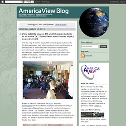
Tim Blum’s geography class (photo below) at the UW Lab School got a birds-eye view of how humans have impacted or modified their environments (31 January 2011). Images acquired by satellites decades apart showed cleared forests, irrigated crop fields in the middle of the deserts, altered landscapes (new roads and water bodies), and urban growth. As part of the Earth Observation Day (EOD) activities, WyomingView coordinator Ramesh Sivanpillai described the utility of images acquired by satellites are useful for monitoring changes on earth’s surface.
For example, Landsat images acquired in 2000 (bottom left) and 2009 (bottom right) shows the newly constructed roads (linear features), drilling pads (square features at the end of the roads), and ponds (in different shades of blue) for an area within the Powder River Basin. USGS Global Visualization Viewer. Real-time Earthquake Map. Back to School with Google Earth. OpenStreetMap. Geotecnologias. Natural Earth. Mapping & Cartography. Geoprocessamento, mapas, imagens satélites, GPS, GIS. InfoGEO. Revista MundoGEO en Español Edición 66. Revista MundoGEO en Español Edición 67. Revista Scoop.it sobre SIG. Instantly compare any two places on Earth! SIG. TUTORIAL ARCGIS 10 EN ESPAÑOL. GIS Tutorials for Beginner, Intermediate, and Advanced GIS Users - GISTutor.com.
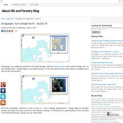
Arc2google: Sync Google Earth - ArcGIS 10. Arc2Google is an additional extension for ArcGIS-ArcMap made by Hussein Nasser which allows ArcMap users to view Google Earth / Google Maps in a dockable window, in the same area with the view extents in ArcMap canvas and can be synchronized.

With this Arc2Google, whenever a user to zoom in / out in ArcMap, Google Earth / Google Maps on dockable window will adjust the same location as the display in ArcMap. To facilitate your understanding of the functions of the ArcGIS extensions, please see the video below. Now, this Arc2Google been updated and now available for ArcGIS 10. LINK FLORESTAL - FOREST GIS. WEBINAR: Tecnologias GIS Aplicadas à Gestão Pública. The Collection.