
Modules & Activies Main Page. Using climate science models and NASA satellite images and data sets, students apply problem-solving methods and scientific inquiry skills to address six climate-related scenarios.
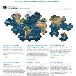
More Each of the problem-based learning scenarios also includes teacher pages to help educators implement the modules into their classroom teaching. All of the materials are free. Our only request is that teachers register for the site to access the module-specific teacher pages and complete a post-event survey. More Login Whether you’re new to problem-based learning or have extensive experience using this type of instructional approach, we encourage you to view our problem-based learning pages. The Exploring the Environment legacy modules include four variations on problem-based learning—activities, basic, comprehensive, and advanced.
Games and Challenges - NPS Celebrates! Current Challenge: Water Clarity. What is water clarity?
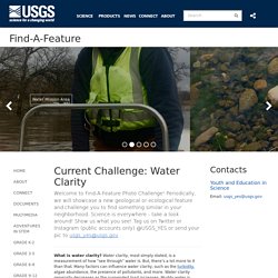
Water clarity, most simply stated, is a measurement of how “see through” water is. But, there’s a lot more to it than that. Many factors can influence water clarity, such as the turbidity, algae abundance, the presence of pollutants, and more. Water clarity generally decreases as the suspended load increases. How to Read Topographic Maps - Gaia GPS. Draw On Maps and Make Them Easily.
Gribrouillon. Loading Gribrouillon | © OpenStreetMap contributors Choose a color Share your map By email Choose map background.
RockCycleChooseYourOwnAdventure. Teaching Powerful Note-Taking Skills - ACUE. Bligh, D.
A. (2000). What’s the use of lectures? San Francisco, CA: Jossey-Bass. Boye, A. (2012). Note-taking in the 21st century: Tips for instructors and students. This Old Earth. Seven Good Tools for Creating Word Clouds. The popularity of word cloud generation tools seems to have declined from their peak of about six years ago.
None-the-less they are still useful in providing students with a nice way to visualize the most frequently used words in a passage of text. Wordle is probably the best known tool for making word clouds. But Wordle doesn't work well in many web browsers today so here are seven other word cloud generators to try. Geoscience Concepts - Geology. CoRubrics - An Add-on to Facilitate Assessment Among Students. Using Brush Ninja and Screencastify to Make Science Presentations. This week I had the opportunity to work in an eighth grade science class.
I was there to help their teacher help them learn new ways to make presentations. The topic of their presentations was "forms of energy. " That topic lends itself to having students making illustrative animations. In this case I taught the students how to use Brush Ninja to make animated GIFs that they then inserted into Google Slides.
The Future of Publishing - created by DK (UK) VALUE Rubric Development Project. The original VALUE initiative in 2007-09 involved teams of faculty and other educational professionals from over 100 higher education institutions engaged over many months to develop 16 VALUE rubrics for the LEAP Essential Learning Outcomes.
ReClipped. Esri GeoInquiries™ for Earth Science. Teach Students to Ask Their Own Questions. This process explicitly validates all students’ intellectual abilities.– High School History Teacher, New York The reasons behind their questions often bowl me over with their sincerity, the fact that [they] really want to know the answers because it’s important to them, or they feel it would be important for others to know.– 4th Grade Teacher, Chicago The ability to produce questions, improve questions and prioritize questions may be one of the most important—yet too often overlooked—skills that a student can acquire in their formal education.
Strong critical thinking is often grounded in the questions we ask. By deliberately teaching questioning skills, we will be facilitating a process that will help students develop a mental muscle necessary for deeper learning, creativity and innovation, analysis, and problem solving. STEM Resource Finder. For All Things Science - Biology, Chemistry, Physics. Phenomena for NGSS.
National Critical Zone Observatory. The Critical Zone (CZ) is where rock meets life.
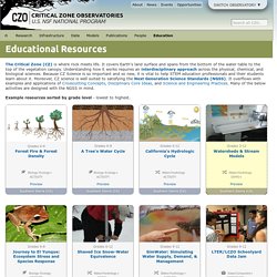
It covers Earth’s land surface and spans from the bottom of the water table to the top of the vegetation canopy. Understanding how it works requires an interdisciplinary approach across the physical, chemical, and biological sciences. CGS Notes CGS Notes. Using the Exploring Earth Web Site. Using Investigations Investigations can be used at many stages of instruction.
They have been employed in whole-group settings, in individual and small group work, as homework or extra-credit assignments, and to launch independent research projects. The investigations serve particularly well as performance assessments because they allow students to apply their understanding and skills to real-world issues or situations. Many of the investigations have mechanisms that provide immediate feedback to student responses. Chapters in the EET. Help Results 1 - 10 of 44 matches Analyzing Plate Motion Using EarthScope GPS Data DATA: EarthScope GPS Data. TOOLS: Spreadsheet, Google Maps.
SUMMARY: Learn how GPS monuments make precise measurements of Earth's surface. Graph motion data and map velocity vectors to explore tectonic motion and surface deformation in the Pacific Northwest. Analyzing the Antarctic Ozone Hole DATA: Total Ozone Mapping Spectrometer (TOMS) Images. Enjoy a Grand Tour of Geology - Geology (U.S. National Park Service) Science or PseudoScience. PBS - THE WEST - Lesson Plans Index. Background Information Students will view the works and read the accounts of such painters as George Catlin (1796-1872), Albert Bierstadt (1830-1872), Thomas Moran (1837-1870), and Frederic Remington (1861-1909). The paintings of Bierstadt and Moran, and the documentary photographers influenced early conservation policy as well as the concepts of "Manifest Destiny" and an era of progress.
Remington's work glorifies the cowboys and soldiers and demonizes the Indians, justifying their increasing elimination from the actual territories of the West. Educational Technology and Mobile Learning: polling tools. Teachers Easy Tools to Create Their Own Apps. The tools below provide you with a user friendly interface where you can choose from templates, customize colour, change font styles and many more. Office Sway - Create and share amazing stories, presentations, and more. Story Maps. Geology central: A Database of Geological Websites. Scroll down for Geological Databases Here at Geology Central you will find hundreds of geology related links, videos, animations, as well as virtual field trips. Field Trips Here you will find geology related Virtual Field Trip links, categorized by topic and region. Geology Links Here you will find general Geology Links, categorized by topic and region.
NWS JetStream Learning Lesson: Water Cycle Paper Craft. Overview Water moves from the ground to the atmosphere and then returns to the ground, however, the actual path water takes in its cycle is more complicated. There are many stops on water's journey. Students will learn how the water cycle works using 3-D paper craft activity.
Procedure The paper craft consists of two sections: the 'earth' and the 'atmosphere'. Discussion. Home - NASA Scientific Visualization Studio. Minerals Education Coalition. Earthguide: Educational Resources in Earth, Marine, Environmental and Planetary Sciences. Prologue. Earth science is an inherently local subject. No two places share exactly the same sequence of events that led to the way they are today. In this sense, Earth science is a subject to be explored in one’s own neighborhood, examining the detailed sequence of rocks for the history that has gone on under our feet. Geologic Resources » Education.
Plate Tectonics. Geology Kitchen, Explorer Multimedia Home. Resources for Educators. This page highlights resources and documents related to using lidar topography and OpenTopography in the classroom. WhoDunit. Browse by Theme. Bay Area Geologic Maps in Google Earth. Browse by Quad. Geologic Resources » Education. Untitled. Geologic Resources » Education. IRIS - Incorporated Research Institutions for Seismology. IRIS - Incorporated Research Institutions for Seismology. FISH! Philosophy. Institute for Global Environmental Strategies >> home. Higher Education. Dk.com - clip art. Faults in Xinjiang. Just south of the Tien Shan mountains, in northwestern Xinjiang province, a remarkable series of ridges dominates the landscape. The highest hills rise up to 1,200 meters (3,900 feet) above the adjacent basins, and they are decorated with distinctive red, green, and cream-colored sedimentary rock layers.
The colors reflect rocks that formed at different times and in different environments. The red layers near the top of the sequence are Devonian sandstones formed by ancient rivers. The green layers are Silurian sandstones formed in a moderately-deep ocean. Floating Farms. Limnic Eruptions: When Lakes Explode. Geysers erupt because they’re all bendy inside. Fault creep along the Calaveras in Hollister, California.
Introduction Hollister, California is located South of the San Francisco Bay area. ARM Climate Research Facility. Earth Science Picture of the Day. Volcano Resources. Geological Speed Dating. Metamorphic Resources. Resources for Teaching about Plate Tectonics. Resources for Teaching about Plate Tectonics. Plate Tectonics Resources. Plate Tectonics Resources. Plate Tectonics Resources. Online Resources for Teaching about Weather. Online Resources for Teaching about Climate Change. USGS Education Resources for Teachers.