
Quality issues in georeferencing: From physical collections to digital data repositories for ecological research - Marcer - - Diversity and Distributions. Natural history collections are a superb record of life on Earth (Holmes et al., 2016).
In contrast to simple observations of occurrence, physical samples held in museums, herbaria and other institutions, allow support for reproducible and repeatable research and for new data extraction from the collected individual or sample (e.g., molecular or genetic markers) on a much richer scale than other kinds of representation; that is photographs (but see Lunghi et al., 2020). Furthermore, and as with other observations of occurrence, their recorded date and place of collection makes it possible to link them to the abiotic and biotic conditions in which they lived. For this, one can infer spatio‐temporal ecological and evolutionary patterns in their occurrence.
The global set of preserved specimens collected over centuries represents a large potential resource for future research (National Academy of Sciences, Engineering, and Medicine, 2020).
Georeferencing the NHM Botanical Types latest update @NHM_Science @NHM_Botany @NHM_Data. Georeferencing Quick Reference Guide [Community review draft] Accuracy the closeness of an estimated value (for example, measured or computed) to a standard or accepted ("true") value.
![Georeferencing Quick Reference Guide [Community review draft]](http://cdn.pearltrees.com/s/pic/th/georeferencing-reference-226849037)
Antonym: inaccuracy Compare error, bias, precision, false precision and uncertainty. Georeferencing Best Practices [Community review draft] ANBG (2018) Australia’s Virtual Herbarium.
![Georeferencing Best Practices [Community review draft]](http://cdn.pearltrees.com/s/pic/th/georeferencing-practices-226849032)
Australian National Botanic Gardens on behalf of the Committee of Heads of Australian Herbaria. Georeferencing calculator manual community review draft. Nature Map Explorer. Why Georeferencing Matters: ref 2017. Georeference.canadensys. Introduction Georeferencing is the process of interpreting textual descriptions of places into spatial descriptions (i.e. geographic coordinates).
E.g. “Bear Island, Lake Temagami, Nipissing District, Ontario, Canada” → decimal latitude: 46.9831216, decimal longitude: -80.0681018, uncertainty: 1410m (show on map). Georeferencing biological specimens – which often only have textual descriptions of their locality – allows the information to be displayed on a map and used in spatial analyses. Although extremely useful, georeferencing is also time-consuming and should be tackled as a community, with the right tools and guidelines.
Why georeferencing matters: Introducing a practical protocol to prepare species occurrence records for spatial analysis. Abstract Species Distribution Models (SDMs) are widely used to understand environmental controls on species’ ranges and to forecast species range shifts in response to climatic changes.
The quality of input data is crucial determinant of the model's accuracy. While museum records can be useful sources of presence data for many species, they do not always include accurate geographic coordinates. Dots vs. polygons: How I choose the right map visualization. Georeferencer. Worldmapper. DIVA-GIS: mapping, geographic data analysis. Imaging Earth Landmass. At Planet, we’ve been pursuing Mission 1: to image the entire Earth’s landmass every day.
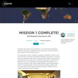
I couldn’t be more excited to announce that we have achieved our founding mission. Six years ago, our team started in a garage in Cupertino. Mission 1 was the north star: we needed to build the satellites and systems, secure the launches, bring down the data to capture a daily image of the planet at high resolution, and make it easy to access for anyone. It became the heart and soul of our company and guiding light for Planeteers. Six years ago we had 7 staff. Where it all began – the founding team in the garage in Cupertino. With so much focus on and passion for Mission 1, it’s easy to understand why everyone at Planet is excited about reaching this unprecedented milestone. For Mission 1, our team was focused on building the hardware and software (and getting it into space) to deliver a data stream about our planet unlike any other.
Mapping Indigenous Lands. With support from organizations like WRI, LandMark, a global online platform, is mapping all of the world’s indigenous lands.
Lands owned by indigenous communities around the world are critical to the wellbeing of nearly 2.5 billion people. Community land is generally held in a collective manner under customary tenure arrangements. Experts estimate that 50-65% of the world’s land is community land, though not much is known about the extent to which these lands are recognized.
According to a 2015 study of 64 countries, comprising 82% of global land area, only 10% of the world’s land (belonging to communities) was legally recognized and another 8% was designated by governments for communities. With the percentage of recognized community land standing at 18, an online project is working on mapping all of the world’s indigenous lands to help secure legal rights of communities and alert them about the potential threats of illegal logging and mining. Background and objective Land covered so far. LandMark: Global Platform of Indigenous and Community Lands. RAINBIO: database on distribution of vascular plants in tropical Africa. Last November, PhytoKeys published an exciting paper on the launch of the first-of-its kind RAINBIO mega database of tropical African vascular plant distributions.
The publication is part of the RAINBIO project (African RAIN forest community dynamics: implications for tropical BIOdiversity conservation and climate change mitigation, funded by CESAB (CEntre de Synthèse et d’Analyse sur la Biodiversité) of the FRB (Fondation pour la Recherche sur la Biodiversité, France). Making use of the innovative data paper format, offered by most Pensoft journals, the project announced is key product – a state-of-the-art high quality mega database of vascular plant species distribution across tropical Africa. The RAINBIO mega database is a response to the limited knowledge of plant species distribution patterns when it comes to the tropical vegetation of Africa. Africa’s vegetation is characterised by high levels of species diversity.
Original Sources: Invasive Species Mapping Made Easy. Mapping Indian seedbank collections. Always happens this way.
No sooner do I find something interesting, that something similar turns up. Case in point my post last week on the Seedlot Selection Tool. It was just a few hours after I happened across the SST that I ran into NBPGR’s PGR-Clim. Ok, it’s not quite the same thing, but almost. Unnatural Surveillance: How Online Data Is Putting Species at Risk.
In the arid far-western region of South Africa is a vast flatland covered with white quartzite gravel known as the Knersvlakte – Afrikaans for “Gnashing Plain” – because it sounds like grinding teeth when you walk across it.
It’s a good place to watch unpeopled horizons vanish into ripples of heat haze, but to appreciate its real value you must get down on your knees. The Knersvlakte holds about 1,500 species of plants, including 190 species found nowhere else on earth and 155 that are Red-Listed by conservation biologists as threatened with extinction. To protect them, 211,000 acres have been set aside as the Knersvlakte Nature Reserve. Melita Weideman, then a Knersvlakte ranger, had just finished work one July afternoon in 2015 when she was called to check out a mysterious pickup truck parked just outside the reserve. Weideman saw a man and woman walking through the approaching winter sunset toward the vehicle and then noticed empty cardboard boxes on the double-cab’s back seat.
Georeferencing documents released for GBIF community review. GBIF has released three new technical documents for community review and welcomes input and feedback on each of the following publications: Georeferencing Best Practices, by Arthur Chapman & John WieczorekGeoreferencing Quick Reference Guide, by Paula Zermoglio, Arthur Chapman, John Wieczorek, Maria Celeste Luna & David BloomGeoreferencing Calculator Manual, by David Bloom, John Wieczorek & Paula Zermoglio Taken together, these three georeferencing documents provide essential tools for improving the practice of spatially interpreting locations, particularly (but not exclusively) for those working with biological occurrence data from museum-based scientific collections.
The Best Practices guide provides theoretical background and methods for georeferencing descriptive localities along with common terms and technologies. The Quick Guide offers practical advice and a citable protocol for georeferencing projects. How do I participate in the community peer review?