
MapTiler - Map Tile Cutter. Overlay Generator for Google Maps, Google Earth (KML SuperOverlay). User discussion. Re: OpenLayers 2.12 Map Rotation Le mercredi 5 décembre 2012, Rob Hyx a écrit : Hey all, I'm curious if OL 2.12 supports map rotation?
I see this is 'planned' for 2.13 but do the functions exist that allow you to orient the map other than north at the top in 2.12? No, map rotation isn't supported by 2.12 and the current dev branch. And I don't know if it will be eventually supported. -- Eric Lemoine Camptocamp France SASSavoie Technolac, BP 35273377 Le Bourget du Lac, Cedex. How to Rotate an Online Map by Your Mouse Scroll Wheel with pure Javascript and CSS3 – Webmove.org. How to Rotate an Online Map by Your Mouse Scroll Wheel with pure Javascript and CSS3 One of the things I always want to do with online maps is rotate them – I am used to that with real, physical maps. just reading Rotating a map with CSS3 and jQuery and found a nice, smart example of rotating an online map by using our mouse scroll wheel implemented in javascript by Ryan Moore.
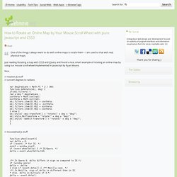
Nice. // rotation JS stuff // convert degrees to radians var deg2radians = Math.PI * 2 / 360; function doRotate(obj, deg) { if(obj.filters) { rad = deg * deg2radians ; costheta = Math.cos(rad); sintheta = Math.sin(rad); obj.filters.item(0).M11 = costheta; obj.filters.item(0).M12 = -sintheta; obj.filters.item(0).M21 = sintheta; obj.filters.item(0).M22 = costheta; } else { obj.style['-moz-transform'] = "rotate(" + deg + "deg)"; obj.style.MozTransform = "rotate(" + deg + "deg)"; obj.style['-webkit-transform'] = "rotate(" + deg + "deg)"; } } // mousewheel js stuff function wheel(event){ var delta = 0; if (! Google Maps Latitude, Longitude Popup. Performance tuning - OpenLayers canvas renderer - redraws all features on selecting a single feature. I am currently trying to learn more about OpenLayers, and I'm coming up against performance / behaviour issues that I wouldn't expect to see.
To elaborate... I have combined this example for generating lots of random points with this example on highlighting / changing the icons of features on selection. The result is available in this JSFiddle. The (very basic) application prioritises the Canvas renderer, so that the points layer is defined like this: The Canvas renderer is nice because zooming and panning works well with thousands of points (unlike SVG) but clicking / feature selection is much slower than SVG. This question on SO suggests that there could be an issue with how OpenLayers is interacting with the Canvas, but unfortunately I don't know enough about HTML5 or OpenLayers (yet) to be sure. Does anyone have experience with OpenLayers / Canvas renderer? Free GIS Datasets - Categorised List.
Integrating Openlayers and HTML5 Canvas « Geo-Mobile Blog. NOTE: take a look at updated solution In an earlier post we showed how HTML5 Canvas could be used on mobile browsers.
Although the example showed a map image, it was just that – an image rather than a web mapping app like Google maps or the popular open source OpenLayers. Getting canvas to work on a mapping application like Google / OpenLayers is somewhat more complicated as the map consists of dozens of image tiles, some within the view port, and others out of view but already cached in the DOM so that a smooth transition without page reloads is possible when a user pans around, creating a nice “slippy map” effect. In this post I show how we tackled the problem of integrating HTML5 canvas into the Openlayers framework.
We already posted on using OpenLayers on mobile browsers and how to make touch gestures rather than mouse events control panning and zooming. Elevationdemo <p>JavaScript required to play <a hreflang="en" type="video/mp4" href=" OpenLayers: Home. Comparison of JavaScript mapping libraries. Commercial APIs (Google,Bing, Yahoo) Using any commercial API leaves you at the mercy of whatever changes the provider makes to the API or Terms of Service.
What happens for example if suddenly your local government portal that uses Google Maps suddenly has adverts popping up all over it? Want to reuse your JavaScript Google Maps code for an Intranet site? You'll find yourself having to pay the $10,000 licencing fee. Microsoft often have more defined and fixed terms for their services (if paying) so there may be less of a risk here. The recent backlash against Twitter is a good example of developers having an API that changed beneath them.
Update - Google starts charging for use of their maps from October 2011. As others have mentioned if you are using an ESRI stack then the ESRI JavaScript API will no doubt work well on top of it. Use OpenLayers... OpenStreetMap. Cesium - WebGL Virtual Globe and Map Engine.