
Africa mappa gratuita, mappa muta gratuita, cartina muta gratuita stati, principali città, colore (bianco) If It Were My Home. World Geography Games - Let's play and learn about the world. EnglishWithSophia.com. EnglishWithSophia.com Articles 1. 1.
Latitude And Longitude Game - By KidsGeo.com. Materials and Directions for Teaching Latitude and Longitude With Battleship Game. Latitude/Longitude Battleship Goals: To practice the proper way to speak aloud a specific location using latitude and longitude. To practice finding latitude and longitude quickly and naturally using a physical map. What Each Player Needs: · 2 Game Sheets – one to record your moves (hits/misses) and one to hide your ships on and record your opponent’s moves (hits/misses). · A Latitude/Longitude Script Sheet · (Optional) A Clipboard · (Optional) Ruler – to help with finding the line’s degree easier. Rules of The Game · Attach the two game sheets to a clipboard – a portable “desk” that will keep your intel private. · Each player must choose one game sheet to represent his/her stealth military invasion- we will call this sheet the “mission sheet” .
Climate Types for Kids. Giochi didattici per la geografia. Documenting Democracy. Google Tour Builder: raccontare storie utilizzando mappe. Google Tour Builder è uno risorsa web che vi permette di raccontare storie utilizzando mappe, collegandole nei vari Paesi del mondo in cui sono ambientate.
Grazie al plug-in di Google Earth, potete creare un tour per esplorare un argomento a vostra scelta, approfondendo la conoscenza dei luoghi in cui è ambientato e inserendo con facilità testi, foto e video. Il viaggio che andrete a creare accompagnerà gli utenti da una parte all'altra del mondo, consentendo loro di visitare tutti i luoghi toccati dal racconto e di inserirsi nel contesto reale grazie alle immagini di Google Earth e ai contenuti personalizzati che inserirete.
I requisiti per poter utilizzare Tour Builder e creare il vostro tour personale, sono un pc collegato ad internet e un browser web in grado di supportare il plug-in di Google Earth. Per scoprire se sul vostro computer è installato il plug-in di Google Earth, andate alla pagina www.google.com/earth/explore/products/plugin.html. Sotto una video guida all'uso. CLIL. Outline Maps.
Test your geography knowledge - USA: states quiz. United States. United States History for Kids (1492-1898) « United States History Map . From Sea to Shining Sea. Untry Profiles - Global Guide to Culture, Customs and Etiquette. Understanding other people's languages, cultures, etiquettes and taboos is of great value to the traveller or visiting business person.
Scroll down the page for information on a selected number of countries. Topics include language, useful phrases, the society, culture, business and social etiquettes. You can access Useful Phrases here or through the corresponding country. Please feel free to share comments you may have about our guides as we are always looking to improve the quality and accuracy of information. This information is also available as an App for the iPhone. Etiquette, Customs and Protocol Guides Warning! It is important to bear in mind that these guides act as basic and general introductions only. Each society, country and culture will have numerous nuances that would make it irresponsible to suggest a uniform approach to understanding any country's social/business culture or etiquette.
Blank and Outline Maps. Geography books and atlases from Usborne Children's Books. Free Flag Pictures and Printables at FlagLane.com. Geografia per le scuole medie e superiori. Informativa sui cookies I cookie sono piccoli file di testo che i siti visitati inviano al terminale (computer, tablet, smartphone, notebook) dell’utente, dove vengono memorizzati, per poi essere ritrasmessi agli stessi siti alla visita successiva.
Sono usati per eseguire autenticazioni informatiche, monitoraggio di sessioni e memorizzazione di informazioni sui siti (senza l’uso dei cookie “tecnici” alcune operazioni risulterebbero molto complesse o impossibili da eseguire). Attraverso i cookie si può anche monitorare la navigazione, raccogliere dati su gusti, abitudini, scelte personali che consentono la ricostruzione di dettagliati profili dei consumatori. voglio10.it utilizza i cookie “proprietari” e “non”, per fornirti dei servizi.
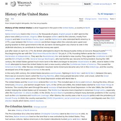
National Geographic Education - National Geographic Education. Educ@geo. Lizard Point Geography Quizzes clickable map quizzes for fun and learning. History of the United States. The flag of the United States during the American Revolution The history of the United States is what happened in the past in the United States, a country in North America.
Native Americans lived in the Americas for thousands of years. English people in 1607 went to the place now called Jamestown, Virginia. Other European settlers went to the colonies, mostly from England and later Great Britain. France, Spain, and the Netherlands also colonized North America. In the early 20th century, the United States became a world power, fighting in World War I and World War II.
The United States and the Soviet Union entered the Cold War. Pre-Columbian America[change | change source] Young Omahaw, War Eagle, Little Missouri, and Pawnees See also: History of North America Colonial America[change | change source] Great Britain was not the only country to settle what would become the United States. By 1733, there were thirteen colonies. American Revolution[change | change source] In 1921, Warren G. United States. Map the 50 States. The U.S.: 50 States - Map Quiz Game.
United States Map Puzzle - U.S. States and Capitals.