
My Maps. Coordonnées GPS, latitude et longitude. OpenTopoMap - Topographische Karten aus OpenStreetMap. Garmin | About | Credits gpx Language 5 km.
Mont Méru. Un article de Wikipédia, l'encyclopédie libre.
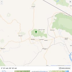
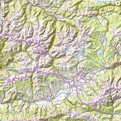
Ne pas confondre avec le pic Meru, un sommet du Nord de l'Inde. Le mont Méru est un volcan du Nord de la Tanzanie qui surplombe la ville d'Arusha. Avec 4 565 mètres d'altitude, il est le deuxième plus haut sommet du pays après le Kilimandjaro et le quatrième sommet le plus haut d'Afrique[1]. En forme de fer à cheval ouvert vers l'est, le mont Méru a connu sa dernière éruption en 1910, faisant de lui un volcan toujours considéré comme actif.
Mont Méru est son nom traditionnel. Le mont Méru vu depuis Arusha. Relief[modifier | modifier le code] Alignements de Carnac. Alignement de Kermario à Carnac Alignement de Kermario à Carnac, vue de l'autre partie Les alignements de Carnac forment un site d'alignements mégalithiques exceptionnel situé sur les communes de Carnac et de La Trinité-sur-Mer dans le département du Morbihan en Bretagne (la région de Carnac réunissant la plus forte concentration de mégalithes du monde[1]) et constitué d'alignements de menhirs, de dolmens et d'allées couvertes et réparti sur plus de quatre kilomètres.
Les alignements de Carnac sont les ensembles mégalithiques les plus célèbres et les plus impressionnants de cette période avec près de 4 000 pierres levées vers 4500 ans avant notre ère[2]. Depuis 1991, la fréquentation sur les sites est régulée, par souci de préservation des monuments, des sols et de la lande. Les alignements sont toutefois accessibles au public en haute saison par le biais des visites conférences avec un guide proposée par la Maison des mégalithes, et sont en libre accès en période hivernale.
Carte détaillée Pyrénées-Orientales - plan Pyrénées-Orientales. OpenStreetMap. Where am I?
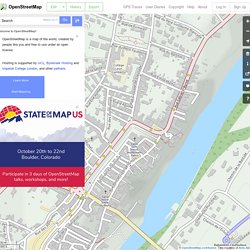
Welcome to OpenStreetMap! OpenStreetMap is a map of the world, created by people like you and free to use under an open license. Hosting is supported by UCL, Bytemark Hosting, Imperial College London, and other partners. Learn More Start Mapping <div id="noscript"><p>You are either using a browser that does not support JavaScript, or you have disabled JavaScript. 20 m 50 ft © OpenStreetMap contributors ♥ Make a Donation. CARTES.
Cartes-Atlas-Plans de villes. CARTES-ATLAS-PLANS de VILLES Mise à jour le 20 octobre 2017, proposez vos liens ABC-MAP: un logiciel libre de cartographie permettant de créer, de mettre en forme et d'imprimer des cartes géographiques simplement, ce logiciel est disponible gratuitement pour tout usage et fonctionne sur Windows, Linux et Mac ANCIENNES CARTES-LITHOGRAPHIES: réalisées entre 1842 et 1879 par M.
Popp pour des centaines de communes belges, une échelle incroyable, parfois jusqu'à 1/1250 et des liens vers des cartes de tous les pays du monde ASKMAPS: cartes gratuites pour l'impression et le téléchargement pour téléphones mobiles (iPhone iOS, Android), pour tablettes et lecteurs ebook (Kindle, Nook)... Géoportail. Fonds de cartes gratuits. Trois formats vectoriels pour une impression plus précise des tracés et un redimensionnement sans altération de la qualité de l'image : PDF, ODG et EMF.
D'autres sites avec des fonds de cartes :- (Sciences Politiques Paris) - (Education Place) - (World Atlas) - (Georesources) - (abc teach) - (Pupil Vision) - Édugéo, le géoportail de l'éducation. OpenStreetMap. Where am I?
Welcome to OpenStreetMap! OpenStreetMap is a map of the world, created by people like you and free to use under an open license. Hosting is supported by UCL, Bytemark Hosting and Imperial College London, and other partners. Learn More Start Mapping <div id="noscript"><p>You are either using a browser that does not support JavaScript, or you have disabled JavaScript. 50 m 200 ft © OpenStreetMap contributors. Directions from hereDirections to hereAdd a note hereShow addressQuery featuresCentre map here. OpenStreetMap. Where am I?
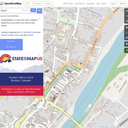
Welcome to OpenStreetMap! OpenStreetMap is a map of the world, created by people like you and free to use under an open license. Hosting is supported by UCL, Bytemark Hosting and Imperial College London, and other partners. Learn More Start Mapping <div id="noscript"><p>You are either using a browser that does not support JavaScript, or you have disabled JavaScript. 50 m 200 ft © OpenStreetMap contributors ♥ Make a Donation Directions from hereDirections to hereAdd a note hereShow addressQuery featuresCentre map here.
OpenStreetMap. 43°49'23.0"N 1°43'33.0"E - Google Maps. Cartes. 54, Promenade des Lices, 81800 Rabastens, France. Cartes de villes et de pays - Indication routières - Vues satellite - Itinéraires. Map of Latitude: 43.8231, Longitude: 1.7258. Relief Map. I Hans Braxmeier, Donaustraße 13, 89231 Neu-Ulm, mail@braxmeier.de Intention The vision of Maps-For-Free is to offer free worldwide relief maps and other layers which can easily be integrated into existing map projects.
MFF-maps are released under Creative Commons CC0. You are free to adapt and use the relief maps and relief layer for commercial purposes without attributing the original author or source. SRTM (Shuttle Radar Topography Mission) was developed to collect three-dimensional measurements of the Earth's surface to generate a near-global digital elevation model (DEM). SRTM flew on board the Space Shuttle Endeavour in February 2000 and used an interferometric radar system to map the topography of Earth's surface. SRTM data was processed into geographic tiles, each of which represents one by one degree of latitude and longitude. For technical reasons data are available between 60 degrees North and 56 degrees South latitud only.
The original SRTM data are available from USGS. VMap0. Zoom Earth - Explore satellite and aerial images of the Earth. Mapper 2.1 - 4.9 km NxNE of Saint-Sulpice. Tiny WMS/WFS Client - Satellite Mapping Application with Search - ACADEMA. Warning:Technical problems (server 4 satellite images - NASA JPL)!
Switch to Maps Only, please! Adjust colors (4 satellite images) Examples: (Coordinate Input) Report Bugs -> contact@academa.si About speed: service is running on 2x550 MHz 20th century machine with 2.5 MBits wireless connection. This page could look like: No pop-up windows, internal movable frames (like windows) are created for external sources, like Google Maps, Yahoo image search, etc.You might have a problem with this kind of windows, we tested this stuff on IE 5.5+, Mozilla 1.7+, Firefox 0.9+, Opera 8+ and Netscape 8+.
Click to see: Pyramides, Stromboli, Ayers Rock (Uluru), Bora-Bora, Rarotonga, Tahiti, Copacabana, Gibraltar Show & Mark: Mt Everest, Aconcagua, Kilimanjaro, Mt Saint Helens, Ararat, Eiger, Mt. Tips: To export center of the map - select Misc. Blue Marble Navigator - 43.82°N 1.73°E. Toulouse Perpignan Pau Montauban Albi Tarbes Narbonne. GeoNames.org. Earth View. Norkart Virtual Globe load and start page. This page loads and starts a Virtual Globe with the following parameters: The Virtual Globe requires Java 1.5 or better installed on your computer, testing for Java: Your browser doesn't tell if you have Java installed or not. You can try to click here to start the Virtual Globe. If it doesn' work you should try to download and install Java first. Your browser may ask what to do with a file of type application/x-java-jnlp-file, you should specify that it should be opened by the program javaws.
Your browser doesn\'t tell if you have Java installed or not. Moving around You can move around in the virtual world by using mouse or key commands. For all commands; combining with [shift] accelerates the key and mouse action. In the upper left corner of the Virtual Globe main window there is an overview map. Some advice for efficient navigation in the 3D world: Move to some distant place: Click in the overview map. View a place from all directions: Troubleshooting. Free Online Topo Maps. The World's search engine. Draw a map from a GPS data file. Топографическая карта Украины, России, Беларуси 43.823,1.7258. EditGPX. EditGPX.