
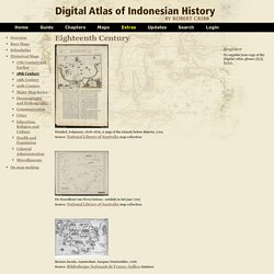
Digital Atlas of Indonesian History - By Robert Cribb. Nieuhof, Johannes, 1618-1672, A map of the islands before Batavia, 1704 Source: National Library of Australia map collection De Noordkust van Nova Guinea : ontdekt in het jaar 1705 Source: National Library of Australia map collection Borneo Insula.
Amsterdam: Jacques Desborddes, 1706 Source: Bibliotheque Nationale de France, Gallica database Batavia (...). Amsterdam: Jacques Desborddes, 1706 Source: Bibliotheque Nationale de France, Gallica database Carta Soera de Nigrara. Isle de Banda (...). Iava Maior. Teaching with GIS in the Geosciences. Created by Brian Welch, Dept. of Environmental Studies, St.
Olaf College, Northfield, MN What is GIS? GIS = Geographic Information Systems GIS represent a collection of methods (usually as computer software) to collect, organize, analyze, and present spatial data. At the introductory level, we can consider the broader concepts of GIS to include any methods that develop and present quantitative spatial relationships within a data set. Learn more about GIS More about Spatial Relationships in Geoscience Why use GIS within introductory geoscience courses?
Mapping America — Census Bureau 2005-9 American Community Survey. Europe Historical Atlas, Europe History Maps, Historical Europe Maps, Europe Historical Map, Historical Europeon Maps, Europe History Maps 1937. Online Digital Sources. ODSAS is a platform for storing, personalized manipulation and individual and collective multilayer annotation of digital resources in the social sciences and humanities.
Components The first component is constituted by the technology, software and webserving, which is called ODSAS itself. The second component is constituted by the program of digitizing and organizing the collections and archival sources. This component, called ADAP (Archives Digitales Asie-Pacifique). Storing ODSAS is first of all a place for storage and provision of digital resources that are of difficult access to the scientific community. Personalized manipulation. Calisphere - A World of Digital Resources. Atlas - Atlas of Historic NM Maps. History Chapter. There is an old saying that geography is the eldest daughter of history.
Implicit in this expression is the importance of studying how place affects the events that shape our world. Together, history and geography describe time and place. To understand the events and conditions in the past, it is important to consider the context of when and where. Maps can set this graphic context and provide keys to understanding major historic events and more subtle changes over time. Maps. Home page Down to: 6th to 15th Centuries | 16th and 19th Centuries | 1901 to World War Two | 1946 to 21st Century.

Historical Maps Overview. Digital History. Digital History>Maps Links to Historic Maps Fifteenth Century | Sixteenth Century | Seventeenth Century Eighteenth Century | Revolutionary Era | Early National Period Nineteenth Century | Civil War Fifteenth Century (1401-1500) 1482 Claude PTOLEMEE, Cosmographia.
Ulm, L. Sixteenth Century (1501-1600) Dave Leip's Atlas of U.S. Presidential Elections. WWW-VL: History Index: Maps. Cyber Badger Research Blog. WORLD HISTORY SOURCES: FINDING WORLD HISTORY. Cartographic Images Home Page. Click here Early Medieval Cover Page to see an Index of 175 cartographic images, with a selection of low resolution JPEG images and accompanying descriptions or monographs representing maps from Click here Late Medieval Maps to see an Index of 175 cartographic images, with a selection of low resolution JPEG images and accompanying descriptions or monographs This site has been re-hosted courtesy of Mr.
Henry Davis Consulting, Inc New Products and Marketing Consultants The 530 Renaissance maps are no longer available online, unless there is a benefactor out there twilling to host these images from 1500 - 1860. World Atlas Maps. Chronological, State Maps, Topical, Military, Cartography, Iraq Map, Historical Locations. WORLD ATLAS - World. Graphical World History ATlas - GWHAT - maps, teachers, students, and their intersection. American History: "Growth of a Nation" The Atlas Blaeu-van der Hem. The Atlas Blaeu-Van der Hem can be considered the most beautiful and most remarkable atlas that has ever been composed.
The atlas contains more than 2400 maps, prints, and drawings, distributed over 46 volumes. This collection, a show-piece of Dutch seventeenth-century cartographic and topographic art, is preserved fully intact in the Austrian National Library in Vienna. An illustrated and annotated catalogue. 6 vols., 1996-2008, see below For the full size facsimile, 2009-… check the special website of the publisher HES & De Graaf: www.blaeuvanderhem.com The Atlas Blaeu - Van der Hem of the Austrian National Library.
Editorial committee: G. A complete catalogue of one of the largest and finest atlases ever assembled. In the past the Atlas Blaeu-Van der Hem has been the subject of several studies in which the atlas has been treated in a more or less concise way (Ausserer in 1929; Wagner in 1976). Introduction. Historical Maps and Atlases. Historical Maps and Atlases General Europe North Africa.
Maptext. The Danelaw. Map of London, 16th Century. Panoramic Maps Collection. The Library of Congress Map Collections | Cities and Towns Geography and Map Division, Library of Congress The Panoramic Maps collection has been migrated to an improved presentation.
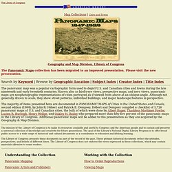
Please visit the new presentation. Search by Keyword | Browse by Geographic Location | Subject Index | Creator Index | Title Index The panoramic map was a popular cartographic form used to depict U.S. and Canadian cities and towns during the late nineteenth and early twentieth centuries. Osher Map Library. U.S. State and County Boundary Maps and Old American Atlas Maps. Map of Italy - Rome, Italy Map Information History, Italian Maps. Italy was certainly influenced by many powerful cultures and political forces over time, including the Byzantines, Etruscans and Greeks, but it was the world-changing impact of both the Roman civilization and the Italian Renaissance that contributed most-significantly to its status in the modern world.
The Roman Republic originated in 510 BC and many powerful Emperors would rule its territories. It was during the life of Julius Caesar (100 BC-44 BC) that the Roman Empire began its total domination of the Mediterranean area and parts of central Europe. Its powerful legions swept across the lands and seas and no one could match the strength of its armies. The pages of history are replete with seemingly invincible cultures that eventually faded away, and the Roman Empire was no different. Centuries of invasions and assorted wars continued here throughout the Middle Ages; small cities emerged; regional powers developed, and Genoa and Venice created vast commercial empires. American Studies @ The University of Virginia. Cultural Maps in American Studies Comments Hans Holbein, the younger, Typus Cosmographia Universalis 1532 Cultural Maps is dedicated to the graphical presentation of non-graphical information -- whatever that turns out to mean.
At present, it has something to do with maps in the ordinary and normal sense of the term; the immediate goal is to build a digital American Historical Atlas. Mémoire du monde. Home - Österreichische Nationalbibliothek. The Atlas Blaeu - Van der Hem. History of Cartography: Regional Map Societies. University Library - The Map Collection / Online Maps. Map Collection - World Sites Atlas. World Atlas A physical and a political map of the world, divided into tiles for easy navigation. Maps of Continents and Regions Select a continent or region below to jump to its map. From there, click on a country name to get maps, hotels, and information.Here is a complete list of links.
Maps of Countries and Territories Use the drop-down list below to jump to map for that country or territory (a few do not have maps yet).Click here for a complete list of country maps. Maps of U.S. Use the drop-down list below to jump to the map page for that state or province.Here is a list of all the state and province map pages. Maps of U.S. We have over 20,000 pages for U.S. cities and towns. Thematic World Maps Select a statistic below to go to its interactive world map.Here is a complete list of links. University of Georgia Libraries.
The Hargrett Rare Book & Manuscript Library at the University of Georgia Libraries maintains a collection of more than 1,000 historic maps spanning nearly 500 years, from the sixteenth century through the early twentieth century. Although not limited to a single geographic subject, the collection heavily emphasizes Georgia as colony and state, along with its surrounding region. The Hargrett maps database serves as a finding aid for the majority of Hargrett's map holdings and provides digital versions of most maps. Not currently included in the database are maps from the Confederate Imprints collection and the County Maps collection. For information on these, please contact the Hargrett Library. For more modern map holdings, visit the UGA Libraries' Map & Government Information Library. Collection numérique de cartes et plans. Welcome to the Bodleian Library Map Room Home Page. An Atlas of Cyberspaces- Historical Maps.
USENET in 1981. The topology of the BITNET in 1981 (partial map) The NSFNET infrastructure and topology in 1991. Historical Maps of the World for every year in recorded history. Usa - United States Map - Geography - Maps, States, Capitals, Flags, Presidents, Do You Know About US geography ? .... 1952-1956. March of Democracy. Historypin. US Presidential History on Google Maps. FreePoverty - Knowing Helps. Interactive Map Showing Immigration Data Since 1880 - Interactive Graphic. Mapping Initiatives.