
KML Tools. GeoSolution. Fun stuff for Google Earth. Παγκόσμια Πανοραμική Φωτογραφία - 360 Cities. Follow Your World. KML Builder. Welcome Kml Builder makes it easy to create and edit KML files to be viewed in Google Earth Places you create with Kml Builder can be emailed to your friends or co-workers and can even be published on the Internet or on Intranets for a broader audience.
Anyone who has Google Earth Desktop installed on their computer can open your created KML files with just a mouse click. The Kml Builder 3-D Earth Viewer displays houses, the color of cars, and even the shadows of people and street signs. You can create Placemark and Shared Style balloons by adding images, pictures, YouTube videos, Flash Macromedia files and Internet links. Kml Builder is perfect if you plan to capture a trip somewhere on the earth by easily adding geospatial points of interest complete with formatted text and styled pop-up balloons. Key features of Kml Builder include: Docked windows in which most windows can be closed. Ομάδες Google. Plexscape - Google Earth AutoCAD. Google Earth Blog. Google Maps Mania.
TJ's consistent KML modelling. How Google Earth Works" Most of us have been using one online mapping program or another for years now.
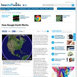
They're a godsend for those of us who get lost within a 3-mile radius of our homes, and they're just plain fun for people who enjoy figuring out where stuff is. With this in mind, imagine how amazing Google Earth must be for it to elicit awe from the online community and cause South Korea to demand changes to the program. Google Earth is no ordinary mapping application. Type "Denver, CO" into the Google Earth search box, and yes, you can learn where Denver, Colo. is in relation to Grand Junction, Colo. and how to get from your address to 1600 Curtis St. in downtown Denver. And you thought the world was small before. The application is fairly easy to use, but there are a lot of functions to try out. Pict'Earth. Google Earth Community - Forums powered by UBB.threads™
Google LatLong. Google Earth Tools. Help keeping these programs freeware.
Make a donation by PayPal. Tools for GoogleEarth freeware Portuguese [Home] [Scale 2.0] [Climogram] Software - FME - Solutions - For Products - Google Earth/Maps. Google Earth Design. GooPs. Free Geography Tools. iCraig. iCraig » iPhotoToGoogleEarth. ZNO. Examining how internet mapping tools like Google Earth affect science and society. Google Earth. Google Earth is a virtual globe, map and geographical information program that was originally called EarthViewer 3D created by Keyhole, Inc, a Central Intelligence Agency (CIA) funded company acquired by Google in 2004 (see In-Q-Tel).
It maps the Earth by the superimposition of images obtained from satellite imagery, aerial photography and geographic information system (GIS) 3D globe. It was originally available with three different licenses, but has since been reduced to just two: Google Earth (a free version with limited function) and Google Earth Pro ($399 per year), which is intended for commercial use.[4] The third original option, Google Earth Plus, has been discontinued.[5][6] For other parts of the surface of the Earth, 3D images of terrain and buildings are available. Google Earth uses digital elevation model (DEM) data collected by NASA's Shuttle Radar Topography Mission (SRTM).[11] This means one can view the whole earth in three dimensions.
Detail[edit] Uses[edit] Mars[edit] Χάρτες @ GIS Planet. KML2KML. Placemarker. GIS planet. Xbbster. Zonums Software Tools. KML-Circles (beta) Google Earth Blog. Finding illegal pools with Google Earth. KML Circle Generator. GIS Cloud. Real time GPS tracking in Google Earth. Real time GPS tracking in Google Earth This guide shows you how to view one or more remote vehicles or persons in Google Earth in real time!
The moving person, let's call him - Person A, needs a mobile phone, a Pocket PC, laptop with a GPS and Internet connection that supports GpsGate.com (You find a list at GpsGate.com). The viewing person, let's call him - Person B, needs a Windows PC with Google Earth installed. Note! In GpsGate 2.5 build 175 and later can you see your whole buddy list in Google Earth! GpsGate.com Both persons needs to create an account by GpsGate.com and invite & accept an invitation to the other persons buddy list. GpsGate Server If you have installed your own GpsGate Server, you can do this as well, just make sure you send and receive data to/from your server and not GpsGate.com Setup for Person A - the mobile guy 1. Now GpsGate on your Pocket PC / laptop will send your position to GpsGate.com Setup for Person B - the viewing guy 1. Χαρτογράφος Google. Google Map Maker officially closed on March 31, 2017, and many of its features are being integrated into Google Maps.
Since 2008, the Google Map Maker community has edited and moderated millions of features to improve the Google Maps experience. To make it easier for all Google Maps users to contribute changes to the map, we’ve started to graduate functionality from Map Maker to Google Maps on both desktop and mobile.