

CartoDB El Hierro. Google Maps Mania. 3D - Climate Change and Pollution Viewer. Google Earth. Synchronize ArcGIS with Google Earth. The advantage of loading satellite images of Google Earth / Maps directly into ArcGIS, offers a wide range of applications and uses, for the simple fact of being the one server that covers a wide geographic area of the globe, also has good resolution and images up to date, you can also synchronize with the services of Bing Maps, OpenStreetMap, CloudMade, MapBox, among others.
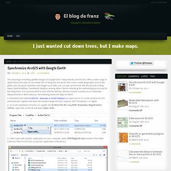
Before indicating the methodological process for the integration, it is recommended to work with the WGS84 reference system (usually occurs otherwise displacements or deformations), the following shows the steps to follow: 1. Download and install ArcBruTile – Basemaps in ArcGIS Desktop 0.2.2 open source (in recent versions ArcGIS automatically registers but does not include Google services) requires. NET Framework 2 or higher. The one million tweet map. Crear mapas con Google Maps Engine Lite.
Google acaba de actualizar el servicio de Google Maps Engine Lite, pasando a denominarse Mis Mapas.
Esta herramienta permite a los usuarios crear fácilmente sus propios mapas sobre los mapa base de Google Maps. Esta versión está diseñada para usuarios que quieren crear mapas sencillos que luego pueden ser fácilmente compartidos. El único requisito es tener una cuenta de Google. Escalable y con un coste ajustadoFácil de usar y compartirPreparado para móvilesInnovador La creación de los datos geográficos en Mis Mapas se puede hacer de dos modos: Dibujando puntos de interés, líneas o polígonos.Mediante la importación de datos de una hoja de calculo que contenga un campo geográfico.
Mis Mapas está diseñado para proyectos pequeños, tiene un límite de 2000 registros al importar hojas de cálculo de Google Drive, CSV, XLSX, TSV, KML, KMZ o GPX. Descarga y guarda el siguiente archivo en el escritorio: 1. Displaying Big Data On A Google Map. //Problem: Displaying Big Data On A Google Map There are two key features of web mapping.
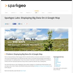
The first is that the interface is resources constrained: it is a browser. The second is that generally you are expected to be able to drive as much data and functionality to that browser as you would expect on a desktop product. In fact, the user doesn't even want to consider how difficult it is to achieve a smooth, immersive map-based experience, they just want to experience what the map is showing them.
Converting SHP to Google Fusion Tables. Google Fusion Tables provides a relatively easy way to display geographic data on top of Google Maps.
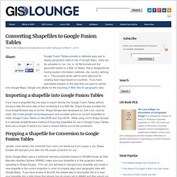
Data can be uploaded in .csv, .tsv, or .txt file formats and the geocoded based on a field (or fields) that is designated as having location information (address, city, country, lat/long, etc.). This process works well for point data and for creating heat maps based on countries. If you have specialized polygon or line data that you want to overlay onto Google Maps, Google only allows for the importing of KML files for geographic data.
Importing a shapefile into Google Fusion Tables If you have a shapefile that you want to import directly into Google Fusion Tables without having to take the extra step of first converting it to a KML file, Shape Escape provides the most straightforward way to do this. A fresh new look for the Maps API. For nearly eight years, developers around the world have used the Google Maps APIs to build beautiful, powerful, and impactful apps.
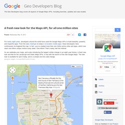
From the early mashups to today’s on-location mobile apps, these developers have continuously re-imagined the map. In fact, you’ve created more than one million active sites and apps, which now reach one billion unique visitors every week. One billion! That’s nearly half the Internet. As we celebrate your maps, we’re also introducing the largest visible change in our eight year history: a fresh new look and feel for the JavaScript and Static Maps APIs, in line with the launch of the new Google Maps.
We’ve carefully designed the change to work seamlessly with all existing sites, and as such all third party customizations such as custom markers, overlays, map types, and the like will continue to function as they did before. New base map tilesnew default markernew info window stylestyle refresh of the controls. Techniques in Google Earth and Google Maps. Techniques in Google Earth and Google Maps Michael Peterson, Konal J.
Dobson, Kevin Fandry, and William Shrader University of Nebraska at Omaha | mpeterson@unomaha.edu The three contributions here come from a graduate course entitled “Cartographic Methods,” taught by Michael Peterson at the University of Nebraska at Omaha during the 2012 Spring semester. The course dealt with various ways of using cloud resources to make maps. Konal Dobson begins by examining how Google Earth can be used to depict subsurface geology through pop-up block diagrams.
-Michael Peterson by Konal J. Google Earth is a useful interactive mapping tool that allows users to control oblique perspective views of the earth. A 3-D element is added to Google Earth by building a model that consists of a block that’s been draped with pixels to give a representation of the building’s exterior. Research into this concept had been previously conducted by Declan De Paor in 2009.
Figure 1. Google Maps Tutorials.