

Using WMS service layers. Colorbrewer: Color Advice for Maps. Making maps, part 1: Less interactivity. This is part one of a five-part series about our recent explorations making choropleth maps using PostGIS, TileMill, Mapnik and Google Maps.
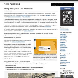
Read parts two, three, four and five for the full effect. Bonus post: part six! The impatient may grab the source code from GitHub, or try out the demo. A couple weeks ago, while drinking some beers with my teammates Chris and Ryan N., we got to talking about how we could improve our maps. Interacting with maps embedded in a box is unsatisfying and often confusing. It gets messier when you want to add information beyond labeling geographic features — the population of a region or a change over time.
Overlaying two images with automatic resize using ImageMagick. Mapnik. Mapnik is an open source toolkit for rendering maps.
Among other things, it is used to render the five main Slippy Map layers on the OpenStreetMap website. It supports a variety of geospatial data formats and provides flexible styling options for designing many different kinds of maps. Mapnik is written in C++ and can be scripted using binding languages such as Javascript (Node.js), Python, Ruby, and Java. It uses the AGG rendering library and offers anti-aliasing rendering with subpixel accuracy. It can read ESRI shapefiles, PostGIS, TIFF rasters, .osm files, any GDAL or OGR supported formats, CSV files, and more. You can learn more about using Mapnik at the The Mapnik Wiki and by joining the #mapnik channel on freenode. Boston GIS: Geographic Information Systems Web Mapping OpenGIS and open source Solutions.
Getting Started with Map Tiling: Mapnik and Shapefiles - Jongyu Lin. About a year ago, I was working on launching a website with a map interface.

I wanted full control over everything, including generating my own map tiles instead of using a third-party provider like Google Maps. It ended up being a bad idea, because map tiles take up a lot of resources to generate and store. By going through the process I have a much better understanding of map tiles and I hope this will serve as a step-by-step process showing how to generate tiles from start to finish. Mapnik-german osm style, problem with views in postgres database. Hi, I am trying to get the german mapnik style to work on Ubuntu 12.04 as proposed by the SVN README: > To deploy this style use the supplied default.style file for > osm2pgsql and import data using the hstore extension of > PostgreSQL (--hstore --hstore-match-only switches of osm2pgsql).
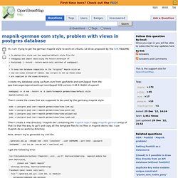
> > To keep the database compatible to the "original" Mapnik style we > now use views instead of tables. SQL scripts to set up these views > are supplied in the views directory. I create my database using sachsen.osm from geofabrik and osm2pgsql from the ppa:kakrueger/openstreetmap (osm2pgsql SVN version 0.81.0 (64bit id space)) osm2pgsql -m -d osm --hstore -W -S /path/to/mapnik-german/views/default.style mapnik/sachsen.osm. Part 2: Building Tiles with PostGIS OpenStreetMap data and Mapnik: Your Own OpenStreetMap. This is a continuation of our Loading OpenStreetMap data in PostGIS.
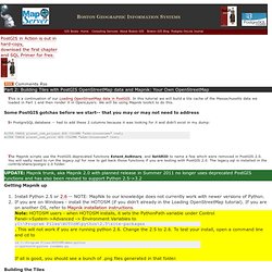
In this tutorial we will build a tile cache of the Massachusetts data we loaded in Part 1 and then render it in OpenLayers. We will be using Mapnik toolkit to do this. Some PostGIS gotchas before we start-- that you may or may not need to address In PostgreSQL database -- had to add these 2 columns because it was looking for it and didn't exist in my dump: ALTER TABLE planet_osm_polygon ADD COLUMN "addr:housename" text; ALTER TABLE planet_osm_point ADD COLUMN "addr:housename" text; Download.geofabrik.de/asia.html. Rendering. Rendering a map from raw geodata, gives us the flexibility to style it in many different ways.
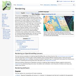
OpenStreetMap's free and open geodata offers tremendous power, and a range of tools are available for rendering with OpenStreetMap The process of rendering a map generally means taking raw geospatial data and making a visual map from it. Often the word applies more specifically to the production of a raster image, or a set of raster tiles, but it can refer to the production of map outputs in vector-based formats. "3D rendering" is also possible taking map data as an input. The ability to render maps in new and interesting styles, or highlighting features of special interest, is one of the most exciting aspects having open access to geodata. Developers in and around the OpenStreetMap community have created a wide variety of software for rendering OpenStreetMap data.
502959 “segfault when parsing docbook XML with several exte...” : Bugs : lxml. Howto real time tiles rendering with mapnik and mod python. Introduction In a project I was creating, based on my own rendering rules sets, I hit a problem that I solved by real-time rendering tiles.
It is clearly not the fastest solution as mod_tile is better. But I didn't want to install mod_tile Here is a live example of it : Yet another validation tool for osm data What is this solution good for? If you wish to save disk space If you want to test or to have several different mapnik styles If you want more flexibility on tile generation process with your own python code If you want updates very often if you can't or don't want to install mod_tile which is faster What problems does that create? Slippy map tilenames. This article describes the file naming conventions for the Slippy Map application.
Tiles are 256 × 256 pixel PNG files Each zoom level is a directory, each column is a subdirectory, and each tile in that column is a file Filename(url) format is /zoom/x/y.png The slippy map expects tiles to be served up at URLs following this scheme, so all tile server URLs look pretty similar. Tile servers The first part of the URL specifies the tile server, and perhaps other parameters which might influence the style. Generally several subdomains (server names) are provided to get around browser limitations on the number of simultaneous HTTP connections to each host. Mapnik/Fedora Installation.
Installation on Fedora Note: Updated for F18 on July 3, 2013 Install and run the database server if you haven't done this before (as root) yum install postgresql-server postgresql-setup initdb systemctl start postgresql Optionally set the service to start automatically systemctl enable postgresql Install the postgres postgis extension (as root)
Mapnik: Rendering OSM XML data directly. Map rendered from raw OSM data using the sample map file, showing a part of Milan, Italy So, you wonder, how to render your own map with mapnik?
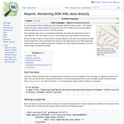
Here, you go... This tutorial covers the basic steps starting from scratch. First of all, make sure you have mapnik installed. How to install Python 2.7 and 3.3 on CentOS 6. In this guide I will show you how to install Python 2.7 and 3.3 on CentOS 6. The examples below are for Python 2.7.6 and Python 3.3.5, but the procedure is the same for any modern version of Python including the upcoming Python 3.4.0. I make regular updates to this guide to track new versions. Please see the end of the document for a changelog. Svn.openstreetmap.org/applications/rendering/mapnik/README.
Outlook - titasak. Osm2pgsql. Osm2pgsql is a command-line based program that converts OpenStreetMap data to postGIS-enabled PostgreSQL databases. Such databases are often used to render OSM data visually using Mapnik, as PostgreSQL is one of the most efficient and flexible formats Mapnik can use for querying large amounts of data. For more information on using osm2pgsql to render OpenStreetMap data with Mapnik, see the Mapnik page. Its homepage is: It currently does not have a sole maintainer but is maintained by a community of contributors and Osm2pgsql does not a designate 'stable' or 'development' versions but most recent builds should be able to be used in a production environment.
Until April 2013, it was hosted on svn. Mapnik/Fedora Installation. UsersWikiPostGIS20CentOS6pgdg – PostGIS. This installation method uses YUM packages maintained by Devrim GUNDUZ of the PostgreSQL Global Development Group (PGDG). For an overview of installing PostgreSQL using this method, see other details at Additional packages from EPEL 6 (Extra Packages for Enterprise Linux) are required to fulfill requirements for GDAL. Configure YUM ¶ Log into the system with root access. These instructions assume that you are using a command-line editor vi, however use whatever text utility you are comfortable with. Create CentOS 6.4 Master OVA. Install PostgreSQL 9.2 on Fedora 19/18, CentOS/RHEL/SL 6.4/5.9.
#417 Foundation. UsersWikiPostGIS20CentOS6pgdg – PostGIS. How to efficiently parse large text files in Ruby. Can't Update or Uninstall Extension Pack. Hi! Same problem here (Win7 x64 ultimate, user with administrative rights but active UAC) - even after starting VirtualBox.exe as administrator. <error-message with translation>Das Zusatzpaket S:/_Tools/Oracle-Sun/VirtualBox/Oracle_VM_VirtualBox_Extension_Pack-4.1.8.vbox-extpack konnte nicht installiert werden. [The extension pack PATH/filename could not be installed. (S:' is the drive letter of a shared folder on a local device. As I too can't uninstall the older extension pack I don't think that the use of this mapped folder is the reason)] HOW TO: Install latest geospatial & scientific software on Linux. Why bother building software from source?
Frequently, the latest and greatest scientific/geospatial software is not available in the standard package repositories (especially on server-oriented distributions, like CentOS). Third-party repositories may exist for some software, but these often conflict with each other and may still not be entirely up-to-date. Dependencies between standard and non-standard packages will often lead to conflicts that may be difficult or impossible to resolve without building some software from source.
Building software from source also allows one to fine-tune the installation to one's needs and allows for packages to be installed on systems where one does not have administrator access. HOW TO: Install latest geospatial & scientific software on Linux. Why bother building software from source? Frequently, the latest and greatest scientific/geospatial software is not available in the standard package repositories (especially on server-oriented distributions, like CentOS).
Completelynovel/html_compressor. Command line - How to check if smtp is working from commandline (Linux) Command line - How to check if smtp is working from commandline (Linux)