
LAStools: converting, filtering, viewing, processing, and compressing LIDAR data in LAS format. Download LAStools HERE now with GUIs and ArcGIS toolbox abstract: We provide an easy-to-use, ultra-light-weight, very efficient C++ programming API called LASlib (with LASzip DLL) that implements reading and writing of LiDAR points from and to the ASPRS LAS format (version 1.0-1.3) as well as its --- losslessly compressed, but otherwise identical twin --- the LAZ format (see below).
All source code (LGPL) is included. Built upon LASlib (with LASzip DLL) are LAStools - a collection of highly-efficient, scriptable tools with multi-core batching that process LAS, compressed LAZ, Terrasolid BIN, ESRI Shapefiles, and ASCII. How to install LAStools toolbox in QGIS. The more complex installation instructions are only relevant for older QGIS versions.
Starting with QGIS 2.10 or newer you can skip directly to step 4 and disregard most of step 6: We had an ArcGIS LiDAR processing toolbox since April 2012 and now we have one for QGIS as well. Rapidlasso GmbH. Our flagship product is the LAStools software suite, which is an easy download (28 MB) and is available for licensing (see pricing).
It is a collection of highly efficient, batch-scriptable, multicore command line tools. We have tools to classify, tile, convert, filter, raster, triangulate, contour, clip, and polygonize LiDAR data (to name just a few functions). All of the tools can also be run via a native GUI and are available as a LiDAR processing toolboxes for ArcGIS versions 9.3, 10.0, 10.1, 10.2, or 10.3, for QGIS versions 1.8, 2.0, 2.2, 2.4, 2.6, 2.8, or 2.10, and for ERDAS IMAGINE versions 14.0 and 15.1. LAStools are the fastest and most memory efficient solution for batch-scripted multi-core LiDAR processing and can turn billions of LiDAR points into useful products at blazing speeds and with low memory requirements.
AutoCAD Civil 3D Help: Tutorial: Working with Point Clouds. Help Sign In English English 日本語 简体中文 English (International) 繁體中文 Čeština Deutsch Español Magyar Italiano 한국어 Português (Brasil) Русский Polski Français Except where otherwise noted, this work is licensed under a Creative Commons Attribution-NonCommercial-ShareAlike 3.0 Unported License.
Please see the Autodesk Creative Commons FAQ for more information. Introduction To UAV Photogrammetry And Lidar Mapping Basics. UAV lidar and photogrammetry imaging applications are increasing rapidly.
This is not surprising as using GPS enabled UAVs for aerial surveying is very cost effective in comparison to hiring an aircraft with photogrammetry equipment. Because UAVs are relatively inexpensive, many organisations will have their own UAV fleet, allowing for rapid surveys over large land areas and infrastructure projects where required. With GPS equipped drones, digital cameras and powerful computers, surveys have an accuracy right down to 1 centimeter.
This post takes an overall look at this drone mapping technology. We also take a quick view at the sectors benefiting from using UAVs for photogrammetry and lidar mapping. Another closely related sector is using LiDAR sensors mounted onto drones. The use of quadcopters and multirotors in photogrammetry and lidar mapping is still in the very early stages but growing very fast. What Exactly Is UAV Photogrammetry 3D Maps And Models. Dem - Viewing LIDAR data (.las) in QGIS? Current community your communities Sign up or log in to customize your list. more stack exchange communities company blog Stack Exchange Inbox Reputation and Badges sign up log in tour help Geographic Information Systems Ask Question.
14.8. Lesson: MNE à partir de données LiDAR. Vous pouvez améliorer l’allure de vos cartes en utilisant différentes images de fond.
Vous pourriez utiliser la carte de base ou l’image aérienne que vous avez utilisées avant, mais un raster d’ombrage du terrain sera plus joli dans certaines situations. Vous utiliserez LAStools pour extraire un MNE depuis un jeu de données LiDAR et ensuite créerez un raster d’ombrage pour l’utiliser dans votre carte de présentation plus tard. Objectif de cette leçon : Installer LAStools et calculer un MNE depuis des données LiDAR et un raster d’ombrage.
Follow Along: Installation de Lastools La gestion de données LiDAR dans QGIS est possible en utilisant le Module de Traitements et les algorithmes fournis par LAStools. You can obtain a digital elevation model (DEM) from a LiDAR point cloud and then create a hillshade raster that is visually more intuitive for presentation purposes. Rendez-vous au dossier exercise_data\forestry\lidar\, vous pouvez y trouver le fichier QGIS_2_2_toolbox.zip. Note. Las data in qgis - Google Search. Aide. Utilisation d'AutoCAD Map 3D: Création de surfaces à partir de données de nuages de points. Autocad map gestionnaire de nuage de points. Aide: Gestionnaire de nuages de points. Aide Connexion Français 简体中文 繁體中文 Čeština Deutsch English Español Français Magyar Italiano 日本語 한국어 Polski Русский English (International) Sauf mention contraire, ce travail est autorisé par une licence Creative Commons Attribution - Pas d’utilisation commerciale - Partage dans les mêmes conditions 3.0 non transposé.
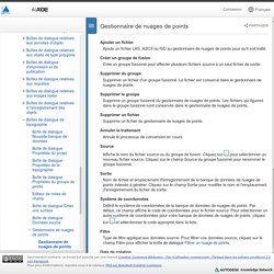
Pour plus d'informations, reportez-vous à la rubrique FAQ sur Autodesk Creative Commons. Utilisation d'AutoCAD Map 3D: Insertion de données LiDAR. Fichier .las dans autocad map.