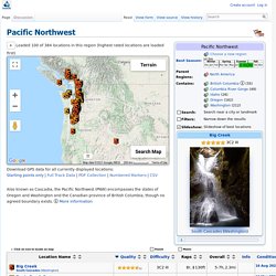
Pacific Northwest - ropewiki. Please wait, loading from server...
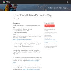
Terrain Map Data Map data ©2021. Upper Klamath Basin Recreation Map North - US Forest Service Pacific Northwest Region (WA/OR) - Avenza Maps. Description: Upper Klamath Basin Pacific Northwest Recreation Map Fremont-Winema National Forests Lakeview District - west – BLM Crater Lake National Park 2006 USDA Forest Service, Pacific Northwest Region, Data Resources Management www.fs.usda.gov/fremont-winema Produced in cooperation with USDI Bureau of Land Management Oregon State Office, National Park Service, and US Fish & Wildlife Service There are two sides to the printed version of this map.
The other side is also available in the Avenza Map Store. Central Oregon Cascades Recreation Map South - US Forest Service Pacific Northwest Region (WA/OR) - Avenza Maps. What's new: Complete map redesign and rebuild with refreshed and reviewed data.
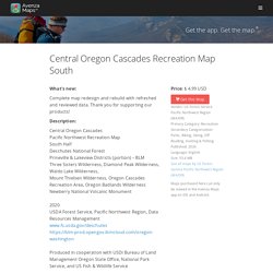
Thank you for supporting our products! Description: Central Oregon Cascades Pacific Northwest Recreation Map South Half Deschutes National Forest Prineville & Lakeview Districts (portion) – BLM Three Sisters Wilderness, Diamond Peak Wilderness, Waldo Lake Wilderness, Mount Thielsen Wilderness, Oregon Cascades Recreation Area, Oregon Badlands Wilderness Newberry National Volcanic Monument 2020 USDA Forest Service, Pacific Northwest Region, Data Resources Management www.fs.usda.gov/ Produced in cooperation with USDI Bureau of Land Management Oregon State Office, National Park Service, and US Fish & Wildlife Service There are two maps to the printed version of this map.
Region 6 - Maps & Publications. Deschutes National Forest - Recreation. P1 Weyerhaeuser Recreation - Find A Permit. Logging in Oregon. Logging industry, pacific northwest, old photos.
Fossil hunting along the Sunset Highway. Mud is us!
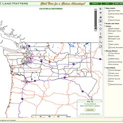
If you spend much time squelching through Oregon’s soggy landscapes you might get the feeling that we have only recently squeezed from the primordial mud. And that might not be too far off, if you permit me to readjust your watch to count eons instead of minutes. Washington Mining Claims. Map Tip× Zoom in FirstThen choose a Base Layer To stay InformedAbout Land Matters Updates Subscribe to the Landmark Newsletter Customize Your MapRight Click on any Layer name and choose "transparency" to blend your Map Layers The ToolAnswers your QuestionsWith a CLICK on the Map You can doComplex Map Searcheswith the Binocular Tool Learn More about Map Toolsby clicking on the Button Above The ToolAnswers your QuestionsWith a CLICK on the Map For better Speedon a Slow ConnectionMake your Map Window Smaller To Zoom in FAST Draw a Zoom Box You can go BACK to a previous map.
ArcGIS Web Application. How to Find an Abandoned Mining Claim in 9 Easy Steps. For those interested in having a mining claim of their very own, it helps to remember that claims are sometimes abandoned by their holders or forfeited for failure to comply with the requirements for maintaining them.
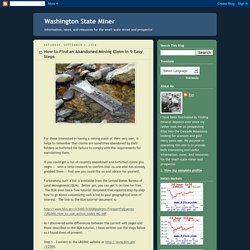
If you could get a list of recently abandoned and forfeited claims you might -- with a little research to confirm that no one else has already grabbed them -- find one you could file on and obtain for yourself. Fortunately, such a list is available from the United States Bureau of Land Management (BLM). Better yet, you can get it on-line for free. The BLM even has a free tutorial document that explains step-by-step how to go about customizing such a list to your geographical area of interest. The link to the BLM tutorial document is: As I discovered some differences between the current web pages and those described in the BLM tutorial, I have written out the steps below as I found them at present: Map of Mining Claims In Washington. MiamiWatershedAnalysis. OGv50all. Historic Oregon Topographic Maps, 1898-1993. The Historic Oregon Topographic Maps consist of superceded or obsolete topographic maps published by the U.S.
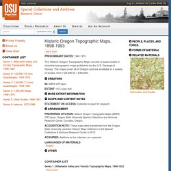
Geological Survey. The maps cover all of Oregon as well as small portions of the bordering states of California, Idaho, and Washington. The bulk of the collection consists of 1:24,000 (7.5 min) quadrangle maps that were issued predominantly in the 1950s through 1970s and 1:62,500 (15 min) quadrangle maps which date from 1906 to the early 1970s. The maps depict topography; vegetation cover; rivers and lakes; roads, railroads, and other transportation; political boundaries; and the boundaries of national forests and parks. Of special note are topographic maps of the Willamette Valley and vicinity that were prepared in the 1900s-1910s; these depict the southern and central Willamette Valley from Springfield and Eugene to Albany. The earliest maps in the collection are 1:125,000 (30 min) sheets published as early as 1898.
Ger usgs topo index 1933. Ger publications list. Oregon Caves National Monument. Location and Importance N southern Oregon, in Josephine County, 52 miles southwest of Grants Pass, are situated the Oregon Caves.
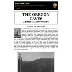
The Caves are set aside as a national monument within the Siskiyou National Forest. The main entrance is on the west side of the divide between the Illinois and Applegate Rivers, about 4,000 feet above sea level and 1,500 feet below the main summit, at the head of Cave Creek. Jaoquin Miller, who thoroughly explored the Caves and wrote interestingly of them, liked to call them "the Marble Halls of Oregon. " These caverns differ from other caves in the variety and beauty of the incrustatioms.
Waterfall near Cape Arago,Coos Bay,oregon. Weatherproof Cork Jacket - MacLeods Scottish Shop. Schemers sought to seize Peter Iredale shipwreck, sell for scrap. Clackamas County man claimed his father had bought the salvage rights in 1908, setting off a huge dust-up among residents, beachgoers and politicians, who scrambled to protect the landmark wreck.

He almost got away with it, too. The wreckage of the Peter Iredale as it appeared in the summer of 2006. (Photo: Matt Conwell) By Finn J.D. John — August 26, 2012 Early in 2012, a big section of a Japanese harbor dock that had drifted across the Pacific Ocean was removed at considerable expense from the beach near Newport.
Oregon Wild Newsletter Fall 2011. Search Results. Advanced Search Login Bookmarks History Limit your search Topic Work Type Region Rights Type.
Eagle Creek falls. Advanced Search Login Bookmarks History Eagle Creek falls Title Eagle Creek falls LC Subject. Mill Creek Falls. Advanced Search. Waterfalls on Elk Creek. Advanced Search Login Bookmarks History. Search Results. Bedrock chutes and falls. Advanced Search Login Bookmarks History Bedrock chutes and falls Title. A little waterfall on the Salmon River. Advanced Search Login Bookmarks History A little waterfall on the Salmon River Title A little waterfall on the Salmon River Photographer Cronk, C.
Congress Slashes $101 Million From National Park Service Budget. More To Come? One-thirteenth of 1 percent of the $3.55 trillion federal budget gets you funding for the entire National Park System and the agency that oversees it, according to National Parks Conservation Association analysts. Yet that miniscule sliver hasn't stopped Congress from eyeing the National Park Service for cuts to help rein-in the $1.5 trillion federal deficit. Stelprd3845381. CemeteryList. SunCalc - sunrise, sunset, shadow length, sun position, sun phase, sun height, sun calculator, sun eclipse, sun movement, map, sunlight phases, elevation, Photovoltaic system, Photovoltaic.
Calculation of sun’s position in the sky for each location on the earth at any time of day. Home > Solar tools > Sun Position. Total Solar Eclipse 2017 - Eclipse Animations. Cave and Mine Adventures. Saturdays & Sundays: 10m to 5pm, Cave Tours: Tours every hour, first tour departs at 10am and last tour departs 5pm. Descriptions of Selected Park Caves - Sequoia & Kings Canyon National Parks (U.S. National Park Service)
Shannon Nieland at Kumback Shelter, Oct. 1978. This old trail shelter, located along an abandoned trail, it is difficult to find. View topic - Starway to Falls on Star Creek - 7/6/08. View topic - Star Way and Star Creek Falls. How To Rappel or Why You Need To Spread Your Legs (Not in a Nasty Way) The abseil is perhaps the best part of climbing. A Wildwood falls (at Brice creek) Cave dive above Cottage Grove Oregon. Pacific Northwest Stream Survey. Ape Canyon - ropewiki. Lillian Halseth Taylor - Lower Breitenbush Hot Springs History. View topic - 1928 train wreck in the columbia river gorge. Great find HikerDude!! I was unaware of this historic wreck, so I super appreciate the head's up, as it mirrors the "Starvation Creek" snowpocalypse from the 1880s...but this one has actual newspaper photos.
Oh, I guess I got ahead of myself. The wreck happened on Jan 1st 1928..and there was extensive coverage the entire next week in the Oregonian. I popped into the Oregonian digital archive and instantly found a trove of articles and pix. Ghost Town of Palmer, Oregon - Pacific Northwest Photoblog. Error 403. It's My Life sheet music and tabs - Bon Jovi. Hand Drilling and Breaking Rock for Wilderness Trail Maintenance - 84232602 - FS Publications - Publications - Recreational Trails. Coast Range Association. 31 Things That Will Make Camping With Your Kids So Much Easier. Multi-Purpose Pack. 686 Industrial Snow Tool Belt. 6f8282c3ca1272d7dd035a9e6d1f11f9.jpg (JPEG Image, 736 × 736 pixels) NGMDB Product Description Page. Spooky Scary Things.