Hydrologic Unit Boundaries, 6th level (HUC6) - Oregon. Watershed Enhancement Board : Watershed Councils : Resources : State of Oregon. Data Basin. What Happened?
When performing a select intersection using a source dataset, Data Basin first selects all the features from the source dataset, and then uses those features to determine where they intersect with the features of the target dataset. Each dataset has a limit of the number of features that can be selected. For most datasets running on current ArcGIS servers, this defaults to 1000, but older, external datasets may be limited to 500, or a number specific to the dataset.
In this instance, the source dataset contained more that the maximum selectable features. This means that the final selection against the target dataset is based on a subset of features from the source dataset. How Can I Fix It? There are multiple ways to address this problem. CropScape - NASS CDL Program. Map - township and range. The National Map - Advanced Viewer. USGS Home Contact USGS Search USGS Services Accessibility FOIA Privacy Policies and Notices U.S.
Department of the Interior | U.S. Land use & Land cover - Geographic Information Systems (GIS) - LibGuides at MIT Libraries. ESA/CCI viewer. C-CAP Land Cover Atlas. NOAA Office for Coastal Management Overview This online data viewer provides user-friendly access to coastal land cover and land cover change information developed through NOAA’s Coastal Change Analysis Program (C-CAP).
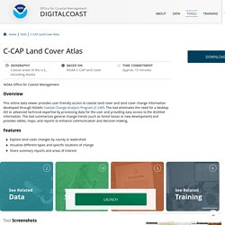
The tool eliminates the need for a desktop GIS or advanced technical expertise by processing data for the user and providing easy access to the distilled information. The tool summarizes general change trends (such as forest losses or new development) and provides tables, maps, and reports to enhance communication and decision-making. Features Explore land cover changes by county or watershed Visualize different types and specific locations of change Share summary reports and areas of interest. The National Map - Advanced Viewer. Introduction to the Land Cover Viewer. << Back to Land Cover Two Biogeographic Analysis Packages provide information derived from the dataset.
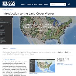
The user can select an Ecoregion and get summaries of the land cover composition or they can explore individual sites (pixels) within the land cover to see what land cover type has been mapped there. By changing the analysis input, the user can explore different levels of thematic detail (e.g. Introduction to the Land Cover Viewer. The Bare Earth For geologists, lidar is an invaluable tool that enables them to see and study large areas of the earth's surface, particularly in places where trees and vegetation obscure the landscape.

Lidar (light detection and ranging) is a technology that uses light pulses to collect three-dimensional information. Lidar data is often collected from an airplane using a laser system pointed at the ground. The system measures the amount of time it takes for the laser light pulses to reach the ground and return. Billions of these rapidly-collected measurements (points) can create extremely detailed three-dimensional models of the Earth's surface. See the diagram below to better understand how airborne lidar is collected. Geologists in Washington State use different bare-earth lidar products to map geology, landslides, and faults, to study volcanoes, glaciers and rivers, and to model tsunami inundation. Map Maker: Map Latitude Longitude Coordinates/Points & More...
Oregon Coastal Atlas - Tools. Oregon Maps - State County City Coast Road Map. Oregon Coastal Atlas - Oregon Coastal Zone management information.
Willamette Explorer - Land and water use issues for the Willamette Valley. Oregon Explorer Map Viewer. ArcGIS Web Application. USGS Topographic Maps. Update 11/28/2011 Seamless Topo Maps - I have released a seamless version (without the map borders) version of the USGS Topographic Map layer for Google Earth.
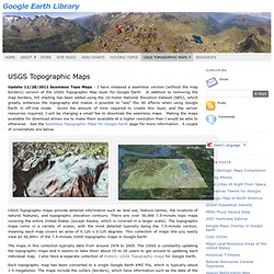
In addition to removing the map borders, hill shading has been added using the 10-meter National Elevation Dataset (NED), which greatly enhances the topography and makes it possible to “see” the 3D effects when using Google Earth in off-line mode. Given the amount of time required to create this layer, and the server resources required, I will be charging a small fee to download the seamless maps. Making the maps available for download allows me to make them available at a higher resolution than I would be able to otherwise. See the Seamless Topographic Maps for Google Earth page for more information. A couple of screenshots are below. USGS Topographic maps provide detailed information such as land use, feature names, the locations of natural features, and topographic elevation contours. Embed Maps In Website. Old Maps Online. Earth wind map.
Map Warper: Home. Maps Gallery. Lidar Data Viewer - Introduction. Interactive map upgrades begin Friday, April 11 The Lidar Data Viewer is undergoing a maintenance update and data layers may not appear.
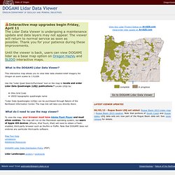
The viewer will return to normal service as soon as possible. Thank you for your patience during these improvements. Until the viewer is back, users can view DOGAMI lidar as a base map option on Oregon HazVu and SLIDO interactive maps. National Geologic Map Database. HomeCatalogLexiconMapViewStandardsComments Find Us: Accessibility FOIA Privacy Policies and Notices U.S.
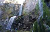
Department of the Interior | U.S. Geological Survey Supported by the National Cooperative Geologic Mapping Program URL: Page Contact Information: Personnel Page Last Modified: Mon Oct 24 23:22:57 2016. Nature of the Northwest, Maps, Hazards, Lidar, Books, geology, topo maps. DOGAMI - Lidar Landscapes Posters: Umpqua Lighthouse State Park; Honeyman State Park; Netarts Bay; Willamette River Historic Channels; Big Obsidian Flow, Newberry Crater; Mt. Hood and the Parkdale Lava Flow. $10 each, from Nature of the Northwest | 2012 Calendar | Postcards Each artistic rendering was created using a lidar bare-earth raster image draped with an orthophoto.
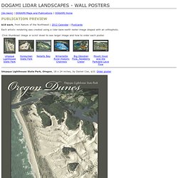
Umpqua Lighthouse State Park, Oregon, 18 x 24 inches, by Daniel Coe, $10. Order poster Honeyman State Park, Oregon, 24 x 18 inches, by Daniel Coe, $10. Order poster Netarts Bay, Oregon, 24 x 18 inches, by Daniel Coe, $10. Maps & Map Postcards. Title:Old Man Alaska Alaska (AK), Linen unused. Oregon maps from Omnimap, the leading international map store with over 275,000 map titles.