
AVO Webcams. From the Vault - Gem Gallery - Smithsonian Institution. Brain & Mind. THE WALKING SITE - Frequent Questions. Walking can provide the same benefits as a running program.
General health benefits are aquired from any walking. For cardio benefits the key is walking fast enough to get your heart rate up. Walkers may miss fewer days due to injury than runners while achieving similar improvements in aerobic conditioning. No! The risk far out weigh the benefits. Calorie Chart, Nutrition Facts, Calories in Food. Millions of people have lost weight using MyFitnessPal, the world's largest nutritional database & easiest calorie counter — get it now, completely FREE!
Doctor recommended studies show that diet journals are essential for weight loss. Largest food database - over 2,000,000 entries Track all major nutrients - calories, fat, protein, carbs, sugar, fiber, cholesterol and more Sync with our free iPhone, Android and Blackberry apps - now with a barcode scanner! Completely free To see calorie and nutritional information for over 2,000,000 foods, sign up for a FREE MyFitnesspal account today!
Make-Ahead Oatmeal Smoothies. Awhile back, I wrote a post about Overnight Refrigerator Oatmeal that has been very popular with Yummy readers.

(Thanks for all of the enthusiastic feedback!) Since then I've been experimenting with a smoothie version of that recipe. Now You Can Completely Eliminate Heart Disease. YES!
Send me my FREE Heart Disease Prevention & Reversal Kit from renowned heart expert Dr. Chauncey Crandall now. And start my one year subscription to Dr. Crandall's Heart Health Report and my three-month trial subscription to Health Radar. I refuse to be a sitting duck for heart disease or a heart attack any longer. I choose to be pro-active when it comes to my health, particularly my heart health. Most importantly, I know I am in the right place at the right time to help prevent or reverse heart problems in myself and my loved ones. In your FREE Heart Disease Prevention & Reversal Kit, you will receive: Report #1: Reversing Heart Disease: My Two-Part Plan for Success (A $15 value — Yours FREE with this Offer!)
You can prevent, and even reverse, heart disease . . .
Sierra Nevada. Find hikes on Hikespeak.com. Getting Ready for Mt. Whitney In SoCal and the Sierra. Online trail guides and maps. Six Hiking/Backpacking Loops in the San Gorgonio Wilderness. The San Gorgonio Wilderness (SGW) is the largest high-altitude wilderness area in Southern California – a hiker's and backpacker's paradise.
But where to hike and backpack in the San Gorgonio Wilderness? I thought I'd lay out six loops as a sort of hiking and backpacking "foundation" for the SGW. You can then build on this foundation, making variants of your own. I list out two example variants, the Nine Peaks Variation and the Seventeen Peaks Variation below, but I'm sure you can come up with more on your own. In Appendix I, I describe one area that really isn't accessible via a loop hike but is so worthwhile that it needed to be included: The N. For Backpackers and Day Hikers I happen to really like spending the night out in the wilderness. Notes on solitude The Lost Creek Trail, the upper Momyer Creek Trail (above the junction with the Alger Creek Trail), and the North Fork Meadows Trail are the three least used major trails in the wilderness.
Dan's Hiking Blog. Dan's Hiking Pages: Mt. Baldy. Mt.
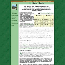
Baldy (Mt. San Antonio) (10,064') via Manker Flats - Devils Backbone Trail / Ski Hut Trail Angeles National Forest - San Bernardino National Forest / Southern California No other peak in the San Gabriel Mountains attracts as many hikers as Old Baldy. In the words of Jerry Schad, "No Southland hiker's repertoire of experiences is complete without at least one ascent of Mt. San Antonio. " There are four primary routes to Mt.
Below I present descriptions of the two most popular routes for hiking to Mt. Whitney Portal Store.
Historic Aerials. Environmental Data Public Records Online Property Data Store Historic Aerials Apr 16, 2014, 11:58 pm Home Discussions Examples Contact Account Points of Interest..
Chase Field, Phoenix AZ « Math. Fishing, Boating, Climbing, Scouting, Search and Rescue, Household, Decorative, Rope Care, Earthquakes - 7 days, M2.5+ Wind Map. An invisible, ancient source of energy surrounds us—energy that powered the first explorations of the world, and that may be a key to the future.

This map shows you the delicate tracery of wind flowing over the US. The wind map is a personal art project, not associated with any company. We've done our best to make this as accurate as possible, but can't make any guarantees about the correctness of the data or our software. Please do not use the map or its data to fly a plane, sail a boat, or fight wildfires :-) If the map is missing or seems slow, we recommend the latest Chrome browser. Surface wind data comes from the National Digital Forecast Database.
How-To - Van Zyverden. Khan Academy. Images/stories/pdf/fieldlistofthebirdsoflosangelescounty.pdf.