

Meteo.
Marble - KDE education program. ZyGrib. Seekarten. Wer weitere Links zu legalen Quellen kennt, bitte als Kommentar (am Seitenende) hinterlassen - danke!
Europa See: Derzeit sind leider keine Quellen bekannt, wo man legal und kostenfrei elektronische Seekarten (ENC) für europäische Küsten- und Seegewässer herunterladen könnte. Binnen: Nordamerika National Oceanic and Atmospheric Administration (NOAA)Die NOAA stellt umfangreiches Kartenmaterial sowohl als Vektorkarten (ENC S57), als auch als Rasterkarten (BSB) zum Download zur Verfügung.Die Abdeckung umfasst:Atlantikküste - KatalogseitePazifikküste - KatalogseiteAlaska - KatalogseiteGreat Lakes - KatalogseiteGolfküste - KatalogseiteFür die Betrachtung der Katalogseiten ist der Adobe Flash Player erforderlich! Mittel- und Südamerika (+ Antarktis) Asien East Asia Hydrographic Commission (EAHC)Normalerweise ist eine (kostenlose) Registrierung erforderlich.
Australien + Neuseeland Afrika Für die Betrachtung der IENCS kann auch ein Freeware Betrachter der Firma SevenCs verwendet werden. Opencpn-on-os-x-snow-leopard-34734-3. Failing a better place to do this, and concerned about creating unnecessary bug reports, I am going to list here the issues I see testing 1.3.6 RC on a C2D MBP running 10.6.2. 1) The chart window is firmly attached to the upper left corner of the screen.
It can be resized but not minimized (no red, yellow, green buttons) 2) The chart info box in the toolbar doesn't run to the right side of the window - instead it starts to repeat 3) After selecting the help icon on the toolbar, the license tab doesn't have any license info in it and the help tab fails to open the help documentation in a browser (the help docs are not in the application package). As always, please feel free to contact me if there is anything I can contribute. Greg. OpenCPN 2.2 unter Mac OS X 10.6.4. Ich bin ja ein grosser Fan freier Software und begeisterter Nutzer von openCPN.
Leider wurde bisher die OS X Version nur stiefmuetterlich behandelt, heute habe ich aber mehr oder minder zufaellig eine aktuelle Version gefunden und diese auch relativ problemlos zum laufen bekommen. Hier also eine Kurzanleitung fuer alle, die auch an bord gerne auf Windoof verzichten moechten: OpenCPN 2.2 Beta fuer Mac auf der deutschen Seite von openCPN runterladen. – Zu finden unter Beta-/Testversionen. Der Download funktioniert ueber Mac’s Mobile Me.
Hier muss man mit Passwort einloggen (findet man auch auf der download-Seite, oben). Nun zum komplizierten Teil: Leider fehlen noch zwei Bibliotheken, ohne die das OpenCPN nicht laeuft. OpenSeaMap - Browse /Maps/Europe. Sailing Simulator: FAQ. Instructions Recommended use General questions Planned features Known issues Instructions The user interface should be pretty intuitive to use.
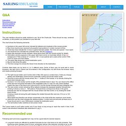
Go to the Charts tab. There should be map, centered on Boston, or the position you checked on your last visit. The chart shows the following elements: Numbers in the upper left corner indicate the latitude and longitude of the mouse pointer. Controls: Most tasks can be done in 2 or 3 different ways. The right mouse button (and Control-click in Mac OS) opens a context menu. The 'Leave marks to port' option works only if your track is long enoug to reach the mark in time. Recommended use Following each and every suggested turn may not be a good idea for several reasons: Long-term tracks are affected by weather forecasts too far in the future to be rally probable. It is generally preferred to sail in straight lines as much as possible. To make the best use of this tool you should observe the long-term forecast, decide on some strategy and stick to it. Le Miarouteur - VlmWiki. De VlmWiki.
Le Miarouteur C'est Quoi ? Le Miarouteur a été développé par "Le_Chat" pour les adeptes de VLM, comme outil d'aide à la décision pour le routage de votre "pixel marin". Cette feuille de calcul automatisée Excel vous permet de calculer différents types de routes en intégrant les informations MTO provenant d'un fichier GRIB. Votre route est fournie : sous forme d'un listing avec les positions du bateau en fonction de la date sous forme d'une route tracée sur différentes cartes marines Simple Comme "1-2-3" 1) Vous indiquez la position de votre bateau et d'un way point vers lequel vous désirez naviguer 2) Vous récupérez un fichier météo (fichier Grib) 3) Vous lancez le calcul de route.
Miarouteur va utiliser un utilitaire développé par la NOAA (Degrib.exe) que vous aurez préalablement installé sur votre PC. Quelles Routes pour quoi faire ? Outils météos - VlmWiki. Virtual Loup-De-Mer.