
GNOSIS. Principles of Chaos Engineering. Authoritarians Distract Rather than Debate - Marginal REVOLUTION. It’s long been known that the Chinese government hires people to support the government with fabricated posts on social media.
In China these people are known as the “50c party”, so called because the posters were rumored to be paid 50 cents (5 jiao or about $.08) to write the posts. Site-deaths - IndieWeb. From IndieWeb Site deaths.
Guest Articles: Greening Digital Finance. Digital finance is the unexpected revolutionary – but which side will it take?
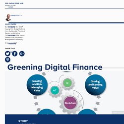
With the help of digital finance, urbane consumers can glide gracefully and seamlessly through their shopping experiences, migrants far from home can move hard-earned money cheaply to their families, small businesses can access credit lines in minutes through big data-driven profiling, and savers can navigate their investment opportunities with pinpoint accuracy. Will digital finance, then, deliver an all-purpose public good, or do we first need to manage possible constraints or even downsides? A new generation of intermediaries are reinventing the financial system, breaking down the old value chains with its many profit-taking intermediaries.
New financial technologies have earned moral credentials by enabling low-cost financial inclusion. Now, they are in the early stages of being used to build bridges between financial and environmental benefits. The prize could be very large. Human Dimensions. Overview ARIES is a web-based technology offered to users worldwide to assist rapid ecosystem service assessment and valuation (ESAV).
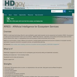
Its purpose is to make environmental decisions easier and more effective. ARIES helps discover, understand, and quantify environmental assets and what factors influence their values, in a geographical area and according to needs and priorities set by its users. Deep Learning Nanodegree Foundation. What is a “Nanodegree Foundation program,” and how does it differ from your existing Nanodegree programs?
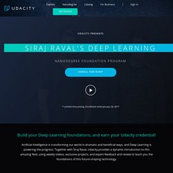
A Nanodegree Foundation program is designed to facilitate your entry into a particular arena of study, with the goal of ensuring that you establish your “foundations” in the field. Depending on your longer-term goals, a Foundation program can enable you to enhance an existing skillset, move forward into deeper and/or more advanced academic studies, or prepare for a career move that requires a fuller understanding of certain technologies and concepts. How do I know if this program is right for me? This program offers an excellent introduction to the world of Deep Learning—a transformational technology that is going to reshape our future, and drive amazing new innovations in AI.
This Declassified Report on Russian Hacking Makes Me Want to Die. FIWARE Catalogue. OpenPDS/SafeAnswers - The privacy-preserving Personal Data Store. Privacy risks Protecting the privacy of personal data is known to be a hard problem.
The recent advances in collecting, storing, and processing high-dimensional data such as call or credit card records at scale makes it even harder. Councilmatic - Your local city council, demystified. Ckan - The open source data portal software. Refarmthecity. Day 1 - Advent of Code 2016. Santa's sleigh uses a very high-precision clock to guide its movements, and the clock's oscillator is regulated by stars.
Unfortunately, the stars have been stolen... by the Easter Bunny. To save Christmas, Santa needs you to retrieve all fifty stars by December 25th. Collect stars by solving puzzles. Two puzzles will be made available on each day in the advent calendar; the second puzzle is unlocked when you complete the first. Each puzzle grants one star. GeoJSON Path Finder - Serverless, offline routing in the browser. GeoJSON Path Finder is a standalone JavaScript library for routing/path finding using GeoJSON as input.
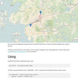
It can run offline in the browser without any server, or as a part of a Node.js application. It is ideal for simpler use cases where a more complete routing engine like OSRM or GraphHopper is overkill or not possible. Given a road network in the form of a GeoJSON FeatureCollection of LineString features, the library builds a routable graph which can perform fast shortest path searches.
Plugins - Leaflet - a JavaScript library for interactive maps. Leaflet Plugins While Leaflet is meant to be as lightweight as possible, and focuses on a core set of features, an easy way to extend its functionality is to use third-party plugins.
Thanks to the awesome community behind Leaflet, there are literally hundreds of nice plugins to choose from. Tile & image layers The following plugins allow loading different maps and provide functionality to tile and image layers. Leaflet - a JavaScript library for interactive maps. GEOS. GEOS (Geometry Engine - Open Source) is a C++ port of the Java Topology Suite (JTS).
As such, it aims to contain the complete functionality of JTS in C++. This includes all the OpenGIS Simple Features for SQL spatial predicate functions and spatial operators, as well as specific JTS enhanced topology functions. GEOS is available under the terms of GNU Lesser General Public License (LGPL), and is a project of OSGeo. Capabilities Include ¶ Geometries: Point, LineString, Polygon, MultiPoint, MultiLineString, MultiPolygon, GeometryCollection Predicates: Intersects, Touches, Disjoint, Crosses, Within, Contains, Overlaps, Equals, Covers Operations: Union, Distance, Intersection, Symmetric Difference, Convex Hull, Envelope, Buffer, Simplify, Polygon Assembly, Valid, Area, Length, Prepared geometries (pre-spatially indexed) STR spatial index OGC Well Known Text (WKT) and Well Known Binary (WKB) encoders and decoders.
Download ¶ GEOFABRIK // Consulting. OpenStreetMap is a young and very dynamic project. The community is evolving, new software and services are introduced and lots of new data is collected. The Geofabrik staff are active members of the OpenStreetMap community. We work on the subject every day and are ideally suited to answer all your questions around OpenStreetMap. If you think about using OSM data in your own project, there is always the question whether the data is spatially complete enough and whether it contains the data and attributes in the right quality for your project. ARTiVIS_DiY Forest Surveillance Kit. GitHub - Ecoblockchain/dolley-madison: Save the data. End of Term Web Archive: U.S. Government Websites. Tools for Government Data Archiving. MapProxy — The accelerating web map proxy. TileStache. OpenGeoscience. Janelia Research Campus.
Mapping the brain for neural activity controlling exploratory locomotion How does the brain control behavior when there is no guidance from the environment? Dunn et al., eLife, 2016 Left: path of a larval zebrafish spontaneously swimming in virtual reality. Middle: functionally identified neurons tuned to turning, overlaid with a map of spinal projection neurons. Right: activity of turning tuned neurons (green and magenta) and turning behavior (black). Extended depth of field light-sheet microscopy In collaboration with the Yuste lab we developed a system for random access light-sheet imaging: Quirin et al., Optics Letters, 2016.
Whole-brain imaging and virtual reality We developed a system for performing whole-brain, neuron-level recordings of the brains of larval zebrafish behaving in virtual reality: Vladimirov et al., Nature Methods, 2014. Whole-brain activity without (left) and with (middle) sensory stimulation. Large-scale data analysis Left: orientation turning throughout the brain. Atlaschain. What is Measurement Lab? - M-Lab. When your Internet connection doesn’t work as expected, how can you tell whether the problem is caused by your connection, the application or something else? Answering this question and others like it is surprisingly difficult. That is where Measurement Lab comes in. GeoTag-X · GeoTag-X Disaster Mapping. HTML5 Ninja - HTML5 marketplace. GPS Visualizer example: Flora observations, colorized and separated into folders. Flowers in folders A GPS Visualizer example map. Semantic Annotation - Tag Metadata in Text - Ontotext. Semantic annotation is the process of attaching additional information to various concepts (e.g. people, things, places, organizations etc) in a given text or any other content.
Unlike classic text annotations for reader’s reference, semantic annotations are used by machines to refer to. When a document (or another piece of content, e.g. video) is semantically annotated it becomes a source of information that is easy to interpret, combine and reuse by our computers. If you are looking to provide high-quality content at low costs you should read our white paper on Dynamic Semantic Publishing.
GitHub - nerves-project/nerves_system_bbb: Base Nerves system configuration for the BeagleBone Black and Green. Craft and deploy bulletproof embedded software in Elixir — Nerves Project. Ocean Wave Simulation (WebGL) Hamiltonian Graph Builder - bl.ocks.org. Index.html# app.js# jquery.caret.1.02.min.js# Paperjs/paper.js. Personalized 3D Avatar API. GLSL Sandbox Gallery. Earth System Science Pathfinder. The Earth System Science Pathfinder (ESSP) Program is a science-driven Program designed to provide an innovative approach to Earth science research by providing periodic, competitively selected opportunities to accommodate new and emergent scientific priorities.
ESSP Projects include developmental, high-return Earth Science missions including advanced remote sensing instrument approaches to achieve these priorities, and often involve partnerships with other U.S. agencies and/or with international science and space organizations. These Projects are capable of supporting a variety of scientific objectives related to Earth science, including the atmosphere, oceans, land surface, polar ice regions and solid earth.
Matter.js - a 2D rigid body JavaScript physics engine. Create a new fiddle - JSFiddle. Indoor Precision Farming in American medical marijuana plantations. Indoor Precision Farming in American medical marijuana plantations. Chainpoint/chainpoint-validate-js: A Node.js module for validating Chainpoint blockchain receipts. A Guide to Deep Learning by YerevaNN. Build an AI Assistant in 3 Lines of Code. HydroCycle-PO4 Phosphate Sensor. United States Global Change Research Program (USGCRP) Start Preamble National Oceanic and Atmospheric Administration (NOAA) United States Global Change Research Program (USGCRP). Federal Register API API Documentation. Federal Register API API Documentation.
S.p.A - Water Quality Analyzers. Alliance for Coastal Technologies - Nutrient Sensor Challenge. WEDNESDAY, December 28, 2016 18:02. Green Horizons. Image 2016-12-28 at 5.13.08 AM.png. 4. 3. 2. 1. Module 2 advanced jape. Module 2 jape. Module 1 ie and eval. Module 1 introduction to gui. GATE.ac.uk - family/training.html. There's good news and bad news. How we design and build a smart city and nation. Climate Science. The field of earth and environmental sciences is rapidly adopting the paradigm of large-scale, data-intensive analytics to understand our complex and ever-changing planet. A Reference Architecture for the Internet of Things. 1. Introduction. US Flooding Public Information Map. OBJ to OpenGL - JeffProd. CmapTools Download - Cmap.