
Tripline. 21 Map Creation Tools for Students and Teachers. Yesterday, I published a review of MapFab which is a fabulous, free, and simple tool for creating maps online.

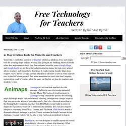
Writing that post got me thinking about all of the other free map creation tools that I've reviewed over the years. Google Maps and Google Earth are my favorite tools for creating maps, but not every school allows teachers and students to download it. And creating Google Maps does require you to have a Google account which is an obstacle to use in some schools too. In the list below you will find some map creation tools that don't require registration. And, of course, all of the tools on this list are free for teachers and students to use. Animaps is a service that was built for the purpose of allowing users to create animated Google Maps. Tripline is a service designed to enable anyone to record a trip they've taken or to plan a trip itinerary.
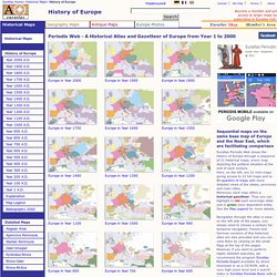
Build A Map is a service that allows you to build layers on top of Google Maps. Atlas of World History. Welcome to Cartography 2.0. Excellent maps re. World War Two / Origins of Cold War #historyteacher. Comparing Netherlands to Netherlands Antilles. Mapa de su sitio web - TIXIK.com. Scribble Maps - Create custom google maps with scribblings and more! Periodis Web - Maps to be Used for the History of Europe. Euratlas Periodis Web shows the history of Europe through a sequence of 21 historical maps, every map depicting the political situation at the end of each century.

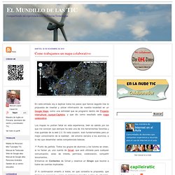
Here, on the left, are 21 mini-maps giving access to 21 full maps and to 84 quarters of maps with more detailed views of the states, provinces and main cities.Moreover, each map offers a historical gazetteer. Thus you can highlight in red each sovereign state and in green each dependent entity. See the Map Legend for more details. Navigation through the atlas is easy: on the left side of the pages, you simply need to choose a century for temporal navigation. French and German versions of this historical atlas are also provided and you can view them by clicking on the small flags at the top of the pages. Periodis is a historical atlas of a new kind. History by Periods History is a continuous string of events among which prominent facts sometimes emerge: wars, conquests, revolutions etc. Como trabajamos un mapa colaborativo. Los mapas no podían faltar en esta experiencia, bien es sabido por los que me conocen que siempre ha sido una de mis herramientas favoritas y mas queridas de la web 2.0.

En esta ocasión, eran fundamentales para un mejor conocimiento de la realidad , del entorno cercano a los alumnos, a la vez que desarrollar varias competencias básicas. 1º Punto de partida: Todos los grupos de alumnos y los tutores se crean, si no tienen ya, una cuenta de Gmail, que será utilizada para cualquier comunicación, aviso de interés, permisos, colaboración, compartir documentos,..Entramos en Contactos de Gmail y creamos un Grupo que reunirá a todos las cuentas implicadas. 2º A continuación enseño a todos, en qué consistía la propuesta, que íbamos a conseguir y como lo haríamos (insertar puntos de situación, texto, fotos y cambiar el icono).
Es una explicación bastante rápida que no lleva mas de 15 minutos. 3º LLega el momento de dar permisos para poder trabajar.