

Dozens of Outline Maps You Can Print for Free. Even with tools like Google Earth and Google Map there is still a need for students to learn some basics of where things are in the world lest they think that Portland, Maine and Portland, Oregon are near each other.
To that end, a classic geography activity has kids labeling blank outline maps. You could make these maps yourself by using the Google Slides method that Tony Vincent demonstrated last week or you could just visit PrintableWorldMap.net to find what you need. On Printable World Map you'll find dozens of maps that you can download as PDFs for free. Included in that collection are blank world maps, continent maps, region maps, and country maps.
There are also some county maps for the United States. Printable Maps. Map creator online to make a map with multiple locations and regions - ZeeMaps. 7 Nifty Tools You Can Use to Create Project Timelines. Advertisement You may have seen a timeline of a friend’s journey on Facebook over the years and thought that was a particularly attractive and striking way to condense information into a simple diagram.
But timelines are not limited only to Facebook users. How to Build a Memorable and Beautiful Facebook Timeline How to Build a Memorable and Beautiful Facebook Timeline Your Facebook timeline sucks. There's no cover photo, you've forgotten to set the profile picture and no one spends time there. It is a collection of faceless, dull updates. Timeline Comparison Chart 2018. Timelines.tv - History, documentary and television on the web. NatGeo Mapmaker Interactive. Timeline of History. History. Beautiful web-based timeline software. Earth album alpha - a slicker google maps + flickr mash-up.
National Geographic Education - National Geographic Society. How to Create a Multimedia Timeline on HSTRY. Last fall I reviewed HSTRY when it was still in beta.
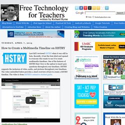
Recently, it lost the beta label and opened to everyone who wants to use it to create multimedia timelines. One of the features of HSTRY that I love is the option to insert quiz questions throughout your timelines. HSTRY supports the inclusion of video, audio, and pictures throughout your timelines. The video embedded below provides a short overview of how to create a HSTRY timeline. The video is from HSTRY's extensive student guide. Applications for Education As a teacher you can create an online HSTRY classroom in which you can view all of your students' timelines. Some Handy Google Maps Tutorials for Teachers. March 11, 2015 Google Maps is an excellent tool to use with students to develop their spatial thinking.
Beyond getting driving or walking directions to the other, this tool enables students to discover the world right from their classrooms. It is also a very good way to teach students about geography concepts, distance measurement, map readings and other fundamentals of mapping such as longitude, latitude, locations and many more. Homeschool Geography & Maps Activities and Games Free Downloads. Geography & Maps The following downloads are provided for those of you who purchased a hard copy of this curriculum.
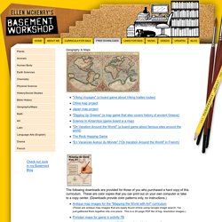
These are color copies that you can print out on your own computer or take to a copy center. (Downloads provide color patterns only, no instructions.) Introduction. Timeglider: web-based timeline software. OurStory.com - Capture your stories, save them permanently. Timeline. Timeline allows students to create a graphical representation of an event or process by displaying items sequentially along a line.
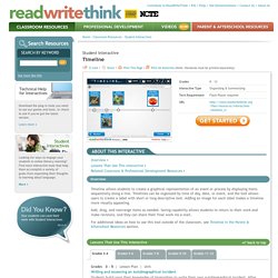
Timelines can be organized by time of day, date, or event, and the tool allows users to create a label with short or long descriptive text. Adding an image for each label makes a timeline more visually appealing. Add, drag, and rearrange items as needed. Saving capability allows students to return to their work and make revisions, and they can share their final work via e-mail.
For additional ideas on how to use this tool outside of the classroom, see Timeline in the Parent & Afterschool Resources section. Related Classroom & Professional Development Resources back to top Grades 11 – 12 | Lesson Plan | Standard Lesson A Blast from the Past with Nuclear Chemistry Grades 6 – 8 | Lesson Plan | Standard Lesson Timelines and Texts: Motivating Students to Read Nonfiction Grades 3 – 12 | Student Interactive | Organizing & Summarizing Graphic Map Plot Diagram. Dipity - Find, Create, and Embed Interactive Timelines. Share Photos, Videos, Text, Music and Documents Easily. Create timelines, share them on the web. GeoCommons. Tour Builder. Dr. Alice Christie's GoogleTreks™ Site. World Geography Games - Let's play and learn about the world. Outline Maps for continents, countries, islands states and more - test maps and answers. Printable World Maps - Free World Maps to Print. Map Library. Outline Maps. The Ultimate List of Geography Facts: Longest Rivers, Tallest Mountains, Largest Cities, etc.
Table of Contents Overview of the Earth Sometimes also called "the World" or "the Globe", the Earth is the third planet from the Sun.
The Earth rotates on its axis in orbit around the Sun, which is the main source of energy for all life on Earth. Outline Map Sites. Maps - National Geographic. Map Collection - World Sites Atlas. The National Map: Small Scale. The National Map is now offering a collection of small-scale datasets that can be downloaded for free.
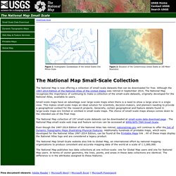
Although the 1997-2014 Edition of the National Atlas of the United States was retired in September 2014, The National Map recognizes the importance of continuing to make a collection of the small-scale datasets, originally developed for the National Atlas, available to users. Map creator online to make a map with multiple locations and regions. Maps for the masses. Visual History of War, Religion, and Government.