
Mineral Collecting in Maine. Current Geologic Site of the Month A Summary of the 2017 State of Maine’s Beaches Report Maine Geological Survey Geology Web Maps Now Available The Maine Geological Survey now has many our of popular PDF map series available in an interactive web map.
See What's New? For a description. Updated Surficial Geology Handbook Now Available The popular Surficial Geology Handbook for Southern Maine, first published in 1978, has been significantly updated by Woodrow Thompson. Popular Books and Maps. Geologist: Educational Requirements for Entering the Field of Geology. A branch of geosciences, geology is the study of the materials that compose the Earth's crust.
Geologists analyze rocks, formations and other structures in order to understand how the Earth has changed and evolved over time. Continue reading to learn about the educational requirements for entering this field. Education and Degree Options Some geologists working for private industries may only be required to have a bachelor's degree. Specialized positions, such as consulting for companies in the oil industry or professorships in the geosciences, generally require a master's or doctoral degree. Bachelor's Degree Program in Geology Students preparing for a career as a geologist may enroll in a bachelor's degree program in geology, earth sciences or a related scientific field. Graduate Programs in Geology Graduate programs cover concepts in plate tectonics, petrogenesis and other advanced geological topics. Geology Career Information. James Cameron Explores the Mariana Trench. Actualidad Volcánica de Canarias - Animacion. How Diamond-Studded Magma Rises From Earth's Depths.
Richard A.
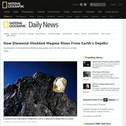
Lovett According to a new study, diamonds can be carried up through the lithosphere—the crust and uppermost layer of the mantle—by dense magmas rich in carbonate. "These melts are really quite special, because they can hold a huge amount of dissolved carbon dioxide, up to 40 to 45 percent by weight," said study leader James "Kelly" Russell , a petrologist from the University of British Columbia in Vancouver. Introduction to Plate Tectonics and Earthquakes - Instructional Aids. Teachers on the Leading Edge is a professional development program for Pacific Northwest teachers of Earth Science.

This program features plate tectonics and geologic hazards of the Pacific Northwest. Through funding from the National Science Foundation, Teachers on the Leading Edge has provided teacher workshops each summer from 2008 through 2010. This website offers K-12 teachers an introduction to the active continental margin geology of the Pacific Northwest. Teaching resources provided include animations, video lectures, slide shows, virtual field experiences, and lesson plans that feature plate tectonics and geologic hazards of the Pacific Northwest. Although intended for middle school teachers of Earth Science, most resources can be adapted for use in many K-12 grade levels. 1720 feet-tall - Lituya Bay, Alaska. (As reported by Don J. Miller in United States Geological Survey Professional Paper 354-C, Giant Waves in Lituya Bay, Alaska, 1960) Account of Howard G.
Ulrich Mr. Ulrich and his 7-year-old son, on the Edrie, entered Lituya Bay about 8:00 p.m. and anchored in about 5 fathoms of water in a small cove on the south shore. "The wave definitely started in Gilbert Inlet, just before the end of the quake. Ulrich continued to watch the progress of the wave until it reached his boat about 2 1/2 to 3 minutes after it was first sighted. After the giant wave passed the water surface returned to about normal level, but was very turbulent, with much sloshing back and forth from shore to shore and with steep, sharp waves up to 20 feet high. Geology. Activité volcanique - Actualité volcanique.
Japan's quake updated to magnitude 9.0. Read more: "Special report: After Japan's megaquake" 0930 GMT, 12 March 2011 Sumit Paul-Choudhury, editor, newscientist.com There has been a massive explosion at the Fukushima-Daiichi nuclear power plant, raising fears of a radioactive meltdown.
Several workers are believed to have been injured in the blast, which seems to have caused major structural damage to the plant. A state of nuclear emergency was declared at the plant yesterday as its operator, the Tokyo Electric Power Company, struggled to contain rising temperatures and pressures in the core of two reactors whose cooling systems failed after Friday's magnitude 9.0 earthquake. Read more: Our live blog on the reactor explosion 1830 GMT, 11 March 2011 Paul Marks, senior technology reporter Electrical, mechanical and diesel generator failures are said to have combined to deprive the reactor of power for its coolant pumps.
US Secretary of State Hilary Clinton said local US air bases are helping deliver the coolant. 1722 GMT, 11 March 2011. Géomatique. Geology.maps. Lava Cooling Underwater on Devour. Most incredible volcano footage ever. Tendencias 21. La radioprotection du mineralogiste. 1040/large/ Dynamic Earth . Intro.
WR: abril 2009. NOAA Learning Objects. Seismic Monitor. The Rock Cycle . Introduction. Welcome to the USGS - U.S. Geological Survey. Geology.maps. Geologic Time: Age of the Earth. So far scientists have not found a way to determine the exact age of the Earth directly from Earth rocks because Earth's oldest rocks have been recycled and destroyed by the process of plate tectonics.

If there are any of Earth's primordial rocks left in their original state, they have not yet been found.