
Public Alerts.
Humanitarian Icons - Google. This page contains versions of the Humanitarian Icons provided by UN OCHA in August 2012, which have been optimized and hosted for use in online maps, by adding the appropriate backgrounds and by converting the to 64 and 32 pixel png images.
The 64px icons are recommended for use in Google Earth, and 32px icons are recommended for Google Maps. Anyone making maps for disaster response or other humanitarian purposes is encouraged to use these icons for their digital maps, and is welcome to link to them directly on this server, to avoid having to re-host them. Simply scroll down to find the icons you want, choose the color and size, and right-click on the filename to copy the full URL for the icon image file. Whenever possible, please provide credit as follows: "Source: OCHA". For details, see ReliefWeb. If you wish to download all of the icons for use offline, or in order to host them on your own server, they are available in this 3.9MB zip file: unocha_icons.zip. Sistema de Información Central OCHA - Colombia. FEDI-EA - Antena QFH - DIGICLUB, Boletín Informativo de Comunicaciones Digitales.
Autor: LU2HAM.
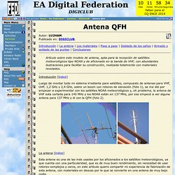
Publicado en: DIGICLUB. Introducción | La antena | Los materiales | Paso a paso | Doblado de los caños | Armado y soldado de las puntas | Conclusiones Artículo sobre este modelo de antena, apta para la recepción de satélites meteorológicos tipo NOAA y de aficionado en la banda de VHF, con abundantes ilustraciones para facilitar su construcción, realizada totalmente con materiales reciclados. Introducción [índice] Luego de montar todo mi sistema irradiante para satélites, compuesto de antenas para VHF, UHF, 1,2 GHz y 2,4 GHz, sobre un boom con rotores de elevación (foto 1), se me dió por empezar a experimentar con los satélites NOAA meteorológicos y, oh problema, la antena de VHF esta cortada para 145 MHz y los NOAA están en 137 MHz, por eso empecé a ver alguna antena para 137 MHz y di con la QFH (foto 2).
La antena [índice] Los materiales [índice] Paso a paso [índice] Tabla de frecuencias finales ya con el acortamiento: Ahora si podemos soldar el conector. Conclusiones [índice] A radio that's out of this world! Convert Latitude / Longitude in Degrees/Minutes/Seconds to/from Decimal (FCC) USA. Phplist.com : phpList : The world's most popular open source email campaign manager.
MAPPING. EDUCOMUNICATION TOOLS. GESTION-OSM. OpenRDI. Open Data Kit. OSM-RUTAS. SATELITE IMG. 2010 Colombia floods/Imagery and data sources. GPS tracks Following is some information on GPS tracks collected in direct relation to the post flood efforts in Colombia.
Photography Humanitarian Field visits Caritas Germany visit to Atlántico: Flikr Groups Aerial imagery needed Flood zones in Colombia (from Nov 2010) Colombian Floods OSM mapping team already has vectorized the major of towns and streets Bing Aerial imagery. Regions demarcated in the 'Flood zones in colombia' image at right are those which need satellite imagery, mapping activity and active updates. Aerial imagery available will likely always be incomplete ... please add more if you find or discover mention of additional areas and sources Date: may 27 2011. Map of floods in La Mojana, Colombia. For the Middle Magdalena area between El Plato, San Benito de Abad, Magangué and El Banco, satellite image derived flood extent vector files can be received from WMS: To use this wms in JOSM, you have to add this entry in Preferences/wms: wms: Date: 2002 URI: (6 Mb image) Where discussed:
Buscar Datos - GeoNode.