
Maps. The World Factbook. People from nearly every country share information with CIA, and new individuals contact us daily.
If you have information you think might interest CIA due to our foreign intelligence collection mission, there are many ways to reach us. If you know of an imminent threat to a location inside the U.S., immediately contact your local law enforcement or FBI Field Office. For threats outside the U.S., contact CIA or go to a U.S. Embassy or Consulate and ask for the information to be passed to a U.S. official. Please know, CIA does not engage in law enforcement. In addition to the options below, individuals contact CIA in a variety of creative ways. If you feel it is safe, consider providing these details with your submission: Your full name Biographic details, such as a photograph of yourself, and a copy of the biographic page of your passport How you got the information you want to share with CIA How to contact you, including your home address and phone number.
Maps ETC Homepage. Welcome to ETC's collection of historic maps.
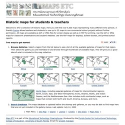
Here you will find over 5,000 maps representing many different time periods. A friendly license allows teachers and students to use up to 25 maps in non-commercial school projects without further permission. All maps are available as GIF or JPEG files for screen display as well as in PDF for printing. Use the GIF or JPEG maps for classroom presentations and student websites. Use the PDF maps for displays, bulletin boards, and printed school reports.
MapTube. Planiglobe beta. David Rumsey Historical Map Collection. WORLD ATLAS - World. World Maps. Anthropocene Mapping. World Map. Signatory States (183) Ratifying States (162) Non-Signatory States (13) The use of particular designations of countries or territories does not imply any judgement by the Commission as to the legal status of such countries or territories, of their authorities and institutions or of the delimitation of their boundaries.
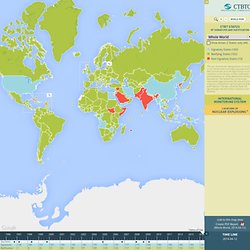
The dotted line on the maps represents approximately the Line of Control in Jammu and Kashmir agreed upon by India and Pakistan. The two countries have not agreed upon the final status of Jammu and Kashmir. All Facilities Primary Seismic Auxiliary Seismic Infrasound Hydroacoustic Radionuclide Radionuclide with Noble Gas Radionuclide Laboratories Nuclear Weapons used in World War II, August 1945 Test Sites: The figures used in this map are approximate and based on official government sources, as well as on information provided by research institutions such as the Natural Resources Defence Council in Washington D.C., and the Stockholm International Peace Research Institute (SIPRI). One World - Nations Online - The Nations Online Project, a World Guide™ SurveyMapper - Welcome to SurveyMapper. National Greenspace Dataset - Scottish Natural Heritage. Using Scotland’s Greenspace Map You can search the map using place names or postcodes, or you can navigate to an area using the zoom and pan tools on the left hand side.
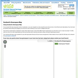
Alternatively, if you hold down the shift key whilst clicking and dragging a box around an area of interest, you can zoom in straight to this area. The presence of greenspace is displayed in green at the national scale. To see all the different types of greenspace you will need to zoom in closer (to at least 1:18,056). When you click on an area of greenspace you will see its primary (and if relevant) secondary coding, ie the type of greenspace present. The underlying GIS data is also available for users with appropriate Ordnance Survey license arrangements. If you have any queries about how greenspace in your local area has been categorised, please contact your local Council.