
Create an interactive street view with jQuery. 5 Artistic Uses of Google Street View. Mark Wright is a freelance arts writer and assistant editor of the Image Source blog.

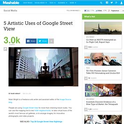
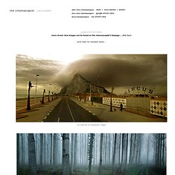
People are using Google Street View for more than checking travel routes. You can use the mapping tool to test hotel neighborhoods, to take virtual tours of the world’s most famous art galleries, or to arrange imagery for innovative photography and video projects. SEE ALSO: Top 28 Google Street View Sightings The Google Street View (GSV) car, fitted with 15 directional cameras, captures panoramas from over 30 countries – but not without controversy. In 2010, GSV cars inadvertently collected payload data from unencrypted Wi-Fi networks, and a few weeks ago Google offered an opt-out from Wi-Fi tracking to curb further criticism. Aaron Hobson’s Cinemascapes project helps to remind us that Google’s mapping tool still has its virtues. And his photo collections are only the beginning. 1. Hobson doesn’t add or remove anything from the original GSV image, and only performs minor retouching.
C i n e m a s c a p e s. La Linea de la Concepcion, Spain Saint-Nicolas-de-la-Grave, France Acquaresi, Sardinia Aragón, Spain Morrone del Sannio, Italy Huautla, Mexico Sanday Island, Scotland Route 17, South Africa Prague, Czech Republic Utsira, Norway Posada de Valdeón, Spain.

How to Create a Time-Lapse Movie with Google Street View. This tutorial describes how you can quickly create a time-lapse movie using Street View imagery from Google Maps and publish it to YouTube in HD.

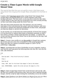
I made a short time-lapse movie today using Street View images from Google Maps and playing them all in a quick sequence with some background music. The end result, as you may have noticed in the video, is quite similar to the view that you would get if you were actually driving on that road while sitting inside the Street View car. This may have some practical uses. For instance, you can create a time-lapse of the route between the airport and your business, add voice narration to mention the important landmarks on that route, and people are then less likely to call you for directions. To get started, you would obviously need hundreds of Street View images.
Step 1. Step 2. Step 3. Step 4. That’s it. Build a simple GIS web application using GeoDjango and Google Maps — Tutorials 1.1.0 documentation. By the end of this tutorial you will have built a simple GIS web application for viewing, editing, searching and uploading GIS data.

We first presented this tutorial as part of a three-hour session on Working with Geographic Information Systems in Python during the 2009 Python Conference in Chicago, Illinois. This tutorial has been updated to work with Django 1.3. Example Make sure that the latest version of GeoDjango is installed; see Install GeoDjango. Start PostgreSQL server. su -c 'service postgresql start' Create PostgreSQL user and PostGIS database. createuser -U postgres geouser -S -D -R psql -U postgres -c "alter role geouser with password 'geopassword';" createdb -U postgres -T template_postgis -O geouser geodatabase Download the code and data. wget unzip geodjango-googlemaps.zip cd geodjango-googlemaps/googlemaps Setup tables. Run server. python manage.py runserver Go to and experiment with the application. Walkthrough Create spatial database Create GeoDjango project Configure settings Test. RED BULL STREET ART VIEW. The Last(.fm) Music Map - Discover music events and concerts near you!
Painting-sharing community, painting the world. Geocoded Art - Explore the Greatest Paintings of the World. Directions Map (with Animated Street View) - TripGeo.com - Map Your Trip. Musicovery. Stereomood – emotional internet radio - music for my mood and activities. Soundtransit.