
Proceedings of the 2014 Esri Ocean GIS Forum. Business GIS and Business Mapping in Marketing. Business GIS for Entrepreneurs 2: Trade Area Analysis and Site Selection. Business GIS for Entrepreneurs 1: Environmental Scanning and Opportunity Analysis. Bill Davenhall: Your health depends on where you live. Business intelligence. Business intelligence (BI) is the set of techniques and tools for the transformation of raw data into meaningful and useful information for business analysis purposes.
BI technologies are capable of handling large amounts of unstructured data to help identify, develop and otherwise create new strategic business opportunities. The goal of BI is to allow for the easy interpretation of these large volumes of data. Identifying new opportunities and implementing an effective strategy based on insights can provide businesses with a competitive market advantage and long-term stability.[1] BI technologies provide historical, current and predictive views of business operations.
Free Online Classes. Free Online Classes. Opencourses.desire2learn. Free Online Classes. Free Online Classes. Free Online Classes. Thinking Spatially. Thinking spatially is a part of everyday living.It is also endemic to all manner of sciences, from astronomy to zoology, and at all scales from the nanoscale to the universe scale.But just what do we know about spatial thinking?
Ok.So now that we realize how widespread spatial thinking really is, let's learn a little more about it.Spatial thinking includes the following: Translating from one dimension to another (as in creating 2-D maps from 3-D environments). Realizing distance properties (such as adjacency, proximity, similarity, nearest neighbor, crow-fly distance, or "over-the-road" distance). Comprehending orientation and direction (e.g., as in using global references such as North, South, East, and West, angular bearings, or clock-face directions-as in "the statue is at two o'clock from you").
Using frames of reference (such as latitude and longitude or local street numbering systems). Back to School with Geo-Literacy. "Geo Learning" by Daniel C.
Edelson,Vice President for Education, National Geographic Society. Spatial Thinking in the Geosciences. Spatial thinking is thinking that finds meaning in the shape, size, orientation, location, direction or trajectory, of objects, processes or phenomena, or the relative positions in space of multiple objects, processes or phenomena.
Spatial thinking uses the properties of space as a vehicle for structuring problems, for finding answers, and for expressing solutions (National Research Council, 2006). Geoscience demands extensive spatial thinking from learners and practitioners (National Research Council, 2006; Kastens & Ishikawa, 2006). Learning to Think Spatially: GIS as a Support System in the K-12 Curriculum. Opencourses.desire2learn. A guide to public domain spatial data. Natural Earth.
Data Sets. The National Map. NOAA's National Weather Service. Maps for the Web, made easy - CartoDB — CartoDB. Design and publish beautiful maps. Smallworld GIS. Golden Software - 2D & 3D scientific data visualization solutions. Maptitude Geographic Information System and mapping software. Mapping made easy Answer a few simple questions and Create-a-Map Wizard™ makes a map at any scale, from all of the countries of the world, to streets around an address, landmark, or intersection.
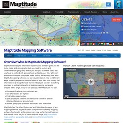
With a few clicks of the mouse, MapWizard® automatic mapping technology helps you create color and pattern maps, dot-density maps, scaled-symbol maps, and maps with integrated pie or bar charts. You can customize the colors, styles, and labels in your map. Once you understand the patterns hidden in the numbers, share your maps to tell your stories. Copy them to reports and slideshow presentations, save them to JPEG, PNG or HTML for use on websites, or print them out as handouts or wall-size posters. MapInfo.com. Security, Government and Infrastructure. The Macintosh GIS. Skills for the Digital Earth: Module 5.
The Learner's Guide to Geospatial Analysis. Geospatial Preparation of the Environment (GPE) The geospatial intelligence preparation of the environment (GPE) analytic method is based on the intelligence cycle and process.
According to NGA ( ), the steps are: 1. Geospatial Analysis - spatial and GIS analysis techniques and GIS software. What is Problem Solving? - Problem Solving Skills from MindTools.com. © iStockphoto/PerlAlexander Problems are only opportunities in work clothes. – Henry Kaiser (American industrialist) Having good strong problem solving skills can make a huge difference to your career.
Problems are at the center of what many people do at work every day. Whether you're solving a problem for a client (internal or external), supporting those who are solving problems, or discovering new problems to solve, the problems you face can be large or small, simple or complex, and easy or difficult. A fundamental part of every manager's role is finding ways to solve them. There are four basic steps in solving a problem: Defining the problem. Steps 2 to 4 of this process are covered in depth in other areas of Mind Tools. The Learner's Guide to Geospatial Analysis. Printer-friendly version (Modified 23 Jul 2010) A number of "ingredients" (concepts) have been used in the development of the Structured Geospatial Analysis Method "stew.
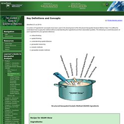
" It is difficult to understand how to apply the method without understanding the ingredients and their associated qualities. Deeper Dive into ArcGIS Online 1: ArcGIS as a System: The Best of All Worlds. How to teach with the ArcGIS platform. Geospatial Analysis - spatial and GIS analysis techniques and GIS software. What is Problem Solving? - Problem Solving Skills from MindTools.com.
The Learner's Guide to Geospatial Analysis. Lesson 4 - Displaying Geospatial Data. Introduction In this lesson you will learn about displaying geospatial data.
You will learn about map design and the elements that are used in the design process. A map critique is provided to help you understand best practices for creating a map and how to make adjustments and modifications as needed. By the end of this lesson, you will be able to: Apply cartographic principles to produce cartographic products. Required Readings Read the following: Online Lesson Material Resources Assignments.
Learning, Unlearning, and Relearning: Implications for GIS Education. Radicalcartography. Flex Projector. Story.html: Introduction to Geospatial Technology Using QGIS. ArcGIS Desktop. Geocoding is the process of transforming a description of a location—such as a pair of coordinates, an address, or a name of a place—to a location on the earth's surface.
You can geocode by entering one location description at a time or by providing many of them at once in a table. The resulting locations are output as geographic features with attributes, which can be used for mapping or spatial analysis. You can quickly find various kinds of locations through geocoding. The types of locations that you can search for include points of interest or names from a gazetteer, like mountains, bridges, and stores; coordinates based on latitude and longitude or other reference systems, such as the Military Grid Reference System (MGRS) or the U.S.
Lesson 4 - Displaying Geospatial Data. Channel: Tutorials. The ESRI Guide to GIS Analysis, Volume 2. Using GIS to Explain Geographic Reasoning. "Geo Learning" A column by Daniel C. Edelson, Vice President for Education, National Geographic Society I began the winding path that has become a career, as a researcher in artificial intelligence. I was drawn to artificial intelligence by one of its central tenets: you can understand how the human mind works by trying to reproduce its behaviors in the form of a computer program. Creativity Quiz - Creativity Tools From MindTools.com. Test your workplace creativity skills! © iStockphoto/fpm If the idea of being creative at work makes you think of artistic talent, don't worry! Business creativity is all about finding fresh and innovative solutions to problems, and identifying opportunities to improve the way that we do things. Integrating Creativity Science With GIS.
Competency Model Clearinghouse - Building Blocks for Competency Model (Pyramid Download Page) GeoTech Center - HOME. Competency Model Clearinghouse - Geospatial Technology Industry Competency Model. ArcGIS Desktop. Excel 2013 training courses, videos and tutorials. Excel 2010 Tutorial For Beginners #1 - Overview (Microsoft Excel) Geospatial Big Data - The Next Petroleum. GTCM Curriculum Guide - GeoTech Center. Credly. What's new—ArcGIS Online Help. ArcGIS Online Help.
ArcGIS Online. Get Started with ArcGIS Online. Channel: Tutorials. Elmhurst College: M.S. in Applied Geospatial Sciences (AGS) Beginning March 1, Elmhurst's Skills for the Digital Earth MOOC offers an introduction to location technologies and the geospatial industry. Register today! Advance Your Career Learn how our program will help you develop a professional network and prepare you to lead in the applied geospatial sciences industry. Growing the Geospatial Workforce As a national partner with the GeoTech Center, Elmhurst and the GeoTech Center collaborate with other colleges, universities and industry to grow the geospatial workforce. Home M.S. in Applied Geospatial Sciences (AGS) Map Out Your Future With a Master’s in AGS! The U.S.
Joseph Kerski, Ph.D. - GeographerJoseph Kerski, Ph.D. – Geographer. Geographyuberalles. This item has been hidden Esri Story Maps for Education II Play all Discover two main ways to make Esri Storymaps.