
A New Way To Map Drought and Water Use Worldwide. Contents Every month, the National Oceanic and Atmospheric Administration’s (NOAA) Center for Climate Prediction has a drought briefing by teleconference to identify the latest drought areas in North America.
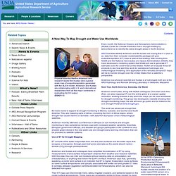
ARS scientists Martha Anderson and Bill Kustas are hoping that in a year or so, data from their computer model/satellite package will give evapotranspiration (ET) maps a seat at that briefing. With funding from NOAA and the National Aeronautics and Space Administration (NASA), they have developed a modeling system that NOAA will use to generate ET estimates over the continental United States.
NOAA will evaluate these ET products to see how well they work for operational hydrologic and meteorological modeling. One application of the remotely sensed ET maps will be to monitor drought over the United States from a satellite’s perspective. @Aqua_Libra Twitter. Water wars: 21st century conflicts? - Features. Click on the water conflict map to see some of Al Jazeera's coverage of an issue which could define 21st century strife The author Mark Twain once remarked that "whisky is for drinking; water is for fighting over" and a series of reports from intelligence agencies and research groups indicate the prospect of a water war is becoming increasingly likely.
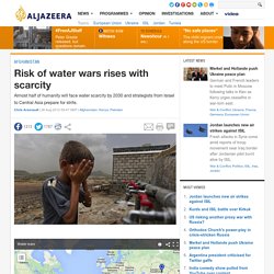
In March, a report from the office of the US Director of National Intelligence said the risk of conflict would grow as water demand is set to outstrip sustainable current supplies by 40 per cent by 2030.