Mineral Resources Online Spatial Data: Geologic maps. Oregon Public Land Survey System (PLSS) Oregon Public Land Survey System (PLSS) The Oregon Map. Page 038 - Township 6 S. Range 5 E., Camelback, Fish Cr., Wash Cr., Divide Butte, Atlas: Clackamas County 1928, Oregon Historical Map. Maps in this atlas contain names of the property owners.

For the names of residents living in the dwellings in many counties, consult atlases published by either Directory Service Company or Farm and Home Publishers when available in the database. For a full list of all published atlases of this area, browse the collection by state. Clackamas County 1928 Oregon Historical Atlas. Search Browse Help About Cart Home > Browse > United States > Oregon > Clackamas County 1928 Oregon Clackamas County 1928 Metsker Maps, 1928 Image Quality:

Page 044 - Township 5 S. Range 6 E., Clackamas River, Cripple Cr., Bull Cr., Three Lynx, Atlas: Clackamas County 1928, Oregon Historical Map. Maps in this atlas contain names of the property owners.

For the names of residents living in the dwellings in many counties, consult atlases published by either Directory Service Company or Farm and Home Publishers when available in the database. For a full list of all published atlases of this area, browse the collection by state. Map Information Full Title: Page 044 - Township 5 S. Clackamas County. How do I search for an address?
On the upper right corner of the application, next to the magnifying glass, is an arrow or triangle pointing down. Clicking on the arrow will reveal a list of search options. The first option is "Address". Address is the default search option. watch the videoStart typing an address in the search window and a list of suggested results will appear. Cannonball Mountain Bike Trail - Government Camp, Oregon. GLO Index Quadrant 4. Water Resources of the United States—National Water Information System (NWIS) Mapper.
Mt Hood National Forest - Data Library. Metadata Information Welcome to the Mt.
Pacific Northwest Seismic Network. Earthquake Fault Map. Cascades Volcano Observatory. Small magnitude earthquake swarms detected beneath Mount St.
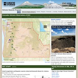
Helens.December 12, 2016 Four swarms of small magnitude earthquakes were detected beneath Mount St. Helens beginning November 21, 2016. No anomalous gases or increases in ground inflation have been detected and there are no signs of an imminent eruption. During a week's time, there have been over 120 tiny earthquakes, most too small to be formally located by the Pacific Northwest Seismic Network. The current pattern of seismicity is similar to swarms most recently seen at Mount St. For more information, see the Activity Updates for Volcanoes in CVO Area of Responsibility and Earthquake Monitoring at Mount St. Lidar allows researchers to identify over 200 landslides in the western Columbia Gorge.November 04, 2016 The western Columbia Gorge has been long recognized as an area susceptible to landslides.
The imagery shows that landslides cover about two thirds of the 222 square km (86 square mi) map area. ArcGIS Web Application. Mt Hood NF Recreation Opportunities. USGS TNM 2.0 Viewer. USGS Global Ecosystems - United States. Land surface forms for the conterminous United States were also generated as part of the ecosystems modeling effort (Cress and others, 2009b).
After extensive investigation into various land surface form methodologies, the decision was made to use the methodology developed by the Missouri Resource Assessment Partnership (MoRAP). MoRAP made modifications to Hammond's (1964a, 1964b) land surface form classification, which allowed the use of 30-meter source data and a 1-km2 window for analyzing the data cell and its surrounding cells (neighborhood analysis) (True, 2002; True and others, 2000). While Hammond's methodology was based on three topographic variables, slope, local relief, and profile type, MoRAP's methodology uses only slope and local relief (True, 2002). Using the MoRAP method, slope is classified as gently sloping when more than 50 percent of the area in a 1-km2 neighborhood has slope less than 8 percent, otherwise the area is not gently sloping, that is, steeply sloped. Global Ecosystems. U.S. Geological Survey - National Hydrography Dataset.
The Watershed Boundary Dataset (WBD) defines the areal extent of surface water drainage to a point, accounting for all land and surface areas.
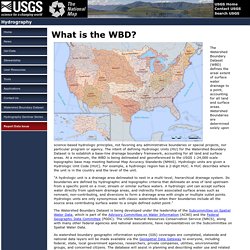
Watershed Boundaries are determined solely upon science-based hydrologic principles, not favoring any administrative boundaries or special projects, nor particular program or agency. The intent of defining Hydrologic Units (HU) for the Watershed Boundary Dataset is to establish a base-line drainage boundary framework, accounting for all land and surface areas. Hydrologic Unit Boundaries, 6th level (HUC6) - Oregon. Columbia River Keepers. My WATERS Mapper.
You are here: EPA Home WATERS My WATERS Mapper MyWATERS Mapper dynamically displays snapshots of EPA Office of Water program data.
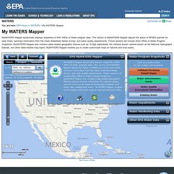
This version of MyWATERS Mapper depicts the status of NPDES permits for each State; summary information from the Clean Watershed Needs Survey; and water quality assessments. Future versions will include other Office of Water Program Snapshots. Oregon Restoration Viewer. WR Map Tool. The OWRD Water Rights Mapping Tool allows you to explore water rights managed by the state.
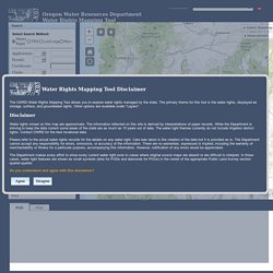
The primary theme for this tool is the water rights, displayed as storage, surface, and groundwater rights. Other options are available under "Layers". Disclaimer Water rights shown on this map are approximate. The information reflected on this site is derived by interpretations of paper records. Please refer to the actual water rights records for the details on any water right.
The Department makes every effort to show every current water right even in cases where original source maps are absent or are difficult to interpret. USGS TNM 2.0 Viewer. Glaciers of the American West. Mt. Hood - Campsites. EDW/EDW_RecreationOpportunities_01 (MapServer) View In:ArcGIS JavaScriptArcGIS Online map viewerGoogle EarthArcMapArcGIS Explorer View Footprint In: ArcGIS Online map viewer Service Description: Recreational areas are displayed as points starting from scale 1:400,000.
Recreation areas are symbolized using standard USFS recreation symbols as used on other USFS map products. Map Name: U.S. Forest Service Recreation Opportunities Legend. View topic - Map of old Mt. Hood NF ranger districts. Just found this article from June 13, 1952. Rangers Pare River District ... 539D6E1A73 It talks about dividing the Clackamas River drainage into three districts: Estacada (HQ in Estacada), Collawash (HQ at Station Creek Camp....where is that?)
, and Lakes (HQ at Oak Grove RS). The article also mentions that the previous Lakes district became the Bear Springs district at this time. UPDATE: Blasted link requires a library card. _________________Cheryl "Nature is not a place to visit. MHNF 1967 map. Northwest Hiker presents Hiking in the Mt Hood National Forest and Wilderness. Mount Hood National Forest Mountain Bike and Hiking Trails. <h3>Javascript is disabled. This site uses javascript to enable interactive features, so some content and features will not work while Javascript is disabled. <a href=" title="Site Technical Requirements and Support">Site Technology</a></h3> The Barlow and Hood River Ranger Districts contain a cluster of the best rides in the Northern Oregon Cascades. Extensive wilderness area limits biking in the rest of the Mt Hood National Forest. Geocortex Viewer for HTML5. Hood National Forest - Maps & Publications.
Free, Downloadable Maps These maps overlay Forest Service assets, such as roads, trails, and campgrounds, on USGS's topographic maps. They are available for download by quadrangle. Buy Maps Online A full, nationwide selection of National Forest, Ranger District, Wilderness, and Specialty Maps for purchase online or by phone, fax, and mail. National Forest maps also available for download via the Avenza App. Mt Hood NF Recreation Opportunities. Maps and Data Oregon/Washington BLM. Welcome to the Maps and Data page. We hope you will take the time to explore it. Mt Hood National Forest - Data Library. Historical Maps – Trail Advocates. The maps below are ones that have been collected from a variety of sources.
The list of maps will hopefully increase over time as new maps are found. We will try and keep them organized the same way to make them easy to find.The 24k (7.5 minute) maps have the greatest level of detail, however they do not have as much historical content (they are not as old). U.S. National Wilderness Preservation System Map. Historic Atlas: Wasco County 1933 Oregon - Historic Map Works. The Oregon Map GIS Viewer. McGee Creek Map. Early Washington Maps. DOGAMI - Mount Hood Geologic Guide and Recreation Map. 1965 Shell Oil Mount Hood Trillium Lake Road Map Oregon Portland Eugene Salem. 1961 Recreation Area Road Map Clackamas County Oregon Mount Hood Forest Trails. Official 1979 Trail Map Mount Hood National Forest Oregon Roads Ranger Stations. The USGS Store - One stop shop for all your maps, world, United States, state, wall decor, historic, planetary, topographic, trail, hiking, foreign, satellite, digital.
The National Map: Printable Maps. The National Map. Oregon National Forest and BLM Maps.