- Backcountry Mapping Evolved. - Backcountry Mapping Evolved. Mt. Hood National Forest, Oregon : United States. Forest Service : Free Download, Borrow, and Streaming. Mount Hood national forest, Oregon, its purposes and resources.. : United States. Forest Service : Free Download, Borrow, and Streaming. Forest trails and highways of the Mount Hood region : United States. Dept. of Agriculture : Free Download, Borrow, and Streaming. Forest trails and highways of the Mount Hood region : United States. Dept. of Agriculture : Free Download, Borrow, and Streaming.
1920 Mt. Hood trails/highways brochure with maps - Oregon Hikers. Cheryl, on that 1911 map -- there were a couple different versions at this scale, and they overlapped.
A full series at that scale was never completed, and eventually just replaced by the 15 minute series, then the 7.5 minute series. The copy you linked to is the only one I've ever seen, and is actually a reprint from the USGS, circa 1950s. Very fun reading through the brochure! Vacation Rentals: Plan Your Oregon Stay. Your Oregon vacation should be as comfortable as possible, so consider a vacation rental to fill all your needs… Mt Hood Vacation Rentals Imagine a romantic getaway in Oregon when you rent a cabin in Mt.
Hood National Forest. Current and Historical Maps – Trail Advocates. This page allows you to overlay different maps and tracks on each other and adjust the transparency of each layer to see how things line up over time.
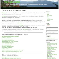
This page is another interesting utility to look at historical maps. This is sponsored by the USGS and it has historical maps for all over the country. Warning – Very large map downloads on both of these two pages – these maps should be downloaded locally for extended use. If you are interested in getting DVDs with all these images to help support this site, send an email to the webmaster. If you know what map you are looking for, This page has links to over 115 current and historical maps of our district. If you want to see what maps cover a certain area, This page allows you to click on an area and it will show which historic maps we currently have cover the area you clicked on. Monitoring Map. Mt. Hood's Volcanic Past. Hourly Timberline Lodge Weather Forecast. Mt Hood Meadows Webcam showing current snow conditions.
Mt. Hood National Forest - Alerts & Notices. Northwest Avalanche Center — Mountain Weather Forecast. Issued: 3:25 PM PST Monday, December 10, 2018 by Dennis D'Amico Jump to: Weather Forecast I Snow/Freezing Level I Precipitation I Free Winds 5k I Free Winds 9k I Extended Weather Weather Synopsis for Monday night through Wednesday A deep trough in the NE Pacific and a strong westerly jet will send a significant storm through our region on Tuesday.
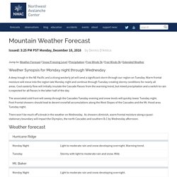
Warm frontal moisture will move into the region late Monday night and continue through Tuesday creating stormy conditions for nearly all areas. The associated cold front will sweep through the Cascades Tuesday evening and snow levels will quickly lower Tuesday night. Distinguished Professor: Peter Clark. MP 13. OGv51all. Oregon Department of Geology and Mineral Industries. NATIONAL REGISTER OF HISTORIC PLACES INVENTORY - NOMINATION FORM. TheBarlowRoad.com - "White River"
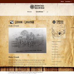
Gate Creek Crossing ...
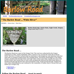
(original route/Smock Road) The early Barlow Road route crosses Gate Creek a little over 5 miles upstream from where Gate Creek merges into Rock Creek. Between 1846 to 1852 the first of five tollgates operating on the Barlow Road was established at this Gate Creek crossing. The route on the 1860 cadastral survey for T4S, R12E, shows the "Immigrant Road" crossing Rock Creek and heading southwest to Gate Creek, where it then turns west following Gate Creek's north bank until it crosses in T4S, R11E, Section 35. The route shown on the 1872 cadastral survey map shows "Road Across the Cascades to Barlow's Gate" crossing at the same location, but entering the area from the northeast. Gate Creek - Oregon Trail: Barlow Road. West of the Tygh valley, the emigrants moved along a grassy ridge about 10 miles to Rock Creek, a tributary to the White River.
From there they entered a small canyon at the east end of a half-mile long meadow, and forded a creek. The site had access to grass and water, and became the location for the first toll gate along the Barlow Road. Hiking the Pacific Crest Trail: Oregon: Section Hiking from Donomore Pass to ... - Eli Boschetto - Google Books. Oregon Field Guide. Use one of the services below to sign in to PBS: You've just tried to add this video to your Watchlist so you can watch it later.

But first, we need you to sign in to PBS using one of the services below. GIS Division. What is GIS?
Geographic Information Systems (GIS) is a combination of computer hardware, software, geographic data and personnel designed to efficiently capture, store, update, manipulate, analyze and display all forms of geographically referenced information.What we do:Wasco County's GIS Department provides spatial based information for not only the public but also for multiple departments and agencies within the County.
Our department manages and maintains the County's GIS data, maps and applications. We are here to help provide the public with information regarding their property or any property of interest. Wasco County Base Map. Mazamas: An abbreviated history. The Mazamas and its members were among the early leaders of Oregon, and they figure prominently in the epic story of the state.

William Gladstone Steel, a no-nonsense postman, was the driving force behind the Mazamas. Steel wanted to establish a climbing organization run by climbers for climbers. He was adamant that summiting a glaciated peak be a requirement for membership, a threshold that remains today. As if founding a new organization was not enough, Steel was also advocating for the creation of Crater Lake National Park. Swim – Mt. Hood History. The resort community of Swim was once located at the base of Multorpor Mountain near Government Camp.
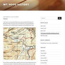
It was established sometime prior to 1924, when it appears on the USGS topo map. A post office opened there in 1925, with resort owner Boyd Summers named postmaster. In 1928 two different advertisements ran in the Oregonian on June 15 and on August 10 listing the features and amenities of the resort, including fishing, hiking, campgrounds, a store, cabins, and “hot tub baths of radio active mineral water.”
Pool at Swim Resort (sign on pole says “Swimming Pond Warm Mineral Water” and sign on building says “Mt. Hood Mineral Springs”) (U.S.
March. Albert Bierstadt’s magical 1869 vision of Mount Hood Long before white settlement had reshaped the American West, artists were traveling with early explorers to capture scenes of the stunning landscape and native peoples. This was the first view most Easterners in our young country had of places like Yellowstone, the Grand Canyon and Yosemite — places that would eventually become the crown jewels of our national park system. And just as Mount Hood and the Columbia River Gorge are still believed by many to be part of the national park system, the painters and photographers of the mid-1800s captured them in their untouched state along with the other great places in the West. Mount Hood WebCams. Mt. Hood Meadows Webcams. 1 climber dead in Mount Hood fall, six others rescued. Newest story: Climber dies after falling on Mount Hood: 'He started cartwheeling' GOVERNMENT CAMP -- A climber died after falling from a ridge on Oregon's tallest peak Tuesday, and at least one other was injured, according to the Clackamas County Sheriff's Office.
Crews were able to rescue six others who were stranded on the steep slopes of Mount Hood. Dozens of rescuers were called into action to rescue a total of seven climbers just before 10:30 a.m. The climbers were stranded in the Hogsback area of the mountain. Clackamas County Sgt. Lost Man Maps.
To review later. Elk Lake Trail 559 – Trail Advocates. USFS Info Sheet Topo Map. Historical Items – Trail Advocates. Here are some historical items of interest Oregon Skyline Trail Lieutenant Abbot and Sam An-ax-shat Biographical Memoir of Henry L. Abbot. Your access to this site has been limited. Your access to this service has been temporarily limited. Please try again in a few minutes. (HTTP response code 503) Reason: Advanced blocking in effect.
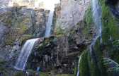
File:Lower South Fork Clackamas River Falls, Mount Hood National Forest, Oregon, 1957. - NARA - 299090.jpg. Portland Railway Light and Power. Estacada. Green Cascadia: Pot Creek Cabin Camp - May 2011. History is a remarkable thing, ever fluid, ever elusive. Geologic Map of Oregon. Mt Hood National Forest - Data Library. Recreation uses on the national forests : Waugh, F. A. (Frank Albert), 1869-1943. Oregon Wild and Scenic Rivers. Middle Fork of the Hood River. Begins on the north side of Mount Hood and flows north to join the East Fork of the Hood River near Dee Flows along the 7,000 year old Parkdale Lava Flow Contains "high quality habitat" for threatened, endangered, and sensitive fish species. United States Forest Service (United States. Forest Service) Online Books by (United States. Mt.Hood National Forest (N.F.), Badger-Jordan ... D. - Full View.
Mt.Hood National Forest (N.F.), Badger-Jordan ... D. - Full View | HathiTrust Digital Library | HathiTrust Digital Library. Oregon Skyline Trail – Trail Advocates.
Ideas. Geomorphology. Geography class. WyEast Blog. Gorge. Native Americans. Mt.Hood National Forest (N.F.), Mt.Hood Planning Unit, Proposed Interagency ... - Google Books. Gerald W. Williams Collection. CCC: Fragmented history of program that built Oregon. About Us - Forest History Center. Agency Main Content The Forest History Center is both a museum and an archive dedicated to preserving the history of forestry and related activities in Oregon. Civilian Conservation Corps . TV. Photo courtesy of Oregon State Forestry Center. Home - Oregon Archaeology. The Volcanoes of Lewis and Clark - November 2, 1805. Cascades Volcano Observatory, History - Naming the Cascade Range Volcanoes - Mount Hood, Oregon.
Mount Hood. Mount Hood is a stratovolcano in northwest Oregon located about fifty miles east of Portland and thirty-five miles south of the Columbia River. At 11,244 feet, it is the highest point in Oregon and the fourth highest peak in the Cascade Range. Mount Hood has played a central role in the geology, history, natural environment, and culture that have helped shape northwest Oregon and the entire Pacific Northwest. Ramona. My Choice 475 - Dolores del Rio: Ramona. Civilian Conservation Corps . TV. TheBarlowRoad.com - "Summit Meadows" Mount Hood Corridor, US 26 Rhododendron to OR 35 Junction, Clackamas County ... - Google Books. Decisions of the United States Geographic Board - United States Geographic Board - Google Books. Mt. Hood National Forest Campgrounds. Glossary: summit, peak, etc : Articles.
National Park Service: CCC and the National Park Service. Forest Trail Handbook (Table of Contents) Resources. Hood National Forest - Recreation. Hot springs. Aviation. Lookout Towers. Keith M Jackson's personal webpage. Glaciers of the American West. Deaths & survival. Plants. Copyright. The Forest Service and The Civilian Conservation Corps: 1933-42 (Chapter 14) The Black Spider. Cascades Volcano Observatory, History - Eruption of Mount Hood, Oregon August 17, 1859. Northwest Hiker presents Hiking in Oregon, Washington, Idaho, and Montana.
Fire. Photography. Videos.
Geology. History. Volcanic present/history. Water.