
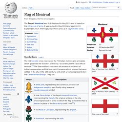
Discovery Education. Les pays du monde (J'apprends la géographie) Ⓓⓔⓥⓐ Comptine des petits. Flag of Montreal. Flag of Montreal from 1939 to 2017 Flag of Montreal from 1935 to 1939.
Google Image Result for. Untitled. Peppa Pig House Kids Crafts: DIY How to Make a Peppa Pig House with a Cheerios Cereal Box. Prononciation objets de la classe. Tour the World - Official Music Video. Flying Over America. Exploring Thomas Point Shoal Lighthouse - Chesapeake Bay Foundation. Which City Should You Live In? Tour the World - Official Music Video. La chanson de l'école. The Chesapeake Bay Bridge’s long history. The William Preston Lane Jr.
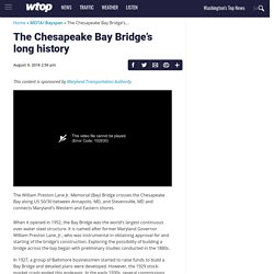
Memorial (Bay) Bridge crosses the Chesapeake Bay along US 50/30 between Annapolis, Maryland, and Stevensville, Maryland, and connects Maryland’s Western and Eastern shores. This content is sponsored by Maryland Transportation Authority This video file cannot be played. (Error Code: 102630) The William Preston Lane Jr.
When it opened in 1952, the Bay Bridge was the world’s largest continuous over-water steel structure. In 1927, a group of Baltimore businessmen started to raise funds to build a Bay Bridge and detailed plans were developed. Under the direction of Governor Lane, the General Assembly passed legislation to begin bridge construction in 1947. What is now the eastbound span opened to traffic on July 30, 1952. The two spans are 4.33 (westbound) and 4.35 (eastbound) miles long and form the longest fixed-water crossing in Maryland.
In 2017, traffic volume in both directions was 27.2 million vehicles. U.S. Constitution. Tour the States - Official Music Video. Maryland Pictures and Facts. Maryland Kids. The Maryland Department of Information Technology (“DoIT”) offers translations of the content through Google Translate.

Because Google Translate is an external website, DoIT does not control the quality or accuracy of translated content. All DoIT content is filtered through Google Translate which may result in unexpected and unpredictable degradation of portions of text, images and the general appearance on translated pages. Google Translate may maintain unique privacy and use policies. These policies are not controlled by DoIT and are not associated with DoIT’s privacy and use policies.
After selecting a translation option, users will be notified that they are leaving DoIT’s website. Annapolis, Maryland Facts for Kids. "Annapolis" redirects here.
For other uses, see Annapolis (disambiguation). Annapolis (/əˈnæpəlᵻs/) is the capital of the U.S. state of Maryland, as well as the county seat of Anne Arundel County. Situated on the Chesapeake Bay at the mouth of the Severn River, 25 miles (40 km) south of Baltimore and about 30 miles (50 km) east of Washington, DC, Annapolis is part of the Baltimore–Washington metropolitan area. Its population was measured at 38,394 by the 2010 census.
History. Beautiful Annapolis Quiz. Find the U.S. States Quiz. Alabama Alaska Arizona Arkansas California Colorado Connecticut Delaware Florida Georgia Hawaii.

Multicultural Education through Miniatures. Multicultural Education through Miniatures. Multicultural Education through Miniatures. Multicultural Education through Miniatures. Multicultural Education through Miniatures. Multicultural Education through Miniatures. Multicultural Education through Miniatures. Maryland State History for Kids. History >> US Geography >> US State HistoryNative Americans Before Europeans arrived in Maryland the land was inhabited by Native Americans.
Most of the Native Americans spoke the Algonquian language. They lived in domed wigwam homes made from tree branches, bark, and mud. The men hunted deer and turkey, while the women farmed corn and beans. World Flags: Interesting Information for Kids on the Flags of the World. Interesting Facts for Kids about the Flags of the World Why are there so many different world flags?
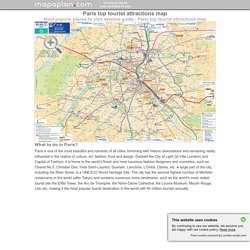
What are the most common symbols on flags? USA Map Match - Geography for Kids. Paris maps - Top tourist attractions - Free, printable - MapaPlan.com. Metro with favourite sights - Paris top tourist attractions map You can view, download or print a full, high resolution (detailed, large) version of this image by clicking on the plan itself Must see travel destinations - Paris top tourist attractions map What to do and where to go - Paris top tourist attractions map Interesting sites in a week - Paris top tourist attractions map Fun locations to go with kids / children - Paris top tourist attractions map City sightseeting route planner - Paris top tourist attractions map.
Google Earth. Directions in French - Les directions en Français. Mon sac a dos, Gregg Lerock. Dans mon sac d'école Sylvie Monette. Directions In French. De gauche a droite, from left to right. Walking Tour of Downtown Annapolis. Page 47 les directions (Children learn French) Les directions.mp4. Directions in French. Aerial Views Annapolis Maryland and United States Naval Academy. C-SPAN Cities Tour - Annapolis: "Annapolis, City on the Severn: A History" What is a country? An intro for kids - Sanger Academy. Mapping the Classroom. Preview the provided Mapping the Classroom pictures of practice to see photographs of a classroom teacher using this activity with students in Grades preK and K. 1.
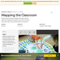
Prepare the map outline and contents. Before class, draw the shape of the classroom on a large piece of butcher paper, leaving an open space for the door(s). Cut shapes out of construction paper, or use the provided Classroom Cutouts worksheet, to represent the large furniture, rugs, and other permanent items in the classroom, staying as true to the actual colors as possible. Write each student’s name on a sticky note. 2. 3. 4. 5.