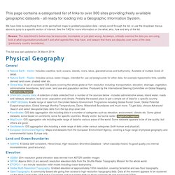

Federal Civil Agency Implementation of the U.S. Commercial Remote Sensing Space Policy. VegTypeIGBP. PLACE: Population, Landscape, and Climate Estimates. Features. Free GIS datasets. This page contains a categorised list of links to over 300 sites providing freely available geographic datasets - all ready for loading into a Geographic Information System.

We have links to everything from arctic permafrost maps to gridded population data - simply scroll through the list, or use the dropdown menus above to jump to a specific section of interest. See the FAQ for more information on the what, who, how and why of the list. Beware: The data linked to below may be inaccurate, incomplete, or just plain wrong. GEO-Portal - GEOPortal Home. GLCF: Landsat GeoCover. Access GeoCover in Earth Science Data Interface The Landsat GeoCover dataset is a collection of high resolution satellite imagery provided in a standardized, orthorectified format, covering the entire land surface of the world (except Antarctica).

This is an invaluable record of land cover and land cover change, provided in a consistent manner that allows for use in a wide range of activities including environmental assessment, planning, land management, resource stewardship and many Earth science research activities. The Congress of the United States provided NASA with funding to operate a Science Data Purchase, through the auspices of the NASA Stennis Space Centers Commercial Remote Sensing Program, now part of their Earth Science Applications Directorate. Global Browse Images for MODIS land products. Time Lapse View from Space, Fly Over. The VIP Research Lab. Mapping your world in 3D. EOS Validation Status for MODIS Vegetation Indices: MOD13.
EarthExplorer. USGS Global Visualization Viewer. World Maps of Köppen-Geiger climate classification.