
Storytelling with Maps. Click2map création de cartes interactives Google Maps. Concevez et publiez vos cartes sur Internet gratuitement L’éditeur de cartes Click2Map est une application riche sur Internet (RIA) totalement gratuite.
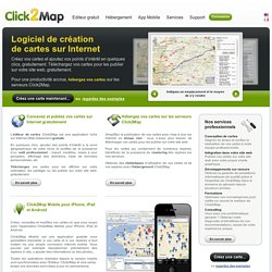
En quelques clics, ajoutez des points d’intérêt à la zone géographique de votre choix et profitez de la puissance d’un outil professionnel : import, modèles, mises à jour groupées, affichage des directions, base de données personnalisée, etc. Téléchargez vos cartes pour les afficher sur votre ordinateur, les partager ou les publier sur votre site web, gratuitement. En savoir plus Click2Map Mobile pour iPhone, iPad et Android Créez, consultez et modifiez vos cartes où que vous soyez avec l'application Click2Map Mobile pour iPhone, iPad et Android.
Click2Map Mobile est une application gratuite vous permettant d'accéder à vos carte et à vos repères à tout instant via une simple connexion internet mobile. En savoir plus. UMapper: créer une carte interactive en quelques secondes. Rapid Mapping Service - 2011. Les produits de cartographie rapide sont réalisés dans un court delai, en optimisant au mieux la donnée disponible.
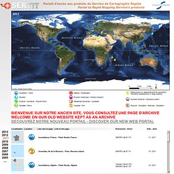
La responsabilité de l'auteur ne peut être engagée quant à leurs contenu ou éventuelle utilisation. Présentation du Service de Cartographie Rapide (.pdf format) Rapid Mapping Activity products are realised to the best of our ability, within a very short time frame, optimising the material available. No liability concerning their content or use is assumed by the producer.
Rapid Mapping Service presentation (.pdf format) GISS: G.Projector — Global Map Projector. G.Projector transforms an equirectangular map image into any of over 125 global and regional map projections.
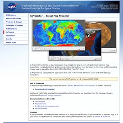
Longitude-latitude gridlines and continental outlines may be drawn on the map, and the resulting image may be saved to disk in GIF, JPEG, PDF, PNG, PS or TIFF form. G.Projector is a cross-platform application that runs on Macintosh, Windows, Linux and other desktop computers. World Wind. TargetMap - Create & share customized data maps on Googlemaps. Free Online Mapping tool. World map of Arab World protests (civil revolutions) by Country.
Hypercities. Openstreetmap.fr. Google Maps. Quand les Net artistes hackent Google Maps » Article. Loin de n'être qu'une cartographie numérique de la Terre, Google Maps et ses bébés Street View et Google Earth sont aussi une ressource au service de la créativité des artistes.
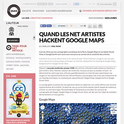
Comment les artistes détournent-ils les outils du web ? Silicon Maniacs inaugure une nouvelle série consacrée au braconnage artistique sur Internet. Aujourd’hui, les hacking de Google Maps, Google Earth et Google Street View. Depuis la seconde moitié des années 1990, des artistes utilisent le web comme un matériau à part entière. Sites Internet, moteurs de recherche, réseaux sociaux ou mondes virtuels : ils détournent les outils que nous utilisons quotidiennement sur Internet pour questionner nos usages et nos représentation du réel. La cartographie n’a jamais été une opération neutre et objective. Issu du collectif Frères Ripoulin, Claude Closky travaille autour des supports immatériels et du numérique.
Mardi Noir est un artiste issu de la scène graffiti rennaise. Google Maps. Google Maps. Recherche par intervalle de dates dans Google Google Operating System signale que vous pouvez restreindre la page des résultats à un intervalle de dates :Accédez à "Google.com in English".Cliquez sur le lien Show options.Servez-vous du lien Custom date range…L’opérateur qui apparaît dans la barre d’adresses est de ce type : &tbs=cdr:1,cd_min:12/01/2008,cd_max:31/01/2008Vous pouvez ensuite filtrer les résultats en cliquant sur les liens Videos, Forums, etc.

Ou définir des préférences de langue afin de n’afficher que les pages en français. Des images pour certaines requêtes géolocalisées Comme l’a remarqué Olivier Andrieu, Google affiche 6 images sur des requêtes géographiques : Paris, par exemple.Un clic sur une des images vous renvoie directement sur Google Maps. Rappelons qu’elles sont toutes extraites de Panoramio. Visualiser un document dans Google Après les PDF, c’est, maintenant, au tour des fichiers XLS. Traduire un document importé en utilisant Google Traduction.