
Cartographie. Atlas of World History. The Historical Atlas of Europe. Europe and the Middle East 1000AD to the Present, software for Windows and Mac OSX. Classical Atlas Project. United Nations Cartographic Section Web Site. DÉSIGNATIONS UTILISÉES: La représentation et l'utilisation des frontières, des noms géographiques et autres données employés sur les cartes et utilisés dans les listes, les tableaux, les documents et les bases de données de ce site ne sont pas garantis sans erreurs, de même qu'ils n'engagent pas la responsabilité de l'Organisation ni n'impliquent de reconnaissance officielle de sa part.
COPYRIGHT: Sauf indication contraire, les cartes qui sont présentées sur ce site ont été établies par la Section de la cartographie et sont protégées par le droit d'auteur. Leur reproduction partielle ou intégrale sans l'autorisation de l'Organisation des Nations Unies est illicite. Atelier de Cartographie.
Mapping History. Historical Atlas of the 20th Century. Historical Atlas. Maps and Graphics at UNEP/GRID-Arendal. Explorez nos cartes. Maps. The section of the Sourcebook is devoted to copy-permitted maps and images. These images can be used in teaching, and in web page creation. The source of images is indicated for each image. © This text is copyright. The specific electronic form, and any notes and questions are copyright. Permission is granted to copy the text, and to print out copies for personal and educational use.
If any copyright has been infringed, this was unintentional. Ireland's History in Maps - Irish History, Geography and Genealogy. History + Geography + Genealogy With a Special Focus on Ancient and Medieval Irish Tribes and Septs Take a Geographic Tour through - Ireland's History.
Athena Review Image Archive: Old World Maps and Site Plans. Welt-Atlas.de - Weltatlas mit Karten aus aller Welt. Weltkarte, Kontinente, Urlaubsregionen, Landkarten aus Europa, Amerika, Asien, Afrika und Australien. Europa in Karten - ein Link-Atlas. Europe Historical Maps. Historical Maps of Europe Le Alpi [The Alps] (1,917K) From Atlante Mondiale Hoepli di Geografia Moderna Fisica e Politica.
Giovanni Roncagli, 1899. Atlas historique et généalogique. World History at KMLA. The World Factbook. The Office of Public Affairs (OPA) is the single point of contact for all inquiries about the Central Intelligence Agency (CIA).
We read every letter, fax, or e-mail we receive, and we will convey your comments to CIA officials outside OPA as appropriate. However, with limited staff and resources, we simply cannot respond to all who write to us. Cartes & Atlas géographiques. Un atlas historique multimédia constitué de cartes animées pour mieux comprendre l'Histoire. Historische Karte - Deutsches Reich 1789. Collins INDiCATE Demo. Histoire-passion > Cartes. Kartenportal.ch - Rechercheportal für Karten - Schweiz. ATLAS HISTORIQUE - Cartographie & histoire. Animated Atlas of American History. Kostenlose stumme Karten, kostenlose unausgefüllt Landkarten, kostenlose hochauflösende Umrisskarten. Karten-weltgeschichte. Mapas Histórico-Políticos de la Edad Moderna. GARDINER'S ATLAS of ENGLISH HISTORY. California Maps - HSU Library. IEG-MAPS. Archiv - Landkarten. IEG-MAPS.
Medieval Britain - General Maps. Maps - UVa Library. Géographie. Plusieurs sites sont consacrés aux noms latins désignant des villes et des peuples.
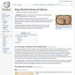
On en signalera quelques-uns : Les cartes disponibles sur le Web ne remplacent évidemment pas les atlas imprimés. On en trouve toutefois un certain nombre. Ainsi : Sur le Web, il existe plusieurs sites consacrés aux noms latins désignant des villes et des peuples. Sur la valeur des atlas parus avant 1987 : Foss C., Classical Atlases, dans CW, t. 80, 1987, p. 337-365. Bengtson H., Milojcic V. Mapa Mundi de Beatus de Liébana. Un article de Wikipédia, l'encyclopédie libre.
IFC. Atlas Histórico. Índice. El Atlas de Historia de Aragón (AHA) contiene 144 mapas históricos y otros tantos textos explicativos adaptados para su manejo informático.
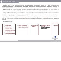
Asimismo facilita orientación bibliográfica y búsqueda onomástica a través de dos índices particulares (toponímico y antroponímico, con acepción en ambos casos de nombres antiguos y modernos). El Atlas original fue obra de setenta especialistas, en su mayor parte doctores y profesores de la Universidad de Zaragoza, que aunaron esfuerzos sin renunciar a sus variados y peculiares puntos de vista en cuanto a temas cartografiados y enfoque de los textos explicativos.
Historical Maps. Geography and Map Reading Room. OpenStreetMap. Cartes anciennes, Atlas historique : collections en ligne LEXILOGOS. REPERTOIRE : Histoire - Cartes, atlas... Maps. Les cartes geopolitiques. Atlas géopolitique en ligne Cartes du monde contemporain-Maps of the world. Geopolitcs maps. Geoatlas propose le monde sur Internet Fort du succès rencontré sur le marché du cédérom libre de droits, et leader européen dans ce domaine, la collection internationale vectorielle (Illustrator Eps) composée actuellement de six cédéroms (WORLD, AMERICA, ASIA , AFRICA, EUROPE, OCEANIA) sera maintenant disponible en ligne.
L'internaute disposera pour 100 euros d'un "pack pays" composé de trois fichiers: une carte physique, une administrative/routière, et une carte simplifiée. Les 192 états recensés par L'ONU seront donc téléchargeables, mais également les 50 états des USA, les Landers allemand ainsi que des planisphères, des globes, des continents et des drapeaux. Chaque fichier est au format Illustrator Eps, 100% modifiable et compatible avec toutes les applications capables de lire ce format. GEOATLAS®...et le monde est à vous Geoatlas propose la France sur Internet Les formats de fichiers proposés, Eps, Wmf sont compatibles avec vos applications bureautiques ou graphiques.
The European Library. Creative Mapping. Historical Atlas of China. Welcome to PGSA. Plattform Stat@las. Don de deux globes du XVIIIe siècle à la Bibliothèque nationale. Jean Antoine Nollet (1700-1770)Globe terrestre dédié à la duchesse du Maine, 1728Globe céleste dédié au comte de Clermont, 1730 D. 32,5 cm (46 avec la table d’horizon) H. 55 cm Photo : Didier Rykner.

Talessman's Atlas of World History (Homepage) Historical Atlas of the 20th Century. ... and other less related sites that might be of interest.
I'll never get around to drawing every map that needs drawing, so here are other maps on other sites drawn by other people. And remember -- these are all external sites, so don't blame them for problems you may have discovered on my site, and vice versa. I don't have a search engine here, but if you're curious about a particular topic, you might want to use [CONTROL]-[F], and then type in a simple keyword(s), like croatia or world war or (****. Broad Outline of Links: Historical Atlas of Poland. Maps - National Geographic. Oddens' Bookmarks, The fascinating world of maps and mapping !
Map History / History of Cartography - WWW-Virtual Library. The Collection. Le Ciel et la Terre : l'Atlas catalan. Ancient Maps. Maps and Geography of the Ancient World Ancient History traditionally starts with the Fertile Crescent (from modern Iraq to Egypt) and focuses mainly on the Mediterranean. To the people in this area, most of the globe was unknown. Science: Social Sciences: Geography. Ancient World Mapping Center. Geography World. Map of Russia. New Jersey Historical Maps. Heratlas - Héraldique française - French Heraldry. Consultation des cartes de Cassini. Cartes historiques. Carte geographique ancienne France / Europe / Monde - l'histoire par les cartes geographiques anciennes - carte geographique ancienne et vieil atlas temoins detailles de l'histoire et de la geographie vers 1860.
Guide voyage sur l'Afrique du Sud. Cartes. Quelques cartes sur l'Afrique du Sud, cliquez pour agrandir (source Atlas-historique.net) : Carte de l'Afrique du Sud en 2002 (Certains noms de villes ou régions mentionnées ont été "réafricanisés" depuis : la province du Gauteng est l'ancienne Prétoria-Witwaterstrand-Vereeniging, la capitale administrative Prétoria a été rebaptisée en "Tshwane", Durban "Ethekwini" et Pietersburg "Polokwane") : Carte de l'Afrique du Sud sous l'Apartheid : Carte de l'Afrique du Sud en 1914 : Historic Atlas: CARTE/DE LA NOUVELLE ANGLETERRE,/NOUVELLE YORCK ET PENSILVANIE/Pour servir a l'Histoire Generale des Voyages. - Historic Map Works. Antiquité — Université de Mulhouse Colmar Alsace. Histoire des pays du Monde Arabe en cartes - Atlas historique en ligne. Atlas géographique dressé pour l'Histoire universelle de l'église catholique, de l'abbé Rohrbacher.
Notes Microfiche de l'exemplaire de l'dition originale se trouvant au Sminaire de Qubec, Bibliothque.Ottawa :Institut canadien de microreproductions historiques,1985. [3], 24 cartes ; 42 cm. Book Details. Histoire et géographie de l'Europe. Atlas - Histoire Ancienne. Histoire des pays du Monde en cartes - Atlas historique en ligne. Romania's ethnographical history. There is not a set number of ethnographic zones in Romania and each Romanian text will have a different combination presented, the total number being somewhere between 60 and 120. The Romanian ethnographic zones are defined as: This section is arranged hieratically from the modern regions of Romania down to the ethnographic sub-zones and regional minorities. The Balkans from Neolithic to modern times, in political development maps, timelines and past and present peoples can be found on our South East European history pages.
Historical Maps of Islam. The Red Kaganate - Khazar Maps. Historical Maps of the Khazar Kaganate. Magyar Elektronikus Könyvtár. Atlas de Historia de España. Historical Atlas by A.Lesage 1808: Overall View. British Maps Home Page. ATLAS HISTORIQUE. Historic Cities: Maps & Documents. Atlas histoire geographie [Alain HOUOT] Historical Atlas, ToC. L'Atlas historique de l'Occident. Some Maps of the Roman Empire. The maps on this section of my website are taken from an unidentified late 19c English-language school atlas of the Roman world. It is not the best atlas, nor do I have the full set of maps or the index. At the time I put them online, I was rescuing them, so to speak, since their owner, Jim Miller, was about to lose his website. Although that did not happen, in July 2001 Mr. Miller died: and this disparate collection of older print maps, rather too large, with occasional scholarship and readability problems, that I can neither fix or identify, will remain onsite for the foreseeable future.