
SOFTWARE. APPs. TRENDS & SKILLS. PROGRAMMING. BOOKS & TUTORIALS. GOOGLE MAPS. WMS. INSTITUTIONS, FOUNDATIONS. Analysis: Which GIS technology to use for disaster management? Summary: For decades, governments and NGOs have relied on private sector solutions to gather and interpret emergency data for crisis response, but a growing number of them have warmed in recent years to much cheaper "open-source" (OS) technology.
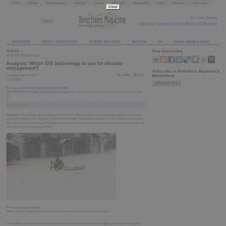
IRIN spoke to experts around the world about their search for the most appropriate mix of technology to manage disasters. Floods, as here in the Philippines, provide enormous challenges for response teams Proprietary software does everything from providing imagery and geographic information system (GIS) data to centralizing government-generated data on a command centre "dashboard" during crises. It has been around decades but is costly.