
Big Map Blog On Quality By way of a quick summary: My prints are of very good quality. Most people selling digital prints of maps online are delivering a very poor product. I make no claim to exclusivity on the source images for the prints on this site – they are, after all, in the public domain (and if you didn't notice, I'm actually, well, giving away the image files on this site). Not to give anyone any business ideas, but it's very possible for anyone to download a Library of Congress image, and without even so much as a glance, upload it to a print-on-demand print shop. Prints on this Site Unlike almost every other seller of similar maps, prints ordered from Big Map Blog are: t59k In short, before you buy any print, ask the seller for a small image showing the full-resolution detail – any reputable seller of digital prints will be glad to comply. Specifications The image quality is discussed above and is unmatched. I'm glad to answer any question you might have. Kind regards, –the 59 King
20 maps that never happened Maps are a powerful way of illustrating not only the world that is, but worlds that never have been. What follow are not fictional maps — there's no Westeros or Middle Earth — but plans and hypotheticals that never came to pass. You'll see military plans for invasions that didn't happen or conquests that were hoped-for and never achieved. You'll also find daring infrastructure schemes that would have remapped cities and even whole continents. War Plans War Plan Red: The invasion of CanadaFollowing the 1927 Geneva Naval Conference, the US Army — evidently bored with the peace and prosperity of the 1920s — decided to draw up plans for a hypothetical war between the United States and the British Empire. Fantasy Political Reforms Five TexasesAny Texan (ask my wife, or my former roommate, or Vox's own Kelsey McKinney) will tell you that Texas has the right to unilaterally split into five separate states. Infrastructure Projects Proposed Countries
Inside The Most Amazing Map Library That You've Never Heard Of | Atlas Obscura The American Geographical Society Library at the University of Wisconsin, Milwaukee. (Photo: Luke Spencer.) Within the campus of University of Wisconsin-Milwaukee is a geographer’s treasure trove: over a million artifacts from the American Geographical Society, one of the most incredible collections of maps, atlases and globes to be found in America. But, ironically, the library is practically unexplored territory. It's an inconspicuous home for a storied collection: this is the final resting place of the library of the illustrious American Geographical Society. Faculty members of the geography department at UWM heard what was happening and applied. It took 16 trucks to move the vast collection, where it lives and is actively curated today in the Golda Meir Library. The 'rare room' of the Library containing some of its most valuable items. Photograph taken by Belmore Browne of the expedition to climb the Ruth Glacier, Alaska. The oldest map in the collection dates from 1452. Dr.
USGS Historical Topographic Maps Accessing historical topographic maps has never been easier TopoView highlights one of the USGS's most important and useful products, the topographic map. In 1879, the USGS began to map the Nation's topography. This interface was created by the National Geologic Map Database project (NGMDB), in support of topographic mapping program managed by the National Geospatial Program (NGP). Packed with new features and downloadable file formats The maps shown through topoView are from the USGS’s Historical Topographic Map Collection (HTMC). GeoTIFF – The GeoTIFF files are a compressed, 300 dpi TIFF image format, with embedded georeferencing information so that the map can be used directly in a Geographic Information System (GIS). Send us your feedback We're pleased to offer these formats to you, and invite you to explore the collection of historical topographic maps.
Wagner & Debes Cartographers English: The Leipzig Geographical Institute of Wagner & Debes was important German cartographic printer and publisher of cartographic work in the 19th- and early 20th century. Established in 1835 as a lithographic press by Eduard Wagner, who worked with cartography publisher Karl Baedeker. In 1872 Heinrich Wagner, son of Eduard Wagner, took over, moved the presses to Leipzig, and established his own publishing firm in collaboration with Ernst Debes. Subcategories This category has the following 2 subcategories, out of 2 total.
Anglo-Saxon London Map The full map in overview. A high-resolution version can be found by clicking below. Central London was once largely marshland. The first major Anglo Saxon settlement was Lundenwic (now Covent Garden/Aldwych). Later, King Alfred re-established a town within the old Roman walls, known as Lundenburh. South London, with some familiar place names. The Thames near Chiswick, which means ‘cheese farm’. North-west London, with the ‘nose-shaped hill’ (Neasdun), Wemba Lea and the curling River Brent, which still flows through the area. The eastern Thames, showing Charlton, Woolwich and Plumstead and, to the north, the important abbey town of Barking (Bercingum). Click here for the full-resolution Anglo-Saxon map (3.2 MB). Three years ago, we put together a map showing the London area in Anglo Saxon times (roughly speaking, 500-1066AD). We’ve now updated the map, based on feedback and further research. The map comes with a few caveats.
An Illustrated Guide to Space Maps Nebra Sky Disc, Germany, 1600 BC. (Photo: Rainer Zenz/WikiCommons CC BY-SA 3.0) With its patinated bronze background and shiny gold sun, moon and stars, the 3600-year-old Nebra Sky Disc is worth gazing at for its beauty alone. But the ancient object is cool for a lot of other reasons: It’s the earliest depiction of outer space we’ve ever found, and it’s also thought to be the oldest known portable astronomical instrument. For as long as humans have stared at the sky, we have sought to understand our place in the cosmos. The story behind the disc’s discovery is almost as crazy as the disc itself: it was dug up by metal-detector- wielding treasure hunters in 1999, along with “two swords, two axes, a chisel, and fragments of armlets.” Is it art or science? From the Harmonia Macrocosmica, Holland, 1660. Compiled by the Dutch astronomer and mathematician Andreas Cellarius towards the end of his life, the Harmonia Macrocosmica is a masterpiece of 17th century space mapping.
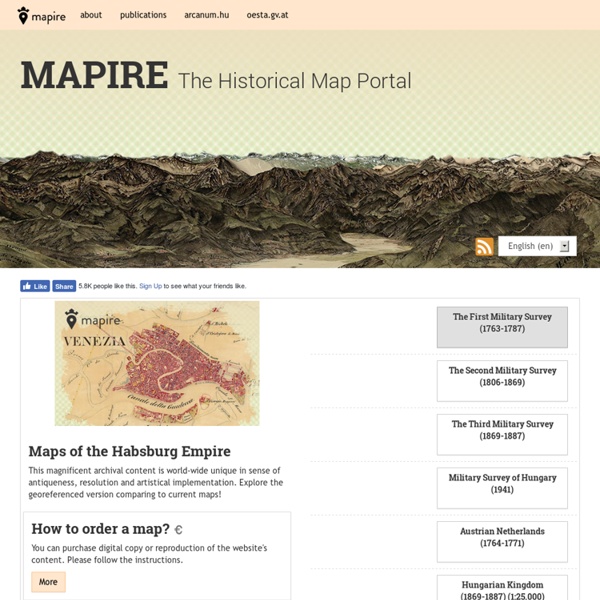
Old maps of Seven Seas (Open Ocean) How does it work? These instructions will show you how to find historical maps online. Getting started Type the place name in the search box to find the exact location. You can further adjust the search by zooming in and out. Zoom Zoom in and out with the buttons or use your mouse or touchpad natively. Exact Area tool Click here and draw a rectangle over the map to precisely define the search area. Set filters Narrow your search with advanced settings, such as Years (from/to), Fulltext, Publisher, etc. Results See the results of your search on the right side.
Appalachian Mountain Club's Equipped: Nearly Every USGS Topo Map Ever Made. For Free. The U.S. Geological Survey (USGS) has been producing detailed topographic maps for more than 125 years. Today they are nearly all digitized and free to download through the USGS Map Store, an incredible treasure trove for both map junkies and casual hikers alike. Locating your desired map is straightforward with the USGS Map Locator and Downloader, which allows you to zoom in or search for your area of interest. To do so, find your desired location and select the type of map you wish to download (usually the 7.5-minute versions, which provide the most detail). Next mark a point within your desired map by first selecting the button next to "Mark Points" and then clicking anywhere within the area of interest. One important thing to note is that, in general, the most recent topo maps listed are markedly different from their predecessors. “Equipped” is an AMC Outdoors blog, written by Matt Heid.
History Map Archive Browse the Map Archive The art and history of cartography, aka mapmaking, goes back to ancient times. Or at least what they thought it could look like. Our English word map derives from the Latin word mappa, meaning napkin or cloth on which maps were drawn. The Map Archive This map collection is indexed chronologically and by continent. Some Map History and Trivia This little gem is a world map compiled around 700 to 500 BC by the ancient Babylonians: Babylonian World Map British Museum London See more details about this ancient map provided by the British Museum. And here is Herodotus' Map of the World. MAP OF THE WORLD — HERODOTUS Library of Congress, Washington, D.C. Comparing drawings from several lunar eclipses, Aristotle observed that Earth cast always a circular shadow on the moon, no matter the moon's trajectory. By 150 BC, the philosopher Crates had fashioned a globe, and others followed. Martin Behaim's 1492 Globe is the Oldest One in Existence More from the More History
Explore georeferenced maps - Map images © Harris Corp, Earthstar Geographics LLC© 2016 IntermapEarthstar Geographics SIO© 2016 Microsoft Corporation© 2010 NAVTEQ© ANDTerms of Use© 2016 DigitalGlobeImage courtesy of NASAImage courtesy of USGS© Getmapping plc© 2016 GeoEye© 2016 Pasco© GeoContent / (p) IntergraphImage courtesy of the IndianaMapImage courtesy of the Nevada State Mapping Advisory Committee© 2016 InterAtlas© 2016 Eurosense© 2016 IGP© 2016 IGN© Province of British Columbia© 2016 Blom© 2016 Aerials ExpressImage courtesy of LAR-IACImage courtesy of ImagePatch.comState of Michigan© 2012 DigitalGlobe© 2010 MapData Sciences Pty Ltd, PSMA© 2010 Zenrin Victorian London in Incredible Detail Here’s a real treat. The National Library of Scotland’s Map Department, supported by David Rumsey, have taken some very high-resolution scans of the Ordnance Survey 1:1056 (that’s 60 inches to the mile!) set of 500+ maps of London issued between 1893 and 1896 and, crucially, reorientated and stitched them together, so that they can be presented seamlessly (using OpenLayers) on top of a “standard” Google web map or OpenStreetMap, with the base map acting as a modern context. The detail in these maps is breathtaking. Here are the individual towers, rooms and staircases, in part of the Tower of London: Here’s University College London’s main building – with internal stairways, rooms and even wall thicknesses visible. Interesting to note from the map above that the alley that is now known as Gower Court used to be called Little Gower Place. While many areas are largely unchanged from 120 years ago, some places are distinctively different. View the map interactively here. Thanks to Go-Geo!
The Perfect 22-Foot Map for Your Ancient Roman Road Trip A close-up of the Tabula Peutingeriana. (Photo: Public Domain/WikiCommons) If you’re planning a road trip in ancient Rome, you'll need two things: a time machine, and the Tabula Peutingeriana. Also known as the “Peutinger Map,” the Tabula illustrates the complex road networks of the Roman Empire. This segment includes the boot of Italy, the Mediterranean Sea, and what's now southern Tunisia and Tripolitania. Given the size of the Roman Empire at its height, your ancient road trip could start in Europe and have stops in North Africa, the Middle East, and parts of Asia. If Atlas Obscura existed in ancient Rome, we'd probably recommend that you check out the mountain views by the Tarento resupply station or the excellent foot courier treatment along the Coriello coast. The full expanse of map, all 6.75 meters of it. The public roads, or cursus publicus, marked on the Tabula Peutingeriana were built in the first century under Emperor Augustus to improve imperial communication.