
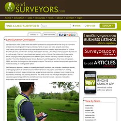
Revalidación de Estudios Extranjeros. Surveyor: Career and Education in San Diego, California. Surveyors can find both educational opportunities and jobs in the San Diego, California area.
There are currently 5,900 working surveyors in California; this should grow 14% to 6,700 working surveyors in the state by 2016. This is not quite as good as the national trend for surveyors, which sees this job pool growing by about 14.9% over the next eight years. CADD Technology and Surveying. Cuyamaca College’s CADD Technology and Surveying programs are designed to equip students with a specialized skill set for immediate employment, upgrade skills for professional advancement or enable students to transfer to a four-year college or university to further pursue their studies.
Students who complete the CADD Technology program will develop foundational skills in blueprint reading and architectural drafting, along with specialized skills in computer-aided design, including three-dimensional drafting. They will be able to create 3D modeling of objects, use the latest version of 2D/3D CADD and Solid Modeling software, and be prepared for various careers in the fast-growing CADD profession.
Students who complete the surveying program will learn the communication and computational skills required for boundary, construction, route, control surveying and more. Emphasis is place upon applications of electronic data collection and related software, including CADD. Surveyor: Career and Education in San Diego, California. Program of Study. Term Effective: Summer 2011 The requirements for this program of study are effective beginning the semester shown above.
If you began working on this program before the effective semester, you may not be affected by the changes. Consult with the program contact person or the department chair to determine your eligibility to complete the program under previous requirements. Description: This major/certificate is undergoing revisions. Assistant Surveyor - San Diego, CA - Project Design Consultants Jobs.
Assistant Surveyor Are you looking for a career that provides challenge and satisfaction?

Does working on high profile projects appeal to you? Do you enjoy being part of team at a firm that attracts prestigious projects with developers and public agencies? Project Design Consultants (PDC) is an award-winning professional design firm. IMMIGRATION: New law lets immigrants apply for licenses. IMMIGRATION: New law lets immigrants apply for licenses Rosie Hernandez, right, of Lake Elsinore, practices different hair cutting techniques during an apprenticeship class at Cosmetica in Downey on Monday, July 27.

New law • The new law, introduced as SB 1159, requires all 39 licensing boards under the California Department of Consumer Affairs to consider applicants despite immigration status. • Instructs licensing boards to accept federal taxpayer identification numbers issued by the Internal Revenue Service as proof of identification by 2016. Eit exam. Faq eng. Google. Eit lsitapp. Licensing Requirements. The procedure to obtain a license to practice land surveying in the State of California is governed by the Department of Consumer Affairs.
The exam is a two-tiered procedure. The first examination is a national exam resulting in the issuance of a Land Surveyor in Training (LSIT) license. Once the appropriate eligibility requirements are met, an LSIT can sit for the Licensed Land Surveyor exam. The requirements for a LSIT are as follows: • Certification as an LSIT is the first step required under California law towards becoming licensed as a professional land surveyor. • Each applicant must file the application, pay the stated filing fee, and sit for the assigned 8-hour written examination. . • Neither U.S. For more information regarding the requirements to submit either a social security number or individual taxpayer identification number, please read the Information Collection, Access, and Disclosure Policy. 10 607 7%20Geospatial%20Surveying%20Technician%20Curriculum%20Sheet%202015 16. Ing. Edson Rodríguez Solórzano. Land Surveyor Certification Info - All About Education and Certification.
Land surveyors in the United States are certified professionals responsible for a wide range of information and services including determining boundaries of land, air space and water, property ownership, map-making, planning and organizing property development and creating legal descriptions for the land.
Boundary Surveys, Construction Surveys, Hydrographic Surveys, Lot Surveys, and Topographic Surveys are a small sample of the jobs that professionals regularly perform. Work is often outdoors and may require travel, carrying surveying equipment across different types of terrain and being exposed to a range of weather. The United States Geological Survey, Bureau of Land Management, Army Corps of Engineers, FEMA, and other similar agencies often employ surveyors. The variety of work and employment opportunities makes surveying an exciting career option. There are several different educational routes to become a Professional Surveyor in the United States.
Leave Comments.
Land Surveyors United Support Matrix. Erods.files.wordpress.com/2013/03/modulo-ii-teoria-de-errores.pdf. Fexposit.webs.ull.es/ife_err.pdf. EDU. Aula Virtual Geomatica. EDU. EDU. EDU. MATEMATICAS. Topografía, Cartografía y Geodesia. La asignatura se ocupa de formar al alumno en las materias relacionadas con la topografía general (tanto aparatos como métodos), las aplicaciones cartograficas y los sistemas de información geográfica como herramienta fundamental en el manejo de la información territorial.
Imagen: UPM Asignatura anual de 4º curso común a todas las especialidades. Fecha de la última revisión (mes y año). Horas de clase: 3 horas de teoría y 2 de prácticas a la semana.Viaje de prácticas de 3 días de duración a Cercedilla. Browse by Subject - Archivo Digital UPM. Bibliografía. Land Surveyors United Support Matrix. Aula Virtual Geomatica. DIBUJO TÉCNICO. Topografía, Cartografía y Geodesia. EDU. Módulos - Manual del alumno. Topografía Universidad Vizcaya de las Américas.
Tesis de otros.