
Kartograph.org. Maze Generator. Maze Generator My son has been interested in mazes recently.

This seemed like the perfect opportunity to show that I could actually do something useful on the computer (in his eyes), so I decided to put together a maze generator. Maze generation is actually relatively trivial and it is often one of the first examples of a recursive algorithm given to computer science students. Template:Image generation. This documentation is transcluded from Template:Image generation/doc.
The template automatically sets the following categories: depending on tool and validation Usage Or use the shorthand {{Igen |… parameters as described …}} (like magyarul "igen" = "yes") Parameter settings. Cartographers' Guild - a community for maps of fantasy, sci-fi and real world locations. Commons:Licensing. For the country by country licensing rules, please see Commons:Copyright rules by territory.
A quick introduction This file has annotations. Move the mouse pointer over the image to see them. Acceptable licenses A copyright license is a formal permission stating who may use a copyrighted work and how they may use it. This cartoon explains why Commons does not accept "noncommercial" licenses. All copyrighted material on Commons (not in the public domain) must be licensed under a free license that specifically and irrevocably allows anyone to use the material for any purpose; simply writing that "the material may be used freely by anyone" or similar isn't sufficient. Sometimes, authors wish to release a lower quality or lower resolution version of an image or video under a free license, while applying stricter terms to higher quality versions.
Category:Invalid SVG. Cancel Edit Delete Preview revert.
Template:Delete. This documentation is transcluded from Template:Delete/doc.
Note: The easiest way to nominate individual images for deletion is to click the "Nominate for deletion" link in the side bar. There's no need to fill this out manually. do not "subst" this templatedo not delete this template, delete the pages and files that embed ituse the following code on the image or page you think should be deleted: {{Delete |reason= |subpage= |day= |month= |year= }} reason — the explanation for why the page referencing this template needs to be deleted.subpage — the subpage of Commons:Deletion requests on which the image nominated for deletion is listed (see below for explanation)day, month, and year — the current day of the month, month as a word in English, and four-digit year, such as 1, January, and 2000, or for today:
Maperitive. Kartenwerkstatt/Positionskarten/Europa. Commons:Link templates. Category:Maps of the Roman Empire. Cancel Edit Delete Preview revert.
Commons:Graphics village pump. Cancel Edit Delete Preview revert Text of the note (may include Wiki markup) Could not save your note (edit conflict or other problem).
Please copy the text in the edit box below and insert it manually by editing this page. Grants:IEG/Wikimaps Atlas. Status: selected project: Wikimaps Atlas project contact: hugo.lpz gmail.com, arun.planemad.
Graphics Lab. From Wikipedia, the free encyclopedia Graphics Lab The Graphics Lab helps improve all graphical content stored on Wikimedia Commons and the English Wikipedia.
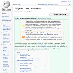
Wikigraphists work to improve the quality of the images that have been proposed by the community. This involves work such as extracting key elements from photos, improving the color of images or emphasizing the main subject, 'stitching' multiple images together and often vectorizing images (converting to SVG). We also create new drawings, diagrams and maps when requests are made to do so. Interested in helping out? Can't draw a thing? Category:Images for cleanup. Category:Images with watermarks. The W3C Markup Validation Service. Template:Infobox settlement. This template should be used to produce an Infobox for human settlements (cities, towns, villages, communities) as well as other administrative districts, counties, provinces, etcetera - in fact, any subdivision below the level of a country, for which {{Infobox country}} should be used.
Parameters are described in the table below. For questions, see the talk page. For a USA city guideline, see USCITY. Usage Important: Please enter all numeric values in a raw, unformatted fashion. Basic blank template, ready to cut and paste. Using metric units Using non-metric units Short version. Kartenwerkstatt/Positionskarten. Commons:Licensing. Commons:SVG Check. Getting SVGs to render correctly can be tricky, but SVG Check can help (GUI slightly outdated). SVG Check is a Wikimedia Labs-based tool designed to make the uploaders of files in the SVG (.svg) format a little easier.
As it stands, MediaWiki converts files in the format into PNG (.png) files before display, for a number of reasons. This process produces a number of quirks and idiosyncrasies which have, in the past, required repeated uploading and general help to sort out. SVG Check eases this process by allowing users to preview the eventual display of an SVG without going through the formality of uploading it, and without creating a permanent record of the potentially botched version. It can also be set to scan the file for errors, and present advice specific to that problem.
File:Test.svg. Help:SVG. Official logo for the SVG file format SVG (scalable vector graphics) is an accepted file format on Wikimedia Commons. It is suited to diagrams, maps, and other non-photographic images. SVG is highly appreciated on Commons because it describes graphical objects with a sourcecode and thus currently provides the best way to modify and improve content. SVG files are used extensively on Wikimedia Commons.
Here are a few tips to get started. Download.geofabrik.de/europe.html. Clustering Map Symbols. These maps demonstrate the map symbol clustering features built into Kartograph.js. They all show the same dataset of UK cities sized by the number of people that have visited this website in 2012. no clustering — The first map shows the +500 symbols without clustering. London (2k visits) is completely covered by hundreds of cities with only a few visitors. Local maxima such as Leeds and Manchester are hidden, too. k-means — Symbols are combined using k-Means clustering. Noverlap — Here symbols are combined only if they overlap, as described here.
Fast and beautiful maps. Kartograph.org. Paint,Color Maps with Statistics (Online Free Tool)