
Openmap - BBN Technologies' Open Mapping Technology. Gis. The goal of the DebianGis project is about improving Debian to make it the best distribution for Geographical Information Systems applications and users.
A good deal of GIS related softwares and libraries (e.g. GRASS GIS , GDAL , and PROJ.4 ) are already present in Debian. Thanks to efforts of the DebianGis team, we currently have many exciting GIS packages in Debian's main archives. Other programs are well along their way to being included in the archive. The coordination of this project happens on the debian-gis@lists.debian.org mailing list. We host a Subversion (SVN) and a Git repository for team maintenance of packaging chores on Debian's Alioth server. UbuntuGis is a page that collects GIS-related information for the UbuntuLinux distribution.
GeoGit by Boundless. GeoNode. OpenGeo. Indiemapper. Scribble Maps. ScapeToad. TileMill. Till Nagel – TileMill for Processing. This tutorial describes how to create beautiful custom maps, and use them in a Processing sketch.
We are going to use TileMill to style our maps, export it, and load the rendered map tiles into PImages. There are two ways of doing that. Basic A single image as static map. If you simply need a geographical background, or want to put some data onto a fixed map, this is the easy way to go. See the example below. Advanced An interactive tile-based map, where users can zoom and pan. Custom map adapted to style of a visualization. Designing custom maps In the last years, there have been tremendous changes in the digital cartography field. Fortunately, in 2009 the CloudMade editor was launched, in which users can select various properties and style maps based on OpenStreetMap by themselves. Now, say hello to the new kid in town: TileMill – A map design studio TileMill is a map design environment, which – as they put it – “enable[s] artists to design maps”.
Single image as static map. GeoServer. GeoServer. Goals[edit] GeoServer aims to operate as a node within a free and open Spatial Data Infrastructure.
Just as the Apache HTTP Server has offered a free and open web server to publish HTML, GeoServer aims to do the same for geospatial data. Features[edit] GeoServer reads a variety of data formats, including: Through standard protocols it produces KML, GML, Shapefile, GeoRSS, PDF, GeoJSON, JPEG, GIF, SVG, PNG and more. GeoServer additionally supports efficient publishing of geospatial data to Google Earth through the use of network links, using KML. GeoServer relies on GeoTools, a GIS library. Usage[edit] Architecture[edit] See also[edit] References[edit] Jump up ^ "GeoWebCache". GIS lab. One thing which keeps me excited these days is my new project called GIS.lab which began as a tool for simple, unbreakable, always-ready-and-clean deployment of multiple machines running software for Geographic Information Systems - QGIS.
Shortly after finishing first workable version I realized big potential of this technology and started adding new features. What is GIS.lab GIS.lab is a solution to create fully equipped, easy-to-use, pre-configured, centrally managed, unbreakable and portable local area network (LAN) solution offering complete office and GIS software. It is configured to work out-of-box, without any need of configuration or other behind a scene knowledge, allowing users to keep high focus on their task. To achieve this goals it uses modern virtualization techniques in conjunction with automatic server provisioning and management.
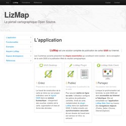
How it works Where to use. OpenStreetMap. LizMap. I.
Passez à LizMap librement Notre solution LizMap, constituée du logiciel QGIS, de son plugin LizMap, et de l'application Internet associée LizMap Web Client, est disponible gratuitement au téléchargement. Vous n'avez aucune licence commerciale à contracter pour obtenir chacune des briques logicielles, elles sont librement exploitables. Le tableau ci-dessous indique les différents liens de téléchargement pour chaque élément Après avoir récupéré les 3 applications, vous devrez les installer et les configurer pour pouvoir utiliser LizMap.
RelucBlog : Installer LizMap sous Windows II. Offre #1 / Nous hébergeons vos données et l'application sur nos serveurs Prestations d'hébergementPour adapter nos solutions à vos besoins, nous vous proposons 4 types d'hébergement : LizMap Découverte, Standard, Pro et Gold. Google Earth.