
Côte Ouest des États-Unis. Un article de Wikipédia, l'encyclopédie libre.
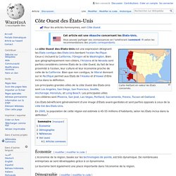
Carte mettant en valeur les États concernés. Ces États bénéficient généralement d'une image d'États avant-gardistes et sont parfois opposés à ceux de la côte Est des États-Unis. En 2005, la population de cette région est estimée à 45-55 millions d'habitants, selon les États inclus dans la définition[1]. Économie[modifier | modifier le code] L'économie de la région, basée sur les technologies de pointe, est très dynamique.
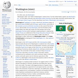
Le tourisme tient également une place importante dans l'économie de la région. Démographie[modifier | modifier le code] Selon l'American Community Survey, en 2010 63,53 % de la population âgée de plus de 5 ans déclare parler l'anglais à la maison, 23,06 % déclare parler l'espagnol, 2,37 % une langue chinoise, 1,93 % le tagalog, 1,27 % le vietnamien, 0,99 % le coréen, 0,51 % le japonais et 6,34 % une autre langue[2]. Références[modifier | modifier le code] Voir aussi[modifier | modifier le code] Washington (state) Washington i/ˈwɒʃɪŋtən/ is a state in the Pacific Northwest region of the United States located north of Oregon, west of Idaho, and south of the Canadian province of British Columbia on the coast of the Pacific Ocean.
Oregon. Oregon ( Oregon was inhabited by many indigenous tribes before Western traders, explorers, and settlers arrived.
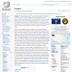
An autonomous government was formed in the Oregon Country in 1843, the Oregon Territory was created in 1848, and Oregon became the 33rd state on February 14, 1859. Today, Oregon is the ninth largest and 27th most populous U.S. state. The capital of Oregon is Salem, the second most populous of its cities, with 160,614 residents (2013 estimate). With 609,456 residents (2013 estimate), Portland is the largest city in Oregon and ranks 29th in the U.S. Etymology[edit]
Hawaii. Coordinates: Hawaii (English pronunciation: i/həˈwaɪʲi/ hə-WY-(y)ee; locally, [həˈwɐ(ɪ)ʔi]; Hawaiian: Hawaiʻi [həˈvɐiʔi]) is the 50th and most recent U.S. state to join the United States, having joined on August 21, 1959.
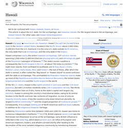
Hawaii is the only U.S. state located in Oceania and the only one composed entirely of islands. It is the northernmost island group in Polynesia, occupying most of an archipelago in the central Pacific Ocean. Hawaii is the only U.S. state not located in the Americas. California. California ( i/ˌkælɨˈfɔrnjə/) is a state located on the West Coast of the United States.
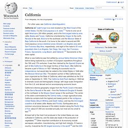
It is the most populous U.S. state,[11] home to one out of eight Americans (38 million people), and is the third largest state by area (after Alaska and Texas). California is bordered by Oregon to the north, Nevada to the east, Arizona to the southeast, and the Mexican State of Baja California to the south. It is home to the nation's second and fifth most populous census statistical areas (Greater Los Angeles area and San Francisco Bay Area, respectively), and eight of the nation's 50 most populated cities (Los Angeles, San Diego, San Jose, San Francisco, Fresno, Sacramento, Long Beach, and Oakland).[12] Sacramento is the state capital. What is now California was first settled by various Native American tribes before being explored by a number of European expeditions throughout the 16th and 17th centuries. Etymology Shortened forms of the state's name include CA, Cal., Cali., Calif. and us-CA. Climate.
Alaska. State in the United States Coordinates: 65°N 150°W / 65°N 150°W / 65; -150 Interactive map showing border of Alaska (click to zoom) Alaska (; Aleut: Alax̂sxax̂; Inupiaq: Alaasikaq; Pacific Gulf Yupik: Alas'kaaq; Tlingit: Anáaski; Russian: Аля́ска, romanized: Alyáska) is a U.S. state on the northwest extremity of the country's West Coast, just across the Bering Strait from Asia.
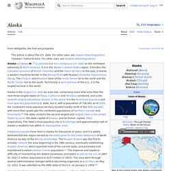
An exclave of the U.S., it borders the Canadian province of British Columbia and territory of Yukon to the east and southeast and has a maritime border with Russia's Chukotka Autonomous Okrug to the west.