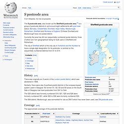

S postcode area. Postcode district boundaries: Google / Bing The S postcode area, also known as the Sheffield postcode area,[2] is a group of postcode districts in and around eight settlements with post town status: Barnsley, Chesterfield, Dronfield, Hope Valley, Mexborough, Rotherham, Sheffield and Worksop in England.

Of these Dronfield and Mexborough have one postal district. Currently the area has 49 non-sequentially numbered postal districts, three of which are 'non-geographical' being for bulk users in Sheffield and Rotherham. The city of Sheffield which is the only city in Yorkshire and the Humber to have a single-digit designation for its postcode, is centred on the sequentially numbered districts from S1 to S14. History[edit] There was originally an S sector of the London postal district, which was abolished in 1868. The S20 district was formerly numbered S19; S21, S25 and S26 were formerly numbered S31, while S32 to S36 were formerly numbered S30. Coverage[edit] Map[edit] See also[edit] References[edit] S postcodes, Sheffield. Sheffield City Council - MaPit. Boundary-Line - Britain's electoral and administrative boundaries. Boundary-Line™ contains the full hierarchy of local government administrative boundaries and electoral boundaries for Great Britain.

Coverage Mid. scale - regional Data use Names and gazetteers Data format Vector With the growth and increase of political, social and demographic information now available, this product is an invaluable tool in a variety of markets. Here are some examples of its use: Local and Central Government - For demographic statistics, administrative decision making, planning applications and legal work. Health authorities - for Health Authorities need to analyse social, economic and population screening to ensure that their services are effective and targeted. Land and property - Boundary-Line is an invaluable aid for showing which administrative area the land is in for planning permission when planning new builds, both commercial and domestic.
Commercial use - targeting customers within specific areas for marketing and sales purposes. OS OpenData Supply - Download or order Ordnance Survey OpenData. Order OS OpenData here Please note that orders for supply on DVD will take up to 28 days to deliver (longer if overseas).

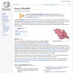
If you would prefer to receive your data more quickly, please select the download option. Data ordered via the download option will be ready for you the same day, normally within 1 hour. Please note that the file sizes for selected products, shown in brackets under the 'coverage' column, refer to downloaded files only. All files for download are supplied as .zip archives. For more information about any of these products, please see our products page. Districts of Sheffield. The wards of Sheffield History[edit] Areas of Sheffield by ward[edit] Other areas[edit] There are other areas that do not fit into the list above:

KML Interactive Sampler. Bluesky - GIS data, imagery and solutions for the environment. Solar suitability maps provided by SolAR (Solar Assessment of Roofs) ArcGIS Explorer. How To Map Excel Data in Google Earth.