Transit App for iOS 6 and Beyond by OpenPlans. With the announcement of iOS version 6, Apple has dropped Google Maps and with it, previously built-in support for travel directions via public transit.
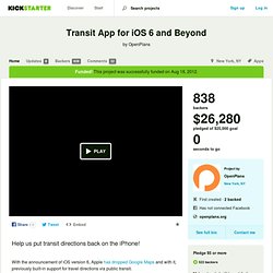
With your support, OpenTripPlanner Mobile, an open source application developed by OpenPlans will put transit back on the iPhone. Initially, we will offer coverage for almost all transit systems in North America (see coverage details below). The app will also add new features that Google Maps didn’t have, allowing users to combine walking, bikes, bike-share and transit together, finding the fastest and most efficient trips regardless of mode of transportation. The more funds we raise the more features and data coverage we'll be able to add. Your donation is tax-deductible and supports our work building software that makes cities better.
The way we get around is changing. We’ve spent the last three years creating a trip planning engine, OpenTripPlanner, in partnership with transit agencies and software developers around the globe. Yes! Catch the Bus iPhone App. OneBusAway. MTA Bus Time for Staten Island Launches; the Arrival of a Platform.
OpenPlans Transportation has been hard at work producing a real time bus tracking system for New York City.
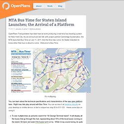
As we announced last fall, with project partner Cambridge Systematics, the MTA launched Bus Time on Jan 11, 2011. And the time has come, for Staten Islanders to know when their bus is about to come. Welcome to Bus Time. It's multipying. You can learn about the technical specifications and characteristics of the new open platform here. To see mutliple lines as pictured, search for “St George Terminal Island” It will display all the buses that go through this hub, representing about 70% of the local buses running on the island. Zoom in to the first or second closest zoom levels. Online Trip Planning Tools. Where's the T?
New apps built by independent developers let you know where your bus or train is and when it will arrive. Check them out below! Real Time Apps Scheduling Apps Note: Android is a trademark of Google Inc.; Blackberry is a registered trademark of Research in Motion Limited; iPhone, iPod, iPod touch, and iPad are trademarks or registered trademarks of Apple, Inc. App Disclaimer These apps are not made by MBTA, and MBTA does not sell or license the apps. iRail.be. Live map of London Underground trains. OpenMBTA: free, open source real-time arrival times and schedules for Boston public transit. London transport data opened to app developers.
17 open data apps for San Francisco. Last year, San Francisco opened up its data stream to the general public, encouraging developers to integrate the data into applications, sites, and bits of information the public could use.
Since then, there’s been more than a dozen applications to utilize the data and turn it in to apps that make residents’ lives easier in a number of ways ~ from finding the best public transit options, to figuring out how to dispose of that old camera. You’ll find all this info and much more within these apps. Here’s a review: The former news girl in me loves this data stream, but EveryBlock is more than just neighborly news. It’s everything you want to know about what’s going on in your neighborhood at a given time!
EveryBlock features what calls to the city have been made recently, including 911 calls, businesses in the area, reviews of businesses and pictures. Spot Crime is an enlightening – yet somewhat frightening! Commuting made easy. How a student used open data to beat national rail enquiries at its own game. How useful is open government data really?
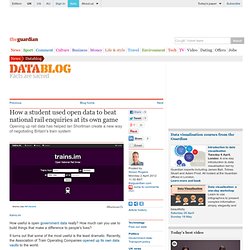
How much can you use to build things that make a difference to people's lives? It turns out that some of the most useful is the least dramatic. Recently, the Association of Train Operating Companies opened up its own data vaults to the world. It effectively means that National Rail Enquiries - which requires a licence to use its data - no longer has a monopoly on rail enquiries. Something which Bristol chemistry undergrad Ian Shortman took advantage of to create trains.im - an open source train timetable service. Why bother? There are a few things that I found really annoying about the railway system. • Not knowing the platform beforehand, especially when trying to make a quick connection • When getting off before the train terminates, it can be hard to know which train is yours (i.e. it's final destination) on departure boards • Not knowing your actual route. Two new iOS apps that use Montreal transit open data.
Here’s to interesting timing: two new iOS apps that use the STM’s open data came out last week, offering some good alternatives to the official STM app and the outdated STM Mobile, which scraped schedules from the STM website and was often out of date.
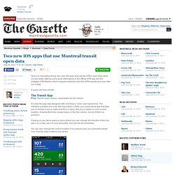
A quick overview of both. The Transit App Price: free for basic version, subscription for full version It’s clear this app was designed with one thing in mind: user experience. The interface is simple and crisp with big buttons. Clicking on any items opens a menu where you can change the direction of the line, see it on a map, star it to your favourites, and see the full schedules. You can also change the current location if you want to plan your schedule ahead. The map view is neat: it shows the bus route, with each stop clearly marked.
City-Go-Round Apps - Bus schedules, train schedules, trip planners, transit maps, and public transit apps. NJT Rails Schedules for NJ Transit trains and buses Platforms: iPhone App Stopango convenient, personalized timetables Platforms: iPhone App, Website (Desktop/Laptop)