
marie_tk
Regenerative Solutions for the Human Hive. Conceptualizing the Crisis Mapping Phenomenon - Insights on behavior and the coordination of agents and information in complex crisis. Adaption in Crises ..........................................................................................................................................
Crisis Convergence in the Inormation Environment .................................................................... A Closer Look at Agents in Adaptive Processes ................................................................................ Haiti Earthquake 2010 ................................................................................................................................. London Riots 2011 ......................................................................................................................................... General Policy Implications .....................................................................................................................
Crisis Maps: Harnessing the Power of Big Data to Deliver Humanitarian Assistance. RAA. RestaurantDay. Hb. Crisis Mapping With OpenStreetMap a Big Focus at Tokyo Conference. [OpenStreetMap]( the free and editable map of the world, kicked off its [international conference]( today in Tokyo, with the entire first day dedicated to improving disaster response and crisis mapping.
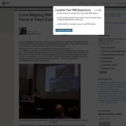
With the March 2011 [Tōhoku tsunami]( still fresh on people’s minds and events like the recent [Talas Typhoon]( reminding us that disasters are a constant threat, we know that disaster response must be an ongoing, structural concern. The Japanese community hosting the conference did a great job highlighting how crisis mapping needs to be central in disaster response efforts — and how a free tool like OpenStreetMap can make a big difference. Fukushima resident and mapper Kinya Inoue talks about the utter devastation the 2011 tsunami left behind. OpenStreetMap delivers valuable open baseline geodata that can play a critical role in aiding disaster response.
Haiti and the Power of Crowdsourcing. It’s been two weeks since I called David Kobia to launch Ushahidi’s crisis mapping platform in Haiti. I could probably write 100 blog posts on the high’s and low’s of the past 14 days. Perhaps there will more time be next month to recount the first two weeks of the disaster response. For now, I wanted to share an astounding example of crowdsourcing that took place 10 days ago.
Boston, January 17, 8pm Picture a snowy Boston evening and the following “Situation Room” a.k.a. my living room at Blakeley Hall, part of The Fletcher School. My fellow PhD colleague Anna Schulz, who has rapidly become an expert in satellite imagery analysis and geolocation, receives an urgent request via Skype from InSTEDD‘s Eric Rasmussen pictured below with Nico di Tada. The urgent request? Boston, January 17, 8.30pm An hour later, Anna had found the GPS coordinates for all but one of the locations for the rescue operations. Boston, January 17, 9.41pm Boston, January 17, 10.26pm Boston, January 17, ~11.00pm.
How Crisis Mapping Proved Henry Kissinger Wrong in Cambodia. Crisis Mapping can reveal insights on current crises as well as crises from decades ago.
Take Dr. Jen Ziemke‘s dissertation research on crisis mapping the Angolan civil war, which revealed and explained patterns of violence against civilians. Think You Know What Ushahidi Is? Think Again. Ushahidi is the name of both the organization (Ushahidi Inc) and the platform.
This understandably leads to some confusion. So let me elaborate on both. Ushahidi the platform is a piece of software, not a methodology. The Ushahidi platform allows users to map information of interest to them. A Brief History of Crisis Mapping (Updated) Introduction One of the donors I’m in contact with about the proposed crisis mapping conference wisely recommended I add a big-picture background to crisis mapping.
This blog post is my first pass at providing a brief history of the field. In a way, this is a combined summary of several other posts I have written on this blog over the past 12 months plus my latest thoughts on crisis mapping. Evidently, this account of history is very much influenced by my own experience so I may have unintentionally missed a few relevant crisis mapping projects. Note that by crisis I refer specifically to armed conflict and human rights violations. What is Crisis Mapping? An Update on the Field and Looking Ahead. I last updated my piece on A Brief History of Crisis Mapping some two years ago, well before the first International Conference on Crisis Mapping was held (ICCM 2009).
So a brief update on the past 24 months may be in order, especially for a field that continues to grow so rapidly. When I Googled the term “crisis mapping” in September 2009, I got 8,680 hits. Today, one gets over 200,000. If you’re curious about the origins of the field and what happened before 2009, my original blog post still serves as a useful intro. I also recommend this recent video on Changing the World One Map at a Time and this earlier blog post on Proposing the Field of Crisis Mapping (also from 2009). Clearly a full update on the past 24 months would constitute at least an MA thesis (if you’re a grad student and looking for a topic, email me!).
Why Universities are Key for the Future of Crisis Mapping. In January 2010, I launched the Ushahidi Crisis Map for Haiti.
In February, I launched the Ushahidi Crisis Map of Chile. Neither initiative would have been possible without the incredible student volunteer network that formed at The Fletcher School/Tufts University, the Graduate Institute in Geneva and Columbia University’s School of International and Public Affairs (SIPA). Please Rob Me. Privacy International. Pedagogy meets Big Data and BIM – Big Data, Sensing and Augmented Reality: Paper and Key Note Presentation. In June 2013 The Bartlett held a conference entitled ‘Pedagogy meets Big Data and BIM’.
The conference brought together over 100 participants from across the United Kingdom, European Union and the United States from diverse backgrounds such as academic institutions, government and industry – including ARUP, Autodesk, Balfour Beatty, BAM, and Royal Institute of British Architects. The Faculty’s motivation to focus on BIM (Building Information Modelling) and Big Data (deriving from the exponential growth of the profession’s access to spatial statistics) was the realisation that innovation, collaboration and technology are rewriting industry practice in profound ways and must also reshape the built environment curricula.
I was lucky enough to be asked to present the key note to the conference, below is the short paper produced along with the full key note presentation: IFTF a plant of civic labs.
Medientechnische und medienwissenschaftliche Entwicklung. Lange Zeit wurden einem technikhistorischen, aber auch einem kritischen Verständnis folgend die Neuen Medien mit einer stetig zunehmenden Enträumlichung und „Entortung“ verbunden.
Doch entgegen der Annahme einer Erodierung des „sense of place“ (Massey 1993) zeigen medientheoretische Diskussionen (Döring/Thielmann 2009) und neuere Studien mobiler Medienpraktiken eine Revaluierung des Ortes (Hjorth 2008; Goggin/Hjorth 2009; Wilken/Goggin 2011). Bei all diesen Entwicklungen handelt es sich im Kern um medientechnische Entwicklungen, die man unter dem Begriff der „Geomedien“ (Döring/Thielmann 2009; Thielmann 2010) fassen kann: georeferenzierende Medien, die unseren Umgang mit Raum und Ort soziotechnisch reorganisieren, und global vernetzte Medien, deren Nutzung und Inhalte sich je nach dem konkreten physischen Ort verändern. Diese medientechnologische Entwicklung begegnet auffälligen Parallelen in der Entwicklung der Medienforschung.
Harvard System of Referencing Guide. Any in-text reference should include the authorship and the year of the work.
Depending on the nature of the sentence/paragraph that is being written, references to sources may be cited in the text as described below: Additional support on how to introduce such references is available from Student Support in their guide. When making reference to an author's whole work in your text, it is sufficient to give the name followed by the year of publication of their work: When writing for a professional publication, it is good practice to make reference to other relevant published work.
This view has been supported by Cormack (1994). However, where you are mentioning a particular part of the work, and making direct or indirect reference to this, a page reference should be included: Cormack (1994, pp.32-33) states that "when writing for a professional readership, writers invariably make reference to already published works". For more examples, see page numbers section. Directly using an and.
Bac.Arbeit.