
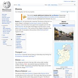
Dowra. Transport[edit] Bus Éireann route 462 serves Dowra on Saturdays only linking it to Drumkeeran, Dromahair and Sligo.[1]
Ballymore, County Cork. Ballymore is the closest village to the centre of the island and is situated on the oldest and longest road on the island.
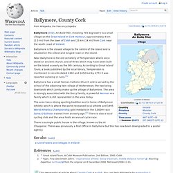
Near Ballymore is the old cemetery of Templerobin where once stood an ancient church, one of three which may have been built on the island as early as the 9th century. According to Great Island Tours, a book published by the local library, Templerobin is mentioned in records dated 1302 and 1652 but by 1774 it was reported as being in ruins.[1] Ferbane. Business[edit] Ferbane Business and Technology Park Ltd is a non profit making company with charitable status owned by the community.
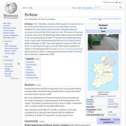
Phase one was ready in January 2005 Since its establishment, Ferbane Enterprise Group has worked non-stop to develop a unique Business & Technology Park in its region. That work is now bearing fruit in terms of jobs, investment and increased profile for the West Offaly town. Over 100,000 sq ft (9,300 m2) of office -Industrial units were completed since the park was opened with an additional 100,000 sq ft (9,300 m2) approved -in planning process. Community[edit] Bright Beginnings Childcare Centre, Ferbane Bright Beginnings opens from 7.45am until 6.00pm, for 51 weeks per annum. River Shannon. Shannon Pot.
Shannon Pot or Legnashinna (from Irish: Lag na Sionna, meaning "hollow of the Shannon") is a pool in the karst landscape near Cuilcagh Mountain in County Cavan, Ireland.[1] An aquifer-fed naturally fluctuating pool, it is the traditional source of the River Shannon.
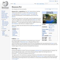
The pool itself is about 16 m (52 ft) wide. It was first explored by divers in 1971 to a depth of 6 m. It was later explored by Martyn Farr among others to a depth of 9.5 m from where the water emerges from a 2 m wide fissure.[1] In early 2009 the pot was dived to a depth of 14.6 m by Artur Kozłowski, who entered an unstable chamber.[2] Towns and villages near the Shannon Pot include Dowra, Blacklion and Glangevlin. Folklore[edit] Ireland. Ireland (locally: /ˈɑːrlənd/; RP: /ˈaɪələnd/; GA: i/ˈaɪərlənd/; Irish: Éire [ˈeːɾʲə] ( Politically, Ireland is divided between the Republic of Ireland, which covers five-sixths of the island, and Northern Ireland, a part of the United Kingdom, which covers the remaining area and is located in the north-east of the island.
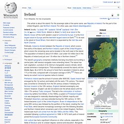
The population of Ireland is about 6.4 million. Just under 4.6 million live in the Republic of Ireland and just over 1.8 million live in Northern Ireland.[7] The island's geography comprises relatively low-lying mountains surrounding a central plain, with several navigable rivers extending inland. Gaelic Ireland. Gaelic Ireland was a Gaelic political and social order that existed in Ireland from sometime in prehistoric era until the early 17th century.
Before the Norman invasion of 1169, Gaelic Ireland comprised the whole island. Thereafter, it comprised that part of the country not under English or at least foreign dominion at a given time. For most of its history, Ireland was a 'patchwork'[1] hierarchy of territories ruled by a hierarchy of kings or chiefs, who were elected by a system known as tanistry. Warfare between these territories was common. Land War. Background[edit] In February 1870 the Land Conference, at a public sitting, passed resolutions condemning "capricious evictions" and demanding "permanent fixture of the tenant in the soil"eviction only on non-payment of rentright of sale of interest by the tenantthe establishment of local land tribunals and the valuation of rent.[1] At this point, most Irish tenant farmers outside Ulster had few rights at law.
Bealadangan. Béal an Daingin or Béal a' Daingin (anglicized as Bealadangan) is a small Gaeltacht[1] village in the heart of Connemara (Conamara), County Galway, Ireland.
The main language is Irish, and all but a few of the elderly population also speak English. There is a pub, a post office and an elementary school (Toureen) a couple of miles from the village. This area is rich in tradition. Many of the residents continue to cut turf (peat) for use in heating their homes during the long winter months. Sean Nós singing is still performed locally, and is rarely heard outside the area. Bannow. Bannow (Irish: Banú) is a civil parish lying east of Bannow Bay on the south-west coast of County Wexford in Republic of Ireland.
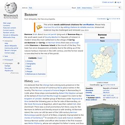
In modern times the main settlement is the village of Carrig-on-Bannow (or Carrig). In Norman times there was a borough called Bannow on Bannow Island at the mouth of the Bay. This town has since disappeared, probably due to the silting up of the natural harbour channels in the 14th century, and the former island is now attached to the rest of the parish. History[edit] Plaque near former Bannow Island, recalling the location where the Normans first landed in Ireland, in 1169.
Ballyduff, County Kerry. Ballyduff (Irish: An Baile Dubh, meaning "black village") is a village near Listowel, County Kerry, Ireland.
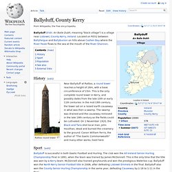
Located on R551 between Ballyheigue and Ballybunion on hills above Cashen Bay where the River Feale flows to the sea at the mouth of the River Shannon. History[edit] Rattoo round tower Near Ballyduff at Rattoo, a round tower reaches a height of 28m, with a base circumference of 15m. This is the only complete round tower in Kerry, and possibly dates from the late 10th or early 11th centuries. Ballyhaise. Ballyhaise Roman Catholic church Ballyhaise (Irish: Béal Átha hÉis, meaning "Entrance to the Ford of the Rapid water") is a village in County Cavan, Ireland. It is situated some 7 km (4.3 mi) north-northeast of Cavan Town. It is approximately a 15 minute drive or 11km via the N54 to the border with Northern Ireland.
Ballysadare. Ballysadare (Irish: Baile Easa Dara, meaning "settlement of the cascades of the oak") is a village about 7 kilometres (4 miles) south of Sligo town Centre. The town developed on an important crossing of the Owenmore (Irish: Abhainn Mór, meaning "Great River"), River. Location[edit] Alternative names for the falls are Ess Mac Modairn (The Falls of the son of Modairn) and Ess na n-Éan (The Falls of the Bird).
Fisheries Early History[edit] Ballysadare is a possible location for the town noted as Nagnata on Claudius Ptolemy's 2nd century CE co-ordinate map of the world.[1]Ballysadare was anciently a major gathering place for all surrounding districts. St. Ballymakeera. Ballymakeera or Ballymakeery (Irish: Baile Mhic Íre,Irish pronunciation: [ˈbˠalʲə vʲikʲ ˈiːrʲə] )[1] is a small Gaeltacht village in the valley of the River Sullane in County Cork, Ireland. It is on the N22 national primary road and forms part of the twin villages of Ballymakeery and Ballyvourney. It is within the Muskerry Gaeltacht. Three Ogham stones are nearby with the somewhat later addition of a Christian shrine to St Abán.[2] References[edit] See also[edit]
Aughrim, County Wicklow. Aughrim (/ˈɔːkrɪm/; Irish: Eachroim, meaning "horse ridge") is a small town in County Wicklow, Ireland. It lies in a scenic valley in the east of Ireland where the Ow and Derry rivers meet to form the Aughrim river. Aughrim is on the R747 regional road which runs between Arklow and Baltinglass. Jamestown, County Leitrim. Jenkinstown Park. Jenkinstown Castle, c. 1830. Aughrim, County Galway. Ardara. Brandon, County Kerry. Bansha. Jenkinstown, County Louth. Johnstown, County Kildare. Johnstown, County Kilkenny. Johnstown, County Kilkenny. Johnstown, Navan. Johnstown Bridge. Johnstown Bridge. Julianstown. Anglesboro. Annestown. Annacotty. Annagassan. Annagry. Annamoe. Aghada. Annascaul. Aghamore. Annyalla. Agher. Aglish. Ahakista. Annacurra. Allen, County Kildare. Allenwood. Ahiohill. Ahascragh. Aherla. Ardagh, County Longford. Allihies. Glangevlin. Dingle. County Cavan. Blacklion. Aghabullogue. Aghada.