
OSM Buildings. Leaflet | © OpenStreetMap contributors, Map tiles © MapBox, © OSM Buildings.
GIM201203_feature_goetz.pdf. OpenStreetMap and Indoor Maps [Part 2/2]: The mapping proposal for OpenIndoorMaps [by Marcus Götz] Following our first post on the challenges and opportunities of an indoor-extended OpenStreetMap, we now wish to concentrate on the specifics and provide a proposal for “OpenIndoorMaps”.
![OpenStreetMap and Indoor Maps [Part 2/2]: The mapping proposal for OpenIndoorMaps [by Marcus Götz]](http://cdn.pearltrees.com/s/pic/th/openstreetmap-openindoormaps-82020235)
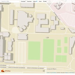
Before doing this, we provide some use-case scenarios that our proposal addresses. Use-Case scenarios for OpenIndoorMaps There are many possibilities or use-case scenarios for indoor maps or services such as routing or navigation. Imagine being a businessman at the airport: after entering the entrance hall you first want to go to the check-in counter and then to a nearby newspaper shop before searching for the lounge and then finally going to the gate. Normally you have to do this “navigation” by yourself, which can be quite a challenging task (especially in huge airports such as Chicago or Beijing). Another example is the following: you are visiting a huge shopping mall. As you can see, there are many meaningful examples of why indoor information is so important.
The indoorOSM model proposal. IndoorOSM - Mapping the Indoor World. IndoorOSM. IndoorOSM is a proposed tagging schema for Indoor Mapping (One of several possible schemes.
See Indoor Mapping#Tagging proposals for a list of other possibilities) You might be looking for IndoorOSM on Android. Intention of this project Currently, most maps (not only online maps but also mobile maps on smartphones) focus on outdoor environments, although most of our time, we spent indoors. Additionally, new (high rise) buildings are constructed and their internal structure gets more and more complex, thus it is likely that (especially foreign) people get lost inside such places.
As many others, we (GIScience UniHD) discovered, that there is an increasing interest inside OSM for building mapping activities (currently there are nearly as much buildings as streets). Of course we want to involve you all (the OSM community) in this model development process and are looking forward to your comments and ideas. Summary To sum up, these are the main characteristics of the model: Use Cases <? <? <? ). ). Challenges for Indoor Maps. This page lists some of the challenges for adding indoor maps and Indoor Mapping in OpenStreetMap, beyond the technical challenge of making the maps themselves.
Handling of New Data by Existing Software The OpenStreetMap database is flexible enough to handle indoor data in any of numerous possible formats. However if a large amount of indoor data is added to the databases the may end up having undesirable consequences for existing renderers. This can be seen on existing indoor maps. Some objects from the indoor maps are rendered on different renderers, such as objects with a name or walkways. There are also some challenges for the editors. The most likely way to handle this is to have a well agreed upon form of the data and make an effort to accommodate this format in the renderers. Stores in a Shopping Center and other Entities on the Map OpenStreetMap has no means of handling business listings. Could you please add some arguments to your conclusions presented?
Legal Challenges. Termite. NOTE: The development of Termite is currently on hold.
The existing Termite editor uses a map model different from the currently preferred IndoorOSM. If you are interested in making indoor maps please see IndoorOSM on the wiki. Termite is a project to make an OpenStreetMap editor for indoor mapping. "Termite" is the name of editor software under design here (not implemented yet) The editor is intended to be easy to use so that non-technically inclined people can easily make indoor maps. A user will have a simple means of selecting a level within a structure on which to work, and then be able to work solely with data for that level. Indoor Map Philosophy Indoor maps are not new and are very common, such as on the store directory at a shopping center. The following diagrams area a representative indoor map from a university building, the Yang and Yamazaki Building from Stanford University. Zlevel Each level is assigned an integer that we will refer to here as zlevel.