
Mysterious Antarctic Circle on Google Earth : Hollow Earth??? Petroglyphs, Pictographs, Cave Paintings, Geoglyphs. Petroglyphs Petroglyphs (also called rock engravings) are pictogram and logogram images created by removing part of a rock surface by incising, picking, carving, and abrading.

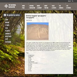
Outside North America, scholars often use terms such as "carving", "engraving", or other descriptions of the technique to refer to such images. Petroglyphs are found world-wide, and are often associated with prehistoric peoples. The word comes from the Greek words pert meaning stone, and glyphic meaning to carve, and was originally coined in French as petroglyphe. The term petroglyph should not be confused with pictograph, which is an image drawn or painted on a rock face. Creation Most Petroglyphs, Pictographs, Cave Paintings, and Geoglyphs tell the story of creation using the same iconographic motifs no matter where they are fund on the planet. Consciousness Hologram Explaining Reality Petroglyphs - Rock Art Petroglyphs are images incised in rock, usually by prehistoric, especially Neolithic, peoples. North America. Geoglyphs – The Natural Navigator. Last night I caught a few minutes of a programme on BBC4, called 'Unnatural Histories.'As so often seems to be the case, a short stroll from the mainstream channels uncovered rough diamonds.In the programme, an aerial shot showed us clearly visible patterns in the earth, patterns that were partly concealed at ground level by dense undergrowth.

The narrator explained that we were looking at 'geoglyphs' in the Amazon rainforest. Geoglyphs are shapes that have been deliberately formed in the land by the hand of man.Like many pilots, I have come to love the way it is possible in the air… Lines and Geoglyphs of Nasca and Pampas de Jumana. Nazca Lines. Coordinates: The Nazca Lines /ˈnæzkə/ are a series of ancient geoglyphs located in the Nazca Desert in southern Peru.

They were designated as a UNESCO World Heritage Site in 1994. The high, arid plateau stretches more than 80 km (50 mi) between the towns of Nazca and Palpa on the Pampas de Jumana about 400 km south of Lima. Although some local geoglyphs resemble Paracas motifs, scholars believe the Nazca Lines were created by the Nazca culture between 400 and 650 AD.[1] The hundreds of individual figures range in complexity from simple lines to stylized hummingbirds, spiders, monkeys, fish, sharks, orcas, and lizards.
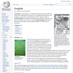
The designs are shallow lines made in the ground by removing the reddish pebbles and uncovering the whitish/grayish ground beneath. Due to the dry, windless, and stable climate of the plateau and its isolation, for the most part, the lines have been preserved. History[edit] Determining how they were made has been easier than figuring why they were made. Purpose[edit] Geoglyph. The geoglyph of Cuzco, map E.G.

Squier, c. 1860. The fortification Sacsahuman (north of the town) represents the head of an animal (El Puma Yacente, puma lying down), the back, legs and tail of the animal are recognisable in the patterns of the town, the backshape follows a mountain river, the feet are standing on the shore of the river Sapi Ancient[edit] Geoglyphs on deforested land in the Amazon rainforest. The most famous geoglyphs are the Nazca Lines in Peru. Contemporary[edit] Bunjil geoglyph at the You Yangs, Lara, Australia, by Andrew Rogers. In 2008–2009 Alfie Dennen created Britglyph, a locative art focused Geoglyph created by having participants across the United Kingdom leave rocks at highly specific locations and uploading media created at each location.
See also[edit] References[edit] External links[edit]