
Free Newspapers Templates - Print and Digital. Výukové materiály - ARCDATA PRAHA. Úvod > Oborová řešení > GIS v oborech > Vzdělávání > Základní a střední školství > Výukové materiály Usnadněte si výuku GIS pomocí připravených materiálů.
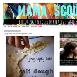
Vyzkoušet můžete ukázkové lekce pro ArcGIS for Desktop v různých úrovních nebo se seznamte s tvorbou interaktivních map na ArcGIS Online. Start-of-the-Year Videos. Storytelling with Maps. {geography lab} salt dough land forms. Are you good at geography?
I never understood geography until I was an adult. I think for many kids, geography is too abstract and seems meaningless. I discovered that I learn places on a map from experience, either traveling or through really amazing stories. The notion of memorizing capitals and countries without a tether to something real is about as alluring to me as cleaning the bathroom. Learning metro and train systems, driving through states, or pouring over maps of the places I read about is how I have come to understand the world and its physicality.
To that end, my kids recently did a project that would be amazing for anyone learning about a specific place. 1. 2. Sight Word Road Map Game. First, we made houses and buildings for our "town".
After they decorated them, I wrote different numbers that I wanted my daughter to practice on them. Then, I used masking tape to make the roads and I wrote different sight words for the street names. We set up the houses on the streets and then started our delivery business. I would tell my daughter which house number on what street needed a delivery with her little toy car. For example, "Go to house #13 on See Street. Clay Model Of the Earth’s Layers. 13 Apr 2013 Making a 3D model is an easy hands-on way for kids to learn what the Earth is made of. We read about the Earth’s layers, to begin with, in The Magic Schoolbus – Inside the Earth . Then we grabbed some clay and the children used the pictures from the book to make their own models. (I was going to make one too, until I realised how much plasticine we were going to get through!) First roll a small ball of clay for the solid metal inner core . The inner core is about 1,500 miles in diameter. Next the melted metal outer core .
Then the solid rock mantle . Followed by the Earth’s crust (one layer in our models, but in reality, layers of sedimentary, metamorphic and igneous rock). And finally, the oceans and continents. When you’re done, use a sharp knife to cut your Earth in half to reveal it in cross-section. Infographic: Tallest Mountain to Deepest Ocean Trench. Mural.ly - Google Docs for Visual People.
Private Tutors, Personal Tutors, Home Tutors, Tutors UK, Tutors advertising. Here's the latest in our series of top educational resources.
This time we’ve compiled a list of our top 20 geography blogs, websites and resources, most of which are based in the UK and aimed at high school students studying GCSE and A level geography. Geobytes Created by St Ivo School’s geography department, this blog has a wealth of resources for students studying geography at all levels and is updated regularly. Geog Debens A GCSE Geography support blog for students of Ms Debens. David Roger's Geography Blog Award winning geography teacher David Roger’s blog following developments in Geography teaching. The Geography Collective A collective of Guerrilla Geography activists, teachers, therapists, academics and artists who have come together to encourage (young) people to see and think about the world in new ways. 25 Creaitvely simple Ideas for teaching geography. O mestách. Atlas historique.
Site Map. Scribble Maps - Create custom google maps with scribblings and more! Digimap for Schools. Spotzi, spot, zoom in and explore. Free Puzzlemaker. Time Zone Map. DST – Click red dot for more info Legend: How to use the interactive Time Zone Map Search for any city in the search field above and place a black "pin" by that city on the map.
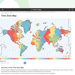
If you place more than one pin, an extra line of information is added underneath the map with links to those cities' pages. You may add as many pins as you like. To remove the pins permanently (undo not possible), simply click here or on the Time Zone Map link in the menu above.Hover your mouse over any of the red dots to see the name of the city and country and current local time. More about the Time Zone Map. Google Earth Placemarks. Smithsonian Global Volcanism Program data for known or inferred Holocene volcanoes are now available as a Google Earth layer, displaying a photo (when available), geographic data, and links to more detailed information from the GVP and international volcano observatories or other websites focusing on regional volcanoes.
The Google Earth software must be downloaded and installed to use this placemark file. Download Holocene Volcanoes Network Link Download Smithsonian / USGS Weekly Volcanic Activity Report Network Link Users may note location differences between plotted volcano locations and the summits of volcanoes on the satellite imagery forming the base layer for Google Earth. This can occur for several reasons. A more fundamental problem originates from the fact that regional topographic mapping does not utilize a standardized global datum, or a surface defined as "zero elevation" with respect to local gravity fields.