
Specification. 1.
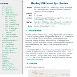
Introduction GeoJSON is a format for encoding a variety of geographic data structures. A GeoJSON object may represent a geometry, a feature, or a collection of features. GeoJSON supports the following geometry types: Point, LineString, Polygon, MultiPoint, MultiLineString, MultiPolygon, and GeometryCollection. Features in GeoJSON contain a geometry object and additional properties, and a feature collection represents a list of features. A complete GeoJSON data structure is always an object (in JSON terms). 1.1. A GeoJSON feature collection: 1.2. JavaScript Object Notation (JSON), and the terms object, name, value, array, and number, are defined in IETF RFC 4627.The key words "MUST", "MUST NOT", "REQUIRED", "SHALL", "SHALL NOT", "SHOULD", "SHOULD NOT", "RECOMMENDED", "MAY", and "OPTIONAL" in this document are to be interpreted as described in IETF RFC 2119. 2. GeoJSON always consists of a single object. 2.1 Geometry Objects 2.1.1.
A position is the fundamental geometry construct. 2.1.2. GeoJSON. GeoJSON[1] is an open standard format for encoding collections of simple geographical features along with their non-spatial attributes using JavaScript Object Notation.
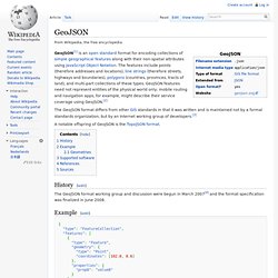
The features include points (therefore addresses and locations), line strings (therefore streets, highways and boundaries), polygons (countries, provinces, tracts of land), and multi-part collections of these types. GeoJSON features need not represent entities of the physical world only; mobile routing and navigation apps, for example, might describe their service coverage using GeoJSON.[2] The GeoJSON format differs from other GIS standards in that it was written and is maintained not by a formal standards organization, but by an Internet working group of developers.[3] A notable offspring of GeoJSON is the TopoJSON format.
History[edit] The GeoJSON format working group and discussion were begun in March 2007[4] and the format specification was finalized in June 2008. Example[edit] Geometries[edit] Supported software[edit] Pro spatial with sql server 2012. Home · mbostock/topojson Wiki. Specification. Expertise québécoise - Gouvernement - Télédétection. Principales caractéristiques Le modèle de développement ouvert, autonome et technologiquement indépendant au ministère de la Sécurité publique (MSP) lui permet de s’appuyer sur les toutes dernières innovations en géomatique, à savoir : les données multisources et la géocollaboration; les logiciels libres et gratuits; les services Web; les services de cartes de base tuilées; les interfaces intuitives; le Web 2.0; les serveurs autonomes.
L’équipe de géomatique du MSP offre des services dans les cas : de mesures d’urgence (ex. : centres d’appels d’urgence 9-1-1, sécurité civile); de prévention des risques (ex. : érosion des berges); de sécurité incendie; d’affaires policières; de sécurité de l’État. Environnement technologique Services électroniques disponibles Applications Avantages Les avantages de l’utilisation de standards reconnus et de la technologie ouverte pour les utilisateurs de la sécurité publique sont nombreux. Renseignements. Well-known text. Well-known text (WKT) is a text markup language for representing vector geometry objects on a map, spatial reference systems of spatial objects and transformations between spatial reference systems.
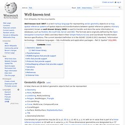
A binary equivalent, known as well-known binary (WKB) is used to transfer and store the same information on databases, such as PostGIS, Microsoft SQL Server and DB2. The formats were originally defined by the Open Geospatial Consortium (OGC) and described in their Simple Feature Access and Coordinate Transformation Service specifications. The current standard definition is in the ISO/IEC 13249-3:2011 standard, "Information technology -- Database languages -- SQL multimedia and application packages -- Part 3: Spatial" (SQL/MM).
Geometric objects[edit] In total, there are 18 distinct geometric objects that can be represented: Coordinates for geometries may be 2D (x, y), 3D (x, y, z), 4D (x, y, z, m) with an m value that is part of a linear referencing system or 2D with an m value (x, y, m). JSON. CPTAQ : Cartographie - Géomatique. Consulter l'application Déméter (cartographie numérique) Cet outil permet de consulter la cartographie numérique de la zone agricole comprenant les inclusions, les exclusions et les décisions(sauf les demandes à portée collective (art.59)).
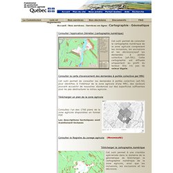
Cette cartographie est diffusée uniquement au profit du lecteur. Elle n'a pas de valeur légale. Consulter la carte d'avancement des demandes à portée collective par MRC Cet outil permet de consulter les demandes à portée collective (art.59) pour identifier, à l'intérieur de la zone agricole d'une MRC, des secteurs pouvant accueillir de nouvelles résidences sur des superficies suffisantes pour ne pas déstructurer le milieu agricole. Télécharger un plan de la zone agricole Consultez l'un des 1700 plans de la zone agricole disponibles en format PDF. Les descriptions techniques sont maintenant incluses Consulter le Registre du zonage agricole (Nouveauté)