
10 Best Photogrammetry Software For 3D Mapping Using Drones. When it comes to 3D photogrammetry software for drones, there is quite a choice.
There are many 3D mapping software companies, which provide a free version or free evaluation period, allowing you to try the software first before any purchase. You can then compare the various photogrammetry software packages. Below, we review with videos, the best photogrammetry software for creating 3D maps and models on the market. To go with 3D mapping software, there are many providers putting together full aerial mapping solutions, which include the drone, mapping software and even training. There are other options to rent professional 3D mapping services, if you feel there is no need to own a drone.
Many photogrammetry software companies, also provide hosting in the cloud or data warehousing of your 3D maps and models. The building of 3D maps from images require a lot of computer processing power and can take ages on an ordinary computer. Ok, lets take a look at our 3D mapping solutions on the market. Introduction To UAV Photogrammetry And Lidar Mapping Basics. UAV lidar and photogrammetry imaging applications are increasing rapidly.
This is not surprising as using GPS enabled UAVs for aerial surveying is very cost effective in comparison to hiring an aircraft with photogrammetry equipment. Because UAVs are relatively inexpensive, many organisations will have their own UAV fleet, allowing for rapid surveys over large land areas and infrastructure projects where required. With GPS equipped drones, digital cameras and powerful computers, surveys have an accuracy right down to 1 centimeter. Agisoft PhotoScan. Pix4d. Drone Mapping Software, Image Processing and Geospatial - DroneMapper. Post Processing. Aerial image stitching - any good software suggestions. Powerful Drone & UAV Mapping Software. Drone Mapping Software - OpenDroneMap. Md4-1000: Robust and powerful – UAV / drone model from Microdrones. Helping Individuals and Businesses Navigate Drone Law.
Brochure mdSOLUTIONS EN. Applications – Phoenix LiDAR Systems. MdLiDAR3000. US Law, Case Law, Codes, Statutes & Regulations. How Easy Is It To Hijack A Drone? Think drones are scary?

Then you might not like the notion of hackable $35,000 police drones flying in your airspace. Drone Surveying Solutions for Surveyors & Consultants. Ground Control Points for Drone Survey & Mapping. GPS Accessories. Flycraft SUP - FLYCRAFT USA. The SUP Gear Tower was designed to keep your rod and paddle easily accessible, yet out of the way. Going from rod to paddle has never been faster. The tower also integrates with our anchor system, providing easy access to the anchor controls. After hauling the anchor in slip the rope into our anchor bag for easy out of the way operation.
Sold out$395.00. Esri unveils Drone2Map for ArcGIS desktop app : Geospatial Solutions. Image credit: Esri Esri recently released Drone2Map for ArcGIS, its new desktop app that turns raw still imagery from drones into professional 2D and 3D imagery.
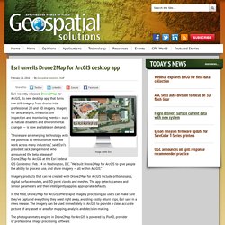
Imagery for land analysis, infrastructure inspection and monitoring events — such as natural disasters and environmental changes — is now available on demand. “Drones are an emerging technology with the potential to revolutionize how we work across many industries,” said Esri’s president Jack Dangermond, who announced the beta release of Drone2Map for ArcGIS at the Esri Federal GIS Conference Feb. 24 in Washington, D.C. “We built Drone2Map for ArcGIS to give people the ability to process, use, and share imagery — all within ArcGIS.” eCFR — Code of Federal Regulations. Electronic Code of Federal Regulations Title 14: Aeronautics and Space Contents Subpart A—General §107.1 Applicability.§107.3 Definitions.§107.5 Falsification, reproduction or alteration.§107.7 Inspection, testing, and demonstration of compliance.§107.9 Accident reporting.

Subpart B—Operating Rules. National Oceanic and Atmospheric Administration. Comparing Pilot Types. FEDERAL AVIATION ADMINISTRATION, DEPARTMENT OF TRANSPORTATION. (i) Operations on unpublished routes and use of radar in instrument approach procedures.
When radar is approved at certain locations for ATC purposes, it may be used not only for surveillance and precision radar approaches, as applicable, but also may be used in conjunction with instrument approach procedures predicated on other types of radio navigational aids. Radar vectors may be authorized to provide course guidance through the segments of an approach to the final course or fix. When operating on an unpublished route or while being radar vectored, the pilot, when an approach clearance is received, shall, in addition to complying with §91.177, maintain the last altitude assigned to that pilot until the aircraft is established on a segment of a published route or instrument approach procedure unless a different altitude is assigned by ATC.
(j) Limitation on procedure turns. FAA Flight Planning Information. The purpose of this site is to provide FAA flight plan guidance for both domestic and international filers.

Information and documentation contained within this site support existing FAA, ICAO, and Flight Services agreements and procedures. Should you have filing questions, you can email us at 9-AJE-FlightPlanQuestions@faa.gov. Topics on this page: Flight Plan Filing Updates. Aeronautical Data and Products. Federal Aviation Administration - Graphic TFR's. Amazon. FAA Form 7233 1 7 31 17. System Wide Information Management (SWIM) Pilot handbook. United States – Basic Flight Information and Air Traffic Control Procedures. The FAA publishes the Aeronautical Information Manual (AIM) which provides basic flight information and air traffic control (ATC) procedures for use in the National Airspace System (NAS); and an international version, the Aeronautical Information Publication (AIP), which contains parallel information to the AIM.

For ease of search, certain sections of the AIM and AIP are highlighted throughout this website. The AIM and AIP, in their entirety, are located via the following links: National Security and Requirements for Civil and Foreign State Aircraft Operations in United States Territorial Airspace Comprehensive requirements for civil and foreign state aircraft operations to or from, within, or transiting United States territorial airspace, are located in the National Security sections of the FAA's Aeronautical Information Manual (AIM) and Aeronautical Information Publication (AIP). Aviation Handbooks & Manuals. Acheter Smarter Farming Package - DJI Store. Trimble Stratus: Drone Analytics Platform for Aggregates and Construction.
Propeller PPK Solution How Accurate is it Whitepaper. Aim. Routescene - beyond the point... 3D mapping solutions for use on drones. FAA Part 107 Drone Exam Practice Tests - Page 1. The 3DR Suite Everything you need to start capturing accurate aerial data on your projects.
Site Scan Platform The complete drone software solution for AEC professionals. Lost oblit. FAA Study Guides. The Small Unmanned Aircraft Knowledge Test is a solid step over a DMV test, it’s unlikely you could show up unprepared and pass without prior aviation knowledge.

While many of the answers are simple common sense, passing the test will require some studying. To help you with this, we’ve compiled here a list of official study resources. VFR Raster Charts. The Federal Aviation Administration (FAA) digital-Visual Chart series is designed to meet the needs of users who require georeferenced raster images of FAA Visual Flight Rules (VFR) charts.
An Aeronautical Raster Chart is a digital image of an FAA VFR Chart. All information that is part of the paper chart is included in the file. The area inside the neat line is georeferenced to the surface of the earth. Only the main body of the chart is accurately georeferenced. Each digital-Visual Chart is provided in one TIF file. Flight Service. General Aviation's largest, most influential association in the world - AOPA. Aerial Surveying with a Drone and Photogrammetry vs LiDAR - Commercial UAV News. Aeronautical Information Services - AJV-5. Aeronautical Information Services is the FAA's civil aviation authority providing the foundations for flight in the national airspace system. Aeronautical Information Services Is the authoritative government source for collecting, validating, storing, maintaining, and disseminating aeronautical data for the U. 5 Problem Areas For Commercial Enterprise Drone Fleet Operations.
This article is written based on my experience interacting with small to multiple billion dollar companies. This article is designed to ask questions which will be the starting point for discussions which need to happen internally in a company. If you are a company wanting to continue the discussion further, contact me. A. Internal Operations Within the Company Between the Different Departments How does the drone department fit into the immediate company? Kimley-Horn. FAA Part 107 Waiver (COW)– What Drone Pilots Need to Know (2018) The FAA understands that not everything will fall neatly into the set of the FAA Part 107 regulations. Sometimes things fall outside of the “box,” but still need to be made safe and legal. The FAA builds into the regulations what is called “regulatory flexibility” which can be understood as legal “wiggle room.” There are multiple ways that regulatory flexibility can happen in the regulations: waivers, authorizations, deviations, and exemptions.
If the particular regulation you are interested in cannot be resolved by waiver, authorization, or deviation, then the exemption process is all that is left. (Updated 2018) Practice Part 107 Test Questions for the Remote Pilot Knowledge Test. These practice Part 107 test questions are designed to be very hard. Free Part 107 Test Study Guide For FAA Remote Pilot Airmen Certificate (Updated 2018) Navigation2. Part 107 Exam Archives - RotorDrone. Unmanned Aircraft Systems. Safety is the FAA's top mission, and the agency maintains the world's safest aviation system. The FAA first authorized use of unmanned aircraft in the National Airspace System (NAS) in 1990. Today, unmanned aircraft are flying in the NAS under very controlled conditions, performing border and port surveillance by the Department of Homeland Security, helping with scientific research and environmental monitoring by NASA and NOAA, supporting public safety by law enforcement agencies, helping state universities conduct research, and supporting various other missions for public (government) entities.
Operations range from ground level to above 50,000 feet, depending on the specific type of aircraft. However, UAS operations are currently not authorized in Class B airspace (PDF), which exists over major urban areas and contains the highest density of manned aircraft in the National Airspace System. DroneZone. Untitled. Part 107 Test Questions (41 Sample Questions Explained) This article will discuss the 41 Part 107 test questions the FAA released. The 41 sample Part 107 knowledge test questions based upon my knowledge as a practicing aviation attorney and current FAA certificated flight instructor. How to Read a Pilot’s Map of the Sky. SkyVector: Flight Planning / Aeronautical Charts. Airplanes and Aircraft for Sale. Homepage - Wings of Wyoming Flight School. Pilot's Handbook of Aeronautical Knowledge, FAA Federal Aviation Administration, eBook - Amazon.com.
Amazon. FNL - Northern Colorado Regional Airport. 3DR Site Scan: The Complete Commercial Drone Platform.