
ATRIUM. Dutch Profiles: Rem Koolhaas OMA. Le Corbusier - Documentary - Part 1. The City - American Institute of City Planners, 1939. La ville radieuse, Le Corbusier. Constant Nieuwenhuys. Gemeentemuseum Den Haag. In maquettes, tekeningen, films, grafiek en manifesten verbeeldt hij zijn ideeën over een moderne en vooruitstrevende samenleving.

Dankzij aankopen in de jaren zeventig en belangrijke schenkingen van de kunstenaar, beheert het Gemeentemuseum Den Haag de grootste collectie werken van New Babylon ter wereld. Utopie In de jaren vijftig van de twintigste eeuw verandert de maatschappij aanzienlijk. Fabrieken automatiseren veel van hun processen en de welvaart neemt langzaam toe. Het auto- en vliegverkeer groeit waardoor mensen zich steeds gemakkelijker, sneller en verder kunnen verplaatsen. New Babylon Met zijn utopische New Babylon creëert hij een ideale wereldwijde stad van de toekomst waarin dynamiek centraal staat en waar ‘verticaal’ geleefd wordt.
Homo Ludens Constant gaat met New Babylon uit van een alternatieve, volledig geautomatiseerde maatschappij, waarin arbeid overbodig is geworden. Home. Étienne-Louis Boullée. Boullee. The Open Utopia. E. HOWARD, GARDEN CITIES OF TO-MORROW. The International Garden Cities Exhibition. AD Classics: Ville Radieuse / Le Corbusier. Ville Radieuse (The Radiant City) is an unrealized urban masterplan by Le Corbusier, first presented in 1924 and published in a book of the same name in 1933.
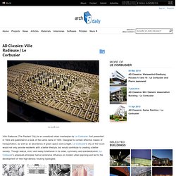
Designed to contain effective means of transportation, as well as an abundance of green space and sunlight, Le Corbusier’s city of the future would not only provide residents with a better lifestyle, but would contribute to creating a better society. Though radical, strict and nearly totalitarian in its order, symmetry and standardization, Le Corbusier’s proposed principles had an extensive influence on modern urban planning and led to the development of new high-density housing typologies. In accordance with modernist ideals of progress (which encouraged the annihilation of tradition), The Radiant City was to emerge from a tabula rasa: it was to be built on nothing less than the grounds of demolished vernacular European cities. The housing districts would contain pre-fabricated apartment buildings, known as “Unités.” Mapping Medieval Townscapes: Introduction. Keith Lilley, Chris Lloyd and Steve Trick, 2005Queen's University Belfast Introduction This resource derives from the Mapping the medieval urban landscape research project which began in 2003 with two years funding from the Arts and Humanities Research Council.

Using mapping as a medium, the project examined how urban landscapes were shaped in the middle ages, the project furthers an understanding of the forms and formation of medieval towns. It is the first project to have used spatial technologies – Geographical Information Systems (GIS) and Global Positioning Systems (GPS) – as a basis for mapping and analysing medieval urban landscapes. The project team was Dr Keith Lilley (director), Dr Chris Lloyd (co-director), and Dr Steven Trick (researcher) and the research was conducted at Queen’s University Belfast. The project focused on a group of ‘new towns’ situated in Wales and England and established in the reign of King Edward I. [top] Accueil - Ville Radieuse. Après la série ininterrompue des voyages d'Europe, Russie et Amérique du Sud, le sentiment des grands classements urbains et régionaux était apparu.

Etaient apparues également diverses solutions caractéristiques apportées par les techniques modernes et dictées par la topographie ou l'insolation (premières idées d'urbanisation de Buenos Aires, Monte-vidéo, Sao Paulo, Rio de Janeiro, Alger, Barcelone, Stockholm, Anvers, etc.). - Au cours des années, les éléments précis d'une doctrine d'urbanisme moderne surgirent l'un après l'autre. Aujourd'hui une véritable doctrine d'urbanisme peut être proposée à l'opinion ou à l'autorité pour répondre à la gigantesque réforme nécessaire en toutes villes et tous continents. La planche VR8 montre le contraste saisissant entre les espaces nouvellement acquis dans les quartiers d'habitation de VR (Ville Radieuse) et l'étroitesse atroce de nos villes actuelles (ici Paris, New York, Buenos Aires).
La thèse est connue : Surface bâtie: 12% du sol total.