

Accurate and Detailed Image-Based 3D Documentation of Large Sites and Complex Objects (Digital Imaging) Part 1. Introduction The environment and its heritage sites or objects suffer from wars, natural disasters, weather changes, and human negligence.
According to UNESCO [1], “a heritage can be seen as an arch between what we inherit and what we leave behind … Heritage is our legacy from the past, what we live with today and what we pass on to future generations.” Thus the importance of cultural heritage documentation is well recognized and there is an increasing pressure to document and preserve them also digitally. Therefore 3D data become a critical component to permanently record the shapes of important objects so that they might be passed down to future generations. The continuous development of new sensors, data capture methodologies, and multi-resolution 3D representations and the improvement of existing ones are contributing significantly to the documentation, conservation, and presentation of heritage information and to the growth of research in the cultural heritage field. PhotoScan – Basic Processing for Photogrammetry. This series will show you how to create 3d models from photographs using Agisoft Photoscan and Esri ArcGIS.
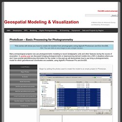
Hint: You can click on any image to see a larger version. Many archaeological projects now use photogrammetric modeling to record stratigraphic units and other features during the course of excavation. In another post we discussed bringing photogrammetric or laserscanning derived models into a GIS in situations where you don’t have precise georeferencing information for the model. In this post we will demonstrate how to use bring a photogrammetric model for which georeferenced coordinates are available, using Agisoft’s Photoscan Pro and ArcGIS. Load Photos Begin by adding the photos used to create the model to an empty project in Photoscan. Align Photos Following the Photoscan Workflow, next align the images.
A choice At this point there are two approaches to adding the georeferenced points to the project. Build Geometry Under ‘Workflow’ in the main menu, select ‘Build Geometry’. 3D Prehistoric Pictograph Printing. A tutorial on hard copy printing of virtual models using 3DS Max and Shapeways There are now several rapid prototyping/3D printing services available for creating hard copy models of virtual creations.
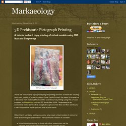
Here, I walk through the steps for preparing a Structure from Motion (SfM) model for color/textured printing using the services provided by Shapeways.com and 3D Studio Max 2009. Shapeways is an economical online service that accepts the upload of 3D files and then sends you a hard copy of that model you can hold in your hands. Other than it just being plainly awesome, why create virtual models of rock art or other archaeological phenomena?
Here are some reasons to consider: Virtual models are easy to share with other researchers via the Internet. Follow along with this tutorial on Youtube.. I start with the 3D model in Alias Wavefront OBJ format. To print the model in color a JPG, or similar texture map, is required. Next, the 3D model needs to be scaled to the size it will be printed at. Sketchfab. How to set up a successful photogrammetry project - Sketchfab Blog. Sketchfab Ambassador Abby Crawford is the owner of Archaeological Graphics.
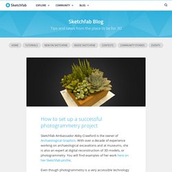
With over a decade of experience working on archaeological excavations and at museums, she is also an expert at digital reconstruction of 3D models, or photogrammetry. You will find examples of her work here on her Sketchfab profile. Even though photogrammetry is a very accessible technology these days, getting great results requires good preparation. Today, Abby teaches us how to plan your project in her Photogrammetry Photography Primer. Introduction Photogrammetry is the art and science of using overlapping photographs to reconstruct three dimensional scenes or objects. In this article we will cover the basics of photography as they pertain to capturing photos for photogrammetry.
Equipment. Converting a video to georeferenced 3D model tutorial (Agisoft PhotoScan, Sputnik GIS) 05 february 2016 Introduction Nowadays, amateur Unmanned Aerial Vehicles (UAV, drones) have an amazing range of applications.
You may wonder: “Can I use my drone for photogrammetry?” And the answer is “Yes”. In this tutorial, you will create a georeferenced and measurable 3D model, using YouTube video captured by DJI Inspire 1. First, a few words about the software required to complete the tutorial: Sputnik GIS allows to measure distances and heights, calculate cut and fill volumes of piles and quarries and volume differences between digital elevation models obtained at different time, generate cross-sections (profiles) of DEMs and export them to DXF. Sputnik Web is an advanced online viewer of georeferenced 3D models, created with Agisoft PhotoScan. The model cannot be used for any kind of important measurements, because the distance measurement errors might reach 1 m or more, due to objective limitations of the method.
Source video (4k / 2160p): Importing IMU. Hola Ola: the IMU log contains recordings of all sensors that provide data to the flight controller.

You may find them in many formats but you probably can have a parsed ascii file with a sequence of records formed as a selection of fields. If your system boasts a very good positioning system (gnss dgps) and you have accurate information about the offset between the camera center and the IMU origin then you could better estimate the photo-centers and use them as true ground control for the whole project. But even if it was inaccurate by some meters, this a priori information can speed up considerably the alignment step if you import the photo geo-tags as ground control for pair preselection.
PD. Geobit.