
https://www.aabsys.com/services/technology-services/
Related: kalpanajain11 • ranjujain • Services & ApplicationUtility Right of Way Mapping Services - AABSyS A utility right of way is a registered easement on private land that allows the local administration and various utility companies the right to access the utilities or services that are routed within the right of way. Utility rights of way usually contain underground or overhead supply lines of utility services such as electric power, water, sewer, telephone, and gas. Utility Right of Way survey or Route survey is carried out to determine and layout the route of a utility link from the distributer to the customer’s home or office. AABSyS IT has a strong expertise in providing utility right of way mapping services.
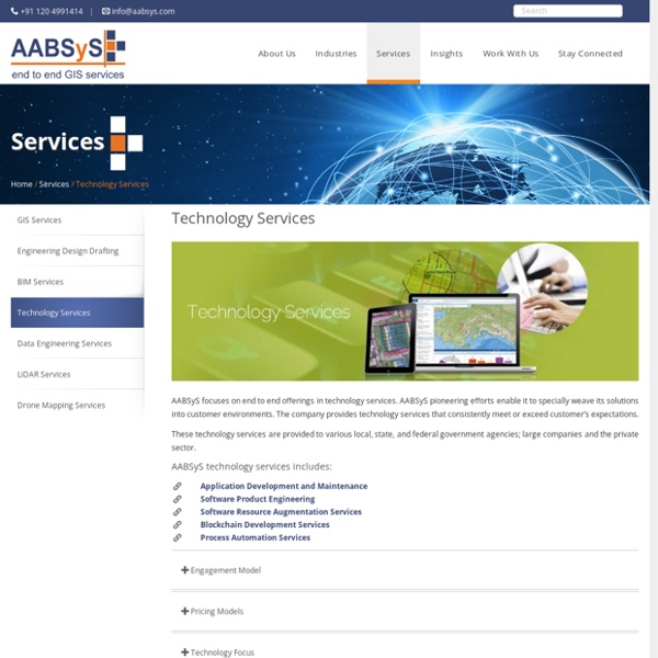
Software Resource Augmentation Services - Resource Augmentation & IT Outsourcing Services AABSyS IT has proven experience and expertise in providing software resource augmentation services for a wide spectrum of GIS technologies including ESRI, MapInfo, Autodesk, Intergraph, GeoServer, MapServer and other open source geospatial platforms. AABSyS resources have technical capabilities in providing services for software solutions ranging for desktop to large, scalable and secure web-enabled systems for enterprise and public portals. We provide highly experienced and skilled GIS software resources for building customized solutions or to assist the maintenance and support of the client’s existing applications. Our experience ranges from GIS software development, product development, and maintenance or product sustenance on both established and evolving emerging technologies. Notable features
Solar Panel Layout Designs - AABS Solar panels with photovoltaic power systems are designed to convert sunlight directly into electricity. A detailed solar panel layout plan is required for the construction and maintenance of large solar farms. With its rich experience in engineering design drafting, layout design along with expertise in template generation and standardization, AABSyS IT is well equipped to address the needs of the solar energy industry. AABSyS team studies and understands the need and scope of each individual project theoretically, and develops a solution that addresses the project requirements practically. The following services are offered for the preparation of solar panel templates: Site plan with roof House photo and vicinity map roof plan Attachment detail drawings Front and side views of mounting planes Line diagram Survey plan 3D rendered views for rooftop panel layouts
Blockchain Development Services - AABSyS AABSyS offers reliable and accurate Blockchain Development services, for customers globally. Blockchain technology enhances the security of transactions, allows content to be distributed without being misused and above all, maintains a secure decentralized repository of information. AABSyS provides end to end services for blockchain development from the secure decentralized solutions to integration of blockchain-based modules into the existing software in order to ensure data integrity and compliance.
FTTX Network Design FTTx encompasses all possible optical fiber topologies from a telecom or cable carrier to customer premises based on the location of the termination point of the fiber connection. Increase in demand for subscriber bandwidth, increasing network cost pressure and the limits of copper technology has triggered the use of fiber in the access network. AABSyS IT has strong expertise and deep domain knowledge in FTTx network designing and drafting. We have supported a number of customers in Europe, Australia, US and India on FTTx Network design, capture of network data along with asset data and physical network inventory, carrying out telecom surveys – long-distance telephony services, creation of As-built drawings (ABD), migration of network data from multiple sources to a single platform and update of As-built data of the network (OSP/ISP) on the enterprise/central GIS via direct or remote access. Some of the FTTx related services offered by AABSyS include,
Survey GIS at AABSyS Survey has played an important role in collecting data from areas that don’t have updated maps. Survey maps also play a crucial role in ground truthing the concerned area for creation of accurate land information maps. These maps also assists companies in understanding the market trends, land information for real estate, architecture, mining and utilities industries. These maps bring about a multi-dimensional perspective for making informed decisions. AABSyS IT has a wide network of surveyors who assist various governmental as well as private organisation in completion of manual survey. They also play an important role in creation of detail oriented navigational maps.
Architectural 3D CAD Modeling at AABSyS The architectural team at AABSyS comprise of experts architects, engineers, draftsmen etc. They have vast experience and expertise to create 3D modeling of floor plans, convert the 2D floor plans into 3D floor plans and create a 3D model of the said houses or building complexes. The 3D architectural floor plans and 3D models can be augmented with AABSyS’s 3D services to provide a realistic view to the model. This model is created on any platform that is suitable to the client and is delivered after strict quality assurance procedures. Telecom Construction Drawings AABSyS has a long standing experience in supporting the global telecommunications industry through different kinds of services. One of these involves the update of wireless telecom construction drawings. Wireless telecom towers would need to be upgraded or modified based on the changes in mobile telecom technology. These changes in the tower infrastructure should also be professionally reported and updated in the telecom operator’s records as well.
Architectural CAD Drafting Services at AABSyS The architecture industry requires architectural CAD drafting services that create floor plans, furniture arrangements plans, elevations and cross-sectional views for residence and multi-stored building. These architectural CAD drafting services create deigns are generated from raster images or hand sketches. Computer aided designing involves creation of architectural CAD drafting designs. The architectural CAD drafting services play a crucial role in understanding space occupancy, forecast space needs and generating, stacking and blocking diagrams for space planning. The services replace manual drafting on paper and allows the designers to prepare drawings on computers.
Architectural Floor Plans - 3D & 2D Floor Plans of Houses and Offices at AABSYS The housing and urban development industry utilise CAD and GIS services provided at AABSyS to generate floor plans that are useful in study, design and planning of constructed space. Architectural floor plans are important feature of any building’s sketch. They assist in easy visualization of the interior setup of a residential house, apartment, office, restaurant, and hotel. The architectural floor plans help AABSyS’s customers to visualize the property to sell, lease, or rent a house or office, which everyone can understand. 3D floor plans allow someone who has no experience in reading plans to understand a layout instantly. They are such a powerful tool that they leave out nothing for guesswork during marketing, sale and leasing of property. The architectural floor plans with furniture layout, floor coverings, wall textures, colour schemes to be utilized for a better look to the interior of the architectural construction.
3-GIS Services 3-GIS helps in the design and management of fiber networks and is the world’s first fully-web-based fiber network management software. 3-GIS is primarily used for Telecom network maintenance and management. With our long-standing experience and deep domain expertise in FTTx network designing and drafting, AABSyS IT has supported several customers globally on fiber network management using 3-GIS services. Our global clients have benefitted in FTTx Network design, network data capture, telecom surveys – long-distance telephony services, migration of network data from multiple sources to a single platform and update of As-built data of the network (OSP/ISP) on the enterprise/central GIS though AABSyS 3-GIS services. The following are the 3-GIS services offered by AABSyS IT: FTTx network design and drafting with 3-GIS Cabinet updates using 3-GIS FTTx network update on 3-GIS Network data migration using 3-GIS
GIS for Business Geographics at AABSyS A start-up venture or an established business often requires support in managing the large amounts of data. This data if utilised to its full potential can be immensely helpful in the growth of the company. With the modernisation and advancement in technology many tools such as GIS can help in accomplishing an array of tasks such as marketing, site selection, survey and data management. The spatial data management and analysis can help in better strategic marketing and management of any business vertical.
GIS for Water Distribution Network at AABSyS Water industry requires the assistance of GIS in many verticals. The judicious use and conservation of water is one of the most talked about topics on global platforms. Every country tries to ensure optimisation of water use by using technologies such as GIS for water. Apart from its everyday use, water can be used for multiple purposes and therefore is an important part of the various industries.
O-Calc AABSyS IT has been successful through delivery of GIS and CAD services for a range of industries from utilities to design, civil engineering and architecture for the past several years. Together with our strategic partners, AABSyS has supported customers in Europe, Australia, US and India through a range of services including digitization, utility mapping, CAD plan re-drafting, survey plan conversion, PDF to CAD conversion, 2D to 3D model conversions, 3D building model rendering and generation of virtual walkthroughs. Our deep domain expertise in the utility industry also includes providing pole loading analysis and make-ready engineering services in the O-Calc platform. O-Calc specializes in pole loading analysis, equipped with user friendly calculation tools, modelling, automatic analysis with sag and tension calculator etc. The following are the tasks accomplished by AABSyS during pole loading analysis with O-Calc: